<< Our Photo Pages >> Dolmen d'Estrabols - Burial Chamber or Dolmen in France in Midi:Aveyron (12)
Submitted by TheCaptain on Friday, 06 May 2011 Page Views: 2021
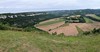
Neolithic and Bronze AgeSite Name: Dolmen d'Estrabols Alternative Name: Dolmen du MazucCountry: France Département: Midi:Aveyron (12) Type: Burial Chamber or Dolmen
Nearest Town: Villefranche-de-Rouergue Nearest Village: Saujac
Latitude: 44.464740N Longitude: 1.908570E
Condition:
| 5 | Perfect |
| 4 | Almost Perfect |
| 3 | Reasonable but with some damage |
| 2 | Ruined but still recognisable as an ancient site |
| 1 | Pretty much destroyed, possibly visible as crop marks |
| 0 | No data. |
| -1 | Completely destroyed |
| 5 | Superb |
| 4 | Good |
| 3 | Ordinary |
| 2 | Not Good |
| 1 | Awful |
| 0 | No data. |
| 5 | Can be driven to, probably with disabled access |
| 4 | Short walk on a footpath |
| 3 | Requiring a bit more of a walk |
| 2 | A long walk |
| 1 | In the middle of nowhere, a nightmare to find |
| 0 | No data. |
| 5 | co-ordinates taken by GPS or official recorded co-ordinates |
| 4 | co-ordinates scaled from a detailed map |
| 3 | co-ordinates scaled from a bad map |
| 2 | co-ordinates of the nearest village |
| 1 | co-ordinates of the nearest town |
| 0 | no data |
Internal Links:
External Links:
I have visited· I would like to visit
johnstone visited on 14th Jun 2017 - their rating: Cond: 4 Amb: 3 Access: 4
")
At about 40m from the road, fairly overgrown with 2 supports of 3m.
You may be viewing yesterday's version of this page. To see the most up to date information please register for a free account.
")
")
Do not use the above information on other web sites or publications without permission of the contributor.
davidmorgan has found this location on Google Street View:
Nearby Images from Flickr


The above images may not be of the site on this page, but were taken nearby. They are loaded from Flickr so please click on them for image credits.
Click here to see more info for this site
Nearby sites
Click here to view sites on an interactive map of the areaKey: Red: member's photo, Blue: 3rd party photo, Yellow: other image, Green: no photo - please go there and take one, Grey: site destroyed
Download sites to:
KML (Google Earth)
GPX (GPS waypoints)
CSV (Garmin/Navman)
CSV (Excel)
To unlock full downloads you need to sign up as a Contributory Member. Otherwise downloads are limited to 50 sites.
Turn off the page maps and other distractions
Nearby sites listing. In the following links * = Image available
827m E 94° Dolmen du Puech Youles 2 Burial Chamber or Dolmen
994m ESE 112° Dolmen du Puech Youles 3 Burial Chamber or Dolmen
1.3km E 90° Dolmen du Puech Youles 1 Burial Chamber or Dolmen
1.4km ESE 111° Dolmen du Puech Youles 6 Burial Chamber or Dolmen
1.5km ESE 102° Dolmen du Puech Youles 5 Burial Chamber or Dolmen
1.6km ENE 70° Dolmen du Puech d'Ols 2 Burial Chamber or Dolmen
1.6km ENE 64° Dolmen du Puech d'Ols 1 Burial Chamber or Dolmen
1.7km ESE 108° Dolmen du Puech Youles 4 Burial Chamber or Dolmen
1.7km E 88° Dolmen des Agars 2 Burial Chamber or Dolmen
1.8km E 83° Dolmen du Cayre Burial Chamber or Dolmen
1.8km E 89° Dolmen des Agars 1 Burial Chamber or Dolmen
1.9km SE 145° Dolmen de Glèbes Burial Chamber or Dolmen
1.9km W 280° Dolmen du Cloup de Cubèles Burial Chamber or Dolmen
2.0km NE 46° Dolmen des Aumieres 1 Burial Chamber or Dolmen
2.1km ESE 123° Dolmen du Bois Barrat Burial Chamber or Dolmen
2.1km E 85° Dolmen des Agars 3 Burial Chamber or Dolmen
2.3km NE 43° Dolmen des Aumieres 2 Burial Chamber or Dolmen
2.4km NNW 347° Dolmen de Salinieres Burial Chamber or Dolmen
2.5km SE 132° Dolmen du Puech de la Guise 1 Burial Chamber or Dolmen
2.5km ENE 67° Dolmen de Pech Mauriol Burial Chamber or Dolmen
2.7km E 85° Dolmen du Trep Burial Chamber or Dolmen
2.9km SE 135° Dolmen du Puech de la Guise 2 Burial Chamber or Dolmen
3.0km ESE 111° Dolmen du Puech du Dougnou Burial Chamber or Dolmen
3.2km NE 47° Dolmen du Pet 2 Burial Chamber or Dolmen
3.2km NE 46° Dolmens du Pet 1 Burial Chamber or Dolmen
View more nearby sites and additional images


 We would like to know more about this location. Please feel free to add a brief description and any relevant information in your own language.
 Wir möchten mehr über diese Stätte erfahren. Bitte zögern Sie nicht, eine kurze Beschreibung und relevante Informationen in Deutsch hinzuzufügen.
 Nous aimerions en savoir encore un peu sur les lieux. S'il vous plaît n'hesitez pas à ajouter une courte description et tous les renseignements pertinents dans votre propre langue.
 Quisieramos informarnos un poco más de las lugares. No dude en añadir una breve descripción y otros datos relevantes en su propio idioma.