

<< Our Photo Pages >> Bagozabalaga Dolmen 3 - Burial Chamber or Dolmen in France in Aquitaine:Pyrénées-Atlantiques 64
Submitted by TheCaptain on Friday, 06 May 2011 Page Views: 2087
Neolithic and Bronze AgeSite Name: Bagozabalaga Dolmen 3Country: France Département: Aquitaine:Pyrénées-Atlantiques 64 Type: Burial Chamber or Dolmen
Nearest Town: Pau Nearest Village: Larrau
Latitude: 43.042800N Longitude: 0.9708W
Condition:
| 5 | Perfect |
| 4 | Almost Perfect |
| 3 | Reasonable but with some damage |
| 2 | Ruined but still recognisable as an ancient site |
| 1 | Pretty much destroyed, possibly visible as crop marks |
| 0 | No data. |
| -1 | Completely destroyed |
| 5 | Superb |
| 4 | Good |
| 3 | Ordinary |
| 2 | Not Good |
| 1 | Awful |
| 0 | No data. |
| 5 | Can be driven to, probably with disabled access |
| 4 | Short walk on a footpath |
| 3 | Requiring a bit more of a walk |
| 2 | A long walk |
| 1 | In the middle of nowhere, a nightmare to find |
| 0 | No data. |
| 5 | co-ordinates taken by GPS or official recorded co-ordinates |
| 4 | co-ordinates scaled from a detailed map |
| 3 | co-ordinates scaled from a bad map |
| 2 | co-ordinates of the nearest village |
| 1 | co-ordinates of the nearest town |
| 0 | no data |
Be the first person to rate this site - see the 'Contribute!' box in the right hand menu.
Internal Links:
External Links:
")
Bagozabalaga is a burial chamber in the community of Larrau, Departement of Pyrénées-Atlantiques, Region of Aquitaine
You may be viewing yesterday's version of this page. To see the most up to date information please register for a free account.
")
")
")
Do not use the above information on other web sites or publications without permission of the contributor.
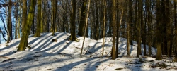
Nearby Images from Flickr
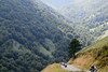
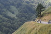
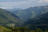
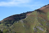
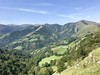
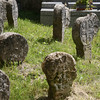
The above images may not be of the site on this page, but were taken nearby. They are loaded from Flickr so please click on them for image credits.
Click here to see more info for this site
Nearby sites
Click here to view sites on an interactive map of the areaKey: Red: member's photo, Blue: 3rd party photo, Yellow: other image, Green: no photo - please go there and take one, Grey: site destroyed
Download sites to:
KML (Google Earth)
GPX (GPS waypoints)
CSV (Garmin/Navman)
CSV (Excel)
To unlock full downloads you need to sign up as a Contributory Member. Otherwise downloads are limited to 50 sites.
Turn off the page maps and other distractions
Nearby sites listing. In the following links * = Image available
83m N 11° Bagozabalaga Dolmen 1 Burial Chamber or Dolmen
92m WSW 259° Bagozabalaga Dolmen 2 Burial Chamber or Dolmen
1.3km NNE 33° Idagorria Chromlech Stone Circle
1.4km NNE 30° Idagorria Haut Barrow Cemetery Barrow Cemetery
2.0km NE 54° Akhitiotia Tumulus Round Barrow(s)
2.1km NE 55° Bostmendieta Haut Barrow Cemetery Barrow Cemetery
3.4km WNW 290° Ugatze Barrow Cemetery Barrow Cemetery
3.5km WNW 292° Ugatze Tumulus Round Barrow(s)
3.5km WNW 288° Ugatze Chromlech Stone Circle
4.4km WNW 293° Hartsudurra Chromlech Stone Circle
4.5km W 265° Bagargi Dolmen* Burial Chamber or Dolmen
5.3km N 353° Potto Chromlech Stone Circle
5.3km WNW 302° Croix Garat Chromlech Stone Circle
5.4km N 354° Arangaitz Barrow Cemetery* Barrow Cemetery
5.5km NW 315° Lutogaïna Tumulus Round Barrow(s)
5.5km WSW 255° Organbideska Chromlech Stone Circle
5.7km N 357° Pocho Tumulus Round Barrow(s)
5.9km WSW 249° Lapatiñegañe Tumulus* Round Barrow(s)
5.9km WSW 249° Lapatiñegañe Chromlech Stone Circle
6.0km WSW 254° Ilharreko Ordokia Chromlech 2 Stone Circle
6.0km SW 232° Millagate Chromlechs* Stone Circle
6.2km WSW 252° Ilharreko Ordokia Chromlech 1* Stone Circle
6.2km SW 232° Millagate Tumulus Round Barrow(s)
6.4km SW 229° Ibarrondo Barrow Cemetery Barrow Cemetery
6.5km N 353° Udoia Barrow Cemetery Barrow Cemetery
View more nearby sites and additional images


 We would like to know more about this location. Please feel free to add a brief description and any relevant information in your own language.
 Wir möchten mehr über diese Stätte erfahren. Bitte zögern Sie nicht, eine kurze Beschreibung und relevante Informationen in Deutsch hinzuzufügen.
 Nous aimerions en savoir encore un peu sur les lieux. S'il vous plaît n'hesitez pas à ajouter une courte description et tous les renseignements pertinents dans votre propre langue.
 Quisieramos informarnos un poco más de las lugares. No dude en añadir una breve descripción y otros datos relevantes en su propio idioma.