

<< Text Pages >> Le Joncquoire 2 - Burial Chamber or Dolmen in France in Picardie:Oise (60)
Submitted by TheCaptain on Wednesday, 08 September 2010 Page Views: 1679
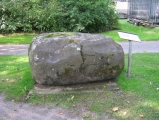
Neolithic and Bronze AgeSite Name: Le Joncquoire 2Country: France Département: Picardie:Oise (60) Type: Burial Chamber or Dolmen
Nearest Town: Compiegne Nearest Village: Pont-Sainte-Maxence
Latitude: 49.301000N Longitude: 2.600000E
Condition:
| 5 | Perfect |
| 4 | Almost Perfect |
| 3 | Reasonable but with some damage |
| 2 | Ruined but still recognisable as an ancient site |
| 1 | Pretty much destroyed, possibly visible as crop marks |
| 0 | No data. |
| -1 | Completely destroyed |
| 5 | Superb |
| 4 | Good |
| 3 | Ordinary |
| 2 | Not Good |
| 1 | Awful |
| 0 | No data. |
| 5 | Can be driven to, probably with disabled access |
| 4 | Short walk on a footpath |
| 3 | Requiring a bit more of a walk |
| 2 | A long walk |
| 1 | In the middle of nowhere, a nightmare to find |
| 0 | No data. |
| 5 | co-ordinates taken by GPS or official recorded co-ordinates |
| 4 | co-ordinates scaled from a detailed map |
| 3 | co-ordinates scaled from a bad map |
| 2 | co-ordinates of the nearest village |
| 1 | co-ordinates of the nearest town |
| 0 | no data |
Be the first person to rate this site - see the 'Contribute!' box in the right hand menu.
Internal Links:
External Links:
burial chamber in Picardie:Oise (60)
Le Joncquoire 2 is a burial chamber in the community of Pont-Sainte-Maxence, Departement of Oise, Region of Picardie
You may be viewing yesterday's version of this page. To see the most up to date information please register for a free account.
Do not use the above information on other web sites or publications without permission of the contributor.
Nearby Images from Flickr
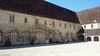
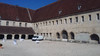
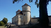
The above images may not be of the site on this page, but were taken nearby. They are loaded from Flickr so please click on them for image credits.
Click here to see more info for this site
Nearby sites
Click here to view sites on an interactive map of the areaKey: Red: member's photo, Blue: 3rd party photo, Yellow: other image, Green: no photo - please go there and take one, Grey: site destroyed
Download sites to:
KML (Google Earth)
GPX (GPS waypoints)
CSV (Garmin/Navman)
CSV (Excel)
To unlock full downloads you need to sign up as a Contributory Member. Otherwise downloads are limited to 50 sites.
Turn off the page maps and other distractions
Nearby sites listing. In the following links * = Image available
133m SSW 213° Le Joncquoire 1 Burial Chamber or Dolmen
3.0km E 92° Le Fond de Rambourg Burial Chamber or Dolmen
3.2km SSE 157° Dolmen du Cheval Blanc* Burial Chamber or Dolmen
4.6km E 86° Dolmen de la Carriere Becquerelle Burial Chamber or Dolmen
7.5km S 189° Senlis Alignement* Stone Row / Alignment
7.6km E 80° Menhir dit la Demoiselle de Rhuis* Standing Stone (Menhir)
10.4km WSW 256° Grotte du Retiro Cave or Rock Shelter
10.5km NE 54° Les Gros Gres 1 Burial Chamber or Dolmen
10.6km NE 54° Les Gros Gres 2 Burial Chamber or Dolmen
13.6km WSW 245° Grotte Sepulcrale de Petit-Therain Cave or Rock Shelter
14.2km SSE 159° La Queusse de Gargantua* Standing Stone (Menhir)
18.6km E 94° Grotte du Mont-Megre Cave or Rock Shelter
19.0km ESE 104° Grotte du Sery-Magneval Cave or Rock Shelter
19.1km ESE 104° Dolmen de Séry-Magneval Burial Chamber or Dolmen
20.5km NE 52° Le Hazoy Burial Chamber or Dolmen
21.7km SE 129° Pierre Glissoire de Péroy-les-Gombries Standing Stone (Menhir)
22.2km NNE 14° Gournay-Sur-Aronde* Ancient Village or Settlement
23.6km SE 131° Dolmen de Nanteuil-le-Haudouin Burial Chamber or Dolmen
24.3km NE 43° Camp de César du Mont Ganelon Ancient Village or Settlement
24.3km NE 48° Dolmen dit la Pierre Monicart Burial Chamber or Dolmen
24.4km SSW 204° La Pierre St Martin* Polissoir
24.4km E 101° Grotte Sepulcrale de Lari-Baré Cave or Rock Shelter
24.6km SSW 212° Le Compan Passage Grave
24.8km ESE 103° Grotte Sepulcrale du Laris-Goguet Chambered Tomb
25.4km SSW 200° la Pierre Longue (Bellefontaine)* Standing Stone (Menhir)
View more nearby sites and additional images


 We would like to know more about this location. Please feel free to add a brief description and any relevant information in your own language.
 Wir möchten mehr über diese Stätte erfahren. Bitte zögern Sie nicht, eine kurze Beschreibung und relevante Informationen in Deutsch hinzuzufügen.
 Nous aimerions en savoir encore un peu sur les lieux. S'il vous plaît n'hesitez pas à ajouter une courte description et tous les renseignements pertinents dans votre propre langue.
 Quisieramos informarnos un poco más de las lugares. No dude en añadir una breve descripción y otros datos relevantes en su propio idioma.