
, Aubrey Burl")
<< Text Pages >> Bois l'Abbé 2 - Burial Chamber or Dolmen in France in Alsace-Lorraine:Meurthe-et-Moselle
Submitted by TheCaptain on Wednesday, 08 September 2010 Page Views: 2554
Neolithic and Bronze AgeSite Name: Bois l'Abbé 2Country: France Département: Alsace-Lorraine:Meurthe-et-Moselle Type: Burial Chamber or Dolmen
Nearest Town: Nancy Nearest Village: Sexey-aux Forges
Latitude: 48.633000N Longitude: 6.026000E
Condition:
| 5 | Perfect |
| 4 | Almost Perfect |
| 3 | Reasonable but with some damage |
| 2 | Ruined but still recognisable as an ancient site |
| 1 | Pretty much destroyed, possibly visible as crop marks |
| 0 | No data. |
| -1 | Completely destroyed |
| 5 | Superb |
| 4 | Good |
| 3 | Ordinary |
| 2 | Not Good |
| 1 | Awful |
| 0 | No data. |
| 5 | Can be driven to, probably with disabled access |
| 4 | Short walk on a footpath |
| 3 | Requiring a bit more of a walk |
| 2 | A long walk |
| 1 | In the middle of nowhere, a nightmare to find |
| 0 | No data. |
| 5 | co-ordinates taken by GPS or official recorded co-ordinates |
| 4 | co-ordinates scaled from a detailed map |
| 3 | co-ordinates scaled from a bad map |
| 2 | co-ordinates of the nearest village |
| 1 | co-ordinates of the nearest town |
| 0 | no data |
Be the first person to rate this site - see the 'Contribute!' box in the right hand menu.
Internal Links:
External Links:
burial chamber in Alsace:Meurthe-et-Moselle (54)
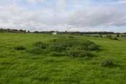
Bois l'Abbé 2 is a burial chamber in the community of Sexey-aux Forges, Departement of Meurthe-et-Moselle, Region of Alsace-Lorraine
You may be viewing yesterday's version of this page. To see the most up to date information please register for a free account.
Do not use the above information on other web sites or publications without permission of the contributor.
Nearby Images from Flickr
The above images may not be of the site on this page, but were taken nearby. They are loaded from Flickr so please click on them for image credits.
Click here to see more info for this site
Nearby sites
Click here to view sites on an interactive map of the areaKey: Red: member's photo, Blue: 3rd party photo, Yellow: other image, Green: no photo - please go there and take one, Grey: site destroyed
Download sites to:
KML (Google Earth)
GPX (GPS waypoints)
CSV (Garmin/Navman)
CSV (Excel)
To unlock full downloads you need to sign up as a Contributory Member. Otherwise downloads are limited to 50 sites.
Turn off the page maps and other distractions
Nearby sites listing. In the following links * = Image available
998m WSW 256° Bois de l'Evêque Dolmen Burial Chamber or Dolmen
1.1km S 176° Bois l'Abbé 1 Burial Chamber or Dolmen
2.3km NW 321° Dolmen du Bois l'Evêque Burial Chamber or Dolmen
3.5km NNW 342° Grotte du Géant Cave or Rock Shelter
5.6km WNW 282° Grotte le Trou-des-Celtes Cave or Rock Shelter
6.3km WNW 282° Grottes dites Trou de Sainte-Reine Cave or Rock Shelter
9.0km E 100° Camp d'Affrique (Chavigny) Ancient Village or Settlement
13.5km NNE 12° La Garenne (Liverdun) Burial Chamber or Dolmen
14.1km NE 45° Enceinte préhistorique de la Fourasse Ancient Village or Settlement
17.4km ENE 58° Oppidum Sainte-Geneviève Ancient Village or Settlement
24.6km NNE 27° Le Trou-du-Chien Cave or Rock Shelter
32.9km N 358° La Pierre-au-Jô Menhir* Standing Stone (Menhir)
37.2km SW 232° Dolmen du Bois du Comtot Burial Chamber or Dolmen
39.9km NW 318° Woinville Menhir* Standing Stone (Menhir)
40.7km WNW 298° Le Menhir des 3 évêchés* Standing Stone (Menhir)
41.2km SW 214° Grotte de L´Enfer et de Jeannuë Cave or Rock Shelter
42.0km SSW 212° Vielles-Roches Barrow Cemetery
42.0km N 0° Le Rudemont Cave or Rock Shelter
42.2km NE 43° Tincry Oppidum protohistorique Ancient Village or Settlement
42.4km NW 316° La Dame Schone Menhir* Standing Stone (Menhir)
42.6km N 357° Le Trou-des-Fées Cave or Rock Shelter
42.7km WNW 300° La Pierre Trouée * Standing Stone (Menhir)
43.7km N 2° Mont Jouy Burial Chamber or Dolmen
44.8km NW 307° Le Camp des Romains Ancient Village or Settlement
45.2km W 271° Oppidum des Leuci* Ancient Village or Settlement
View more nearby sites and additional images


 We would like to know more about this location. Please feel free to add a brief description and any relevant information in your own language.
 Wir möchten mehr über diese Stätte erfahren. Bitte zögern Sie nicht, eine kurze Beschreibung und relevante Informationen in Deutsch hinzuzufügen.
 Nous aimerions en savoir encore un peu sur les lieux. S'il vous plaît n'hesitez pas à ajouter une courte description et tous les renseignements pertinents dans votre propre langue.
 Quisieramos informarnos un poco más de las lugares. No dude en añadir una breve descripción y otros datos relevantes en su propio idioma.