<< Our Photo Pages >> Puades Dolmen - Burial Chamber or Dolmen in France in Provence:Alpes-Maritimes (06)
Submitted by AlexHunger on Tuesday, 07 June 2005 Page Views: 2494
Neolithic and Bronze AgeSite Name: Puades DolmenCountry: France Département: Provence:Alpes-Maritimes (06) Type: Burial Chamber or Dolmen
Nearest Town: Grasse Nearest Village: Saint-Cézaire-Sur-Siagne
Latitude: 43.678240N Longitude: 6.801968E
Condition:
| 5 | Perfect |
| 4 | Almost Perfect |
| 3 | Reasonable but with some damage |
| 2 | Ruined but still recognisable as an ancient site |
| 1 | Pretty much destroyed, possibly visible as crop marks |
| 0 | No data. |
| -1 | Completely destroyed |
| 5 | Superb |
| 4 | Good |
| 3 | Ordinary |
| 2 | Not Good |
| 1 | Awful |
| 0 | No data. |
| 5 | Can be driven to, probably with disabled access |
| 4 | Short walk on a footpath |
| 3 | Requiring a bit more of a walk |
| 2 | A long walk |
| 1 | In the middle of nowhere, a nightmare to find |
| 0 | No data. |
| 5 | co-ordinates taken by GPS or official recorded co-ordinates |
| 4 | co-ordinates scaled from a detailed map |
| 3 | co-ordinates scaled from a bad map |
| 2 | co-ordinates of the nearest village |
| 1 | co-ordinates of the nearest town |
| 0 | no data |
Internal Links:
External Links:
")
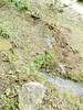
A 19th Century Archeologist blew up the cap stone while attempting to access the interior of the Dolmen. The fragments are scattered around the Dolmen and the remains of the tumulus.
Some more info:
archeoprovence.com
You may be viewing yesterday's version of this page. To see the most up to date information please register for a free account.
")
")
Do not use the above information on other web sites or publications without permission of the contributor.
Nearby Images from Flickr


The above images may not be of the site on this page, but were taken nearby. They are loaded from Flickr so please click on them for image credits.
Click here to see more info for this site
Nearby sites
Click here to view sites on an interactive map of the areaKey: Red: member's photo, Blue: 3rd party photo, Yellow: other image, Green: no photo - please go there and take one, Grey: site destroyed
Download sites to:
KML (Google Earth)
GPX (GPS waypoints)
CSV (Garmin/Navman)
CSV (Excel)
To unlock full downloads you need to sign up as a Contributory Member. Otherwise downloads are limited to 50 sites.
Turn off the page maps and other distractions
Nearby sites listing. In the following links * = Image available
66m WSW 258° Ciste des Puades Cist
521m S 174° Les Vallons Tumulus Burial Chamber or Dolmen
725m SE 140° Dolmen de Mauvans Sud Burial Chamber or Dolmen
788m SE 134° Tumulus de Mauvans Round Barrow(s)
901m ENE 72° Mauvans Nord Dolmen Burial Chamber or Dolmen
1.4km ENE 66° Degoutay Dolmen* Burial Chamber or Dolmen
1.9km SSE 149° Dolmen du Prignon 2 Burial Chamber or Dolmen
2.0km SE 146° Tumulus du Prignon Burial Chamber or Dolmen
2.1km ENE 58° Tumulus des Passages Artificial Mound
2.2km SE 141° Dolmen du Prignon 1 Burial Chamber or Dolmen
2.2km SSW 206° Dolmen des Clapieres Burial Chamber or Dolmen
2.7km S 169° Tombe en Bloc du Deffends de Saint-Cézaire Court Tomb
2.7km ENE 59° Tumuli de Mauvauns Artificial Mound
2.8km NE 48° Tumulus de la Croix de Cabris No.2 Artificial Mound
2.9km ENE 74° Arboin Dolmen Burial Chamber or Dolmen
3.0km SSW 209° Tombe de Clauds Court Tomb
3.1km ENE 66° Tumulus de la Leque No. 2 Artificial Mound
3.1km E 89° Pierre Druidique de Saint-Vallier-de-Thiey Natural Stone / Erratic / Other Natural Feature
3.1km SSE 159° Saint-Cézaire Tumulus Artificial Mound
3.2km NE 40° Tumulus du Caillassou Round Barrow(s)
3.2km SSE 158° Dolmen de la Grau Burial Chamber or Dolmen
3.3km NE 44° Pseudo-Dolmen du Deffends 1 Burial Chamber or Dolmen
3.3km SSW 194° Dolmen de Colbas No.1 Burial Chamber or Dolmen
3.3km SSW 194° Dolmen de Lou Serre d'Inguille Burial Chamber or Dolmen
3.4km ENE 65° Tumulus de la Leque No. 1 Artificial Mound
View more nearby sites and additional images


 We would like to know more about this location. Please feel free to add a brief description and any relevant information in your own language.
 Wir möchten mehr über diese Stätte erfahren. Bitte zögern Sie nicht, eine kurze Beschreibung und relevante Informationen in Deutsch hinzuzufügen.
 Nous aimerions en savoir encore un peu sur les lieux. S'il vous plaît n'hesitez pas à ajouter une courte description et tous les renseignements pertinents dans votre propre langue.
 Quisieramos informarnos un poco más de las lugares. No dude en añadir una breve descripción y otros datos relevantes en su propio idioma.