


<< Our Photo Pages >> Dolmen de Concoules 2 - Burial Chamber or Dolmen in France in Midi:Aveyron (12)
Submitted by TheCaptain on Saturday, 16 April 2005 Page Views: 1847
Neolithic and Bronze AgeSite Name: Dolmen de Concoules 2Country: France Département: Midi:Aveyron (12) Type: Burial Chamber or Dolmen
Nearest Town: Millau Nearest Village: Montjaux
Latitude: 44.073813N Longitude: 2.897502E
Condition:
| 5 | Perfect |
| 4 | Almost Perfect |
| 3 | Reasonable but with some damage |
| 2 | Ruined but still recognisable as an ancient site |
| 1 | Pretty much destroyed, possibly visible as crop marks |
| 0 | No data. |
| -1 | Completely destroyed |
| 5 | Superb |
| 4 | Good |
| 3 | Ordinary |
| 2 | Not Good |
| 1 | Awful |
| 0 | No data. |
| 5 | Can be driven to, probably with disabled access |
| 4 | Short walk on a footpath |
| 3 | Requiring a bit more of a walk |
| 2 | A long walk |
| 1 | In the middle of nowhere, a nightmare to find |
| 0 | No data. |
| 5 | co-ordinates taken by GPS or official recorded co-ordinates |
| 4 | co-ordinates scaled from a detailed map |
| 3 | co-ordinates scaled from a bad map |
| 2 | co-ordinates of the nearest village |
| 1 | co-ordinates of the nearest town |
| 0 | no data |
Internal Links:
External Links:
I have visited· I would like to visit
johnstone visited on 17th Jun 2002 - their rating: Cond: 3 Amb: 3 Access: 3
")
A dolmen with very large capstone (4,2 x 2,9 x 0,5 m, about 13 tons) which rests on two sloping uprights of 3,3 and 3,8 m in length.
Source Location: T4T35.fr
You may be viewing yesterday's version of this page. To see the most up to date information please register for a free account.
")
Do not use the above information on other web sites or publications without permission of the contributor.
Nearby Images from Flickr

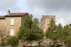
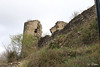

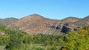
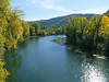
The above images may not be of the site on this page, but were taken nearby. They are loaded from Flickr so please click on them for image credits.
Click here to see more info for this site
Nearby sites
Click here to view sites on an interactive map of the areaKey: Red: member's photo, Blue: 3rd party photo, Yellow: other image, Green: no photo - please go there and take one, Grey: site destroyed
Download sites to:
KML (Google Earth)
GPX (GPS waypoints)
CSV (Garmin/Navman)
CSV (Excel)
To unlock full downloads you need to sign up as a Contributory Member. Otherwise downloads are limited to 50 sites.
Turn off the page maps and other distractions
Nearby sites listing. In the following links * = Image available
151m SSW 199° Dolmen de Concoules 6 Burial Chamber or Dolmen
164m NW 308° Dolmen de Concoules 3* Burial Chamber or Dolmen
181m SW 217° Dolmen de Concoules 5 Burial Chamber or Dolmen
185m W 273° Dolmen de Concoules 4* Burial Chamber or Dolmen
411m NNW 341° Dolmen de Concoules 1* Burial Chamber or Dolmen
3.2km SSE 160° Auriac Dolmen Burial Chamber or Dolmen
4.7km NE 51° Dolmen de Mongisty 6 Burial Chamber or Dolmen
4.7km NE 50° Dolmen de Mongisty 5 Burial Chamber or Dolmen
4.8km NNW 339° Dolmen de Jonquayrolles* Burial Chamber or Dolmen
4.8km ENE 66° Dolmen de Comprégnac Burial Chamber or Dolmen
4.8km NW 321° Dolmen de Candadès 2* Burial Chamber or Dolmen
5.0km W 273° Dolmen de Cazarède* Burial Chamber or Dolmen
5.1km NE 51° Dolmen de Mongisty 7* Burial Chamber or Dolmen
5.2km NE 51° Dolmen de Mongisty 4* Burial Chamber or Dolmen
5.3km NW 320° Dolmen de Candadès 1* Burial Chamber or Dolmen
5.5km NE 45° Dolmen de Mongisty 8 Burial Chamber or Dolmen
5.6km NE 50° Dolmen de Mongisty 3* Burial Chamber or Dolmen
5.7km NE 49° Dolmen de Mongisty 2* Burial Chamber or Dolmen
6.2km S 189° Dolmen de Font-Réal* Burial Chamber or Dolmen
6.3km SSE 164° Dolmen de Taurine Burial Chamber or Dolmen
6.5km SSW 196° Dolmen du Borie Blanque 1* Burial Chamber or Dolmen
6.5km SSW 196° Dolmen du Borie Blanque 2 Burial Chamber or Dolmen
6.6km NNE 15° Dolmen de Castelnau-Pégayrols* Burial Chamber or Dolmen
6.8km SSW 212° Dolmen des Esclots* Burial Chamber or Dolmen
6.8km NE 46° Dolmen de Navas 5* Burial Chamber or Dolmen
View more nearby sites and additional images


 We would like to know more about this location. Please feel free to add a brief description and any relevant information in your own language.
 Wir möchten mehr über diese Stätte erfahren. Bitte zögern Sie nicht, eine kurze Beschreibung und relevante Informationen in Deutsch hinzuzufügen.
 Nous aimerions en savoir encore un peu sur les lieux. S'il vous plaît n'hesitez pas à ajouter une courte description et tous les renseignements pertinents dans votre propre langue.
 Quisieramos informarnos un poco más de las lugares. No dude en añadir una breve descripción y otros datos relevantes en su propio idioma.