<< Text Pages >> Deux polissoirs - Polissoir in France in Pays de la Loire:Vendée (85)
Submitted by TheCaptain on Saturday, 16 April 2005 Page Views: 2631
Neolithic and Bronze AgeSite Name: Deux polissoirsCountry: France Département: Pays de la Loire:Vendée (85) Type: Polissoir
Nearest Town: Bressuire Nearest Village: Pouzauges
Latitude: 46.784000N Longitude: 0.836W
Condition:
| 5 | Perfect |
| 4 | Almost Perfect |
| 3 | Reasonable but with some damage |
| 2 | Ruined but still recognisable as an ancient site |
| 1 | Pretty much destroyed, possibly visible as crop marks |
| 0 | No data. |
| -1 | Completely destroyed |
| 5 | Superb |
| 4 | Good |
| 3 | Ordinary |
| 2 | Not Good |
| 1 | Awful |
| 0 | No data. |
| 5 | Can be driven to, probably with disabled access |
| 4 | Short walk on a footpath |
| 3 | Requiring a bit more of a walk |
| 2 | A long walk |
| 1 | In the middle of nowhere, a nightmare to find |
| 0 | No data. |
| 5 | co-ordinates taken by GPS or official recorded co-ordinates |
| 4 | co-ordinates scaled from a detailed map |
| 3 | co-ordinates scaled from a bad map |
| 2 | co-ordinates of the nearest village |
| 1 | co-ordinates of the nearest town |
| 0 | no data |
Be the first person to rate this site - see the 'Contribute!' box in the right hand menu.
Internal Links:
External Links:
Polissoir in Vendée
IMPORTANT NOTE: Position of site unknown, co-ordinates given for nearest village
You may be viewing yesterday's version of this page. To see the most up to date information please register for a free account.
Do not use the above information on other web sites or publications without permission of the contributor.
Nearby Images from Flickr
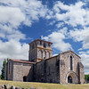
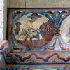
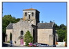
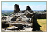
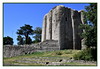
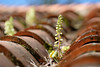
The above images may not be of the site on this page, but were taken nearby. They are loaded from Flickr so please click on them for image credits.
Click here to see more info for this site
Nearby sites
Click here to view sites on an interactive map of the areaKey: Red: member's photo, Blue: 3rd party photo, Yellow: other image, Green: no photo - please go there and take one, Grey: site destroyed
Download sites to:
KML (Google Earth)
GPX (GPS waypoints)
CSV (Garmin/Navman)
CSV (Excel)
To unlock full downloads you need to sign up as a Contributory Member. Otherwise downloads are limited to 50 sites.
Turn off the page maps and other distractions
Nearby sites listing. In the following links * = Image available
383m NNE 34° Dolmen du Marchais* Burial Chamber or Dolmen
584m ENE 72° Pouzauges Stones* Not Known (by us)
11.4km SSE 163° Dolmen de la Pierre-qui-Vire* Burial Chamber or Dolmen
12.5km SSE 159° Polissoir ou pierre à sculpture Polissoir
14.6km SSE 168° Pierre à Cupules des Girardières Rock Art
15.3km SSW 203° Menhir de la Vierge* Standing Stone (Menhir)
15.4km SW 219° Menhir des Landes* Standing Stone (Menhir)
15.4km SW 219° Dolmen des Landes* Burial Chamber or Dolmen
15.5km SSW 209° Dolmen de la Jaudonnière* Passage Grave
15.6km SSW 209° Menhir de la Pierre Rousse* Standing Stone (Menhir)
15.6km SSW 209° Dolmen de la Pierre Rousse* Burial Chamber or Dolmen
15.6km SSW 209° Menhir du Fief de Cous* Standing Stone (Menhir)
15.8km SSW 208° Pierre Folle des Cous* Burial Chamber or Dolmen
15.8km SSW 208° Ciste des Cous* Burial Chamber or Dolmen
16.1km NE 55° Dolmen de la Voie* Burial Chamber or Dolmen
16.8km NNE 25° Les Vaulx Sculptured Stone
16.8km NNE 25° La Pierrière de Saint Aubin Sculptured Stone
16.8km NNE 25° Les Terres du Rail Sculptured Stone
16.8km NNE 25° Les Terres de la Taupinière Sculptured Stone
18.3km WSW 251° Menhirs du Château-des-Roches-Baritaud* Standing Stones
19.2km NW 326° La Pinochonnerie* Not Known (by us)
19.7km ENE 63° Dolmen de Bretignolles Burial Chamber or Dolmen
20.4km NNE 32° Rochers gravés de Saint-Aubin-de-Baubigné Sculptured Stone
22.8km NE 36° Rocher à Cupules de La Millassière Rock Art
25.2km NNW 330° Pierre Branlante (La Verrie) Rock Outcrop
View more nearby sites and additional images


 We would like to know more about this location. Please feel free to add a brief description and any relevant information in your own language.
 Wir möchten mehr über diese Stätte erfahren. Bitte zögern Sie nicht, eine kurze Beschreibung und relevante Informationen in Deutsch hinzuzufügen.
 Nous aimerions en savoir encore un peu sur les lieux. S'il vous plaît n'hesitez pas à ajouter une courte description et tous les renseignements pertinents dans votre propre langue.
 Quisieramos informarnos un poco más de las lugares. No dude en añadir una breve descripción y otros datos relevantes en su propio idioma.