


<< Our Photo Pages >> Le rocher pointu - Standing Stone (Menhir) in France in Aquitaine:Dordogne (24)
Submitted by LaDragonne on Tuesday, 09 August 2022 Page Views: 442
Neolithic and Bronze AgeSite Name: Le rocher pointu Alternative Name: Menhir de LacosteCountry: France Département: Aquitaine:Dordogne (24) Type: Standing Stone (Menhir)
Nearest Town: Bergerac Nearest Village: Maurens
Latitude: 44.943480N Longitude: 0.485770E
Condition:
| 5 | Perfect |
| 4 | Almost Perfect |
| 3 | Reasonable but with some damage |
| 2 | Ruined but still recognisable as an ancient site |
| 1 | Pretty much destroyed, possibly visible as crop marks |
| 0 | No data. |
| -1 | Completely destroyed |
| 5 | Superb |
| 4 | Good |
| 3 | Ordinary |
| 2 | Not Good |
| 1 | Awful |
| 0 | No data. |
| 5 | Can be driven to, probably with disabled access |
| 4 | Short walk on a footpath |
| 3 | Requiring a bit more of a walk |
| 2 | A long walk |
| 1 | In the middle of nowhere, a nightmare to find |
| 0 | No data. |
| 5 | co-ordinates taken by GPS or official recorded co-ordinates |
| 4 | co-ordinates scaled from a detailed map |
| 3 | co-ordinates scaled from a bad map |
| 2 | co-ordinates of the nearest village |
| 1 | co-ordinates of the nearest town |
| 0 | no data |
Internal Links:
External Links:
")
Grande pierre triangulaire en calcaire gréseux jaune local, plantée très profondément à l'intersection de 2 chemins anciens. Elle est sur un terrain privé (celui de la propriété attenante) et mise en valeur. Elle est légèrement concave.
Elle était voisine du centre du village, maintenant déplacé.
Une pierre de justice a été signalée à une trentaine de mètres à l'est, introuvable. Il s'agit peut-être de la m^me entité?
[Translation by Google: "Large triangular stone in local yellow sandstone limestone, planted very deep at the intersection of 2 ancient paths. It is on private land (that of the adjoining property) and developed. It is slightly concave. It was next to the center of the village, now displaced. A stone of justice was reported about thirty meters to the east, not found. Maybe it is the same entity?"
You may be viewing yesterday's version of this page. To see the most up to date information please register for a free account.
")
Do not use the above information on other web sites or publications without permission of the contributor.
Nearby Images from Flickr
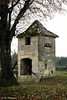
The above images may not be of the site on this page, but were taken nearby. They are loaded from Flickr so please click on them for image credits.
Click here to see more info for this site
Nearby sites
Click here to view sites on an interactive map of the areaKey: Red: member's photo, Blue: 3rd party photo, Yellow: other image, Green: no photo - please go there and take one, Grey: site destroyed
Download sites to:
KML (Google Earth)
GPX (GPS waypoints)
CSV (Garmin/Navman)
CSV (Excel)
To unlock full downloads you need to sign up as a Contributory Member. Otherwise downloads are limited to 50 sites.
Turn off the page maps and other distractions
Nearby sites listing. In the following links * = Image available
2.3km NNE 13° Pierre Teule* Marker Stone
3.6km N 7° Le Roc del Cayre* Natural Stone / Erratic / Other Natural Feature
3.6km N 6° Dolmen Le Cayre de Beleymas* Burial Chamber or Dolmen
6.7km N 7° Dolmen Peyrelevade de Beleymas* Burial Chamber or Dolmen
7.6km NNW 336° Menhir dit La Peyre-Chaume* Standing Stone (Menhir)
8.9km NE 34° Menhir de Pierrefiche (Villamblard)* Standing Stone (Menhir)
9.1km SSE 158° Dolmen Peyrelevade de Pecharmant* Burial Chamber or Dolmen
9.3km SSE 158° Menhir Peyrelevade de Pecharmant* Standing Stone (Menhir)
9.5km WNW 303° Menhir de Les Leyches* Standing Stone (Menhir)
9.6km S 177° La Peyre du Pont de la Peyre* Standing Stone (Menhir)
9.8km NW 319° Dolmen de La Caze* Burial Chamber or Dolmen
10.3km S 181° La Peyre de Fonpeyre* Stone Circle
10.4km S 181° Peyre Levade Intramuros* Burial Chamber or Dolmen
11.7km SSE 147° Gisements de Creysse Cave or Rock Shelter
11.9km NE 37° Dolmen de Peyrelevade (Villamblard)* Burial Chamber or Dolmen
12.0km NE 38° Pierre philosophale de Peyrelevade* Natural Stone / Erratic / Other Natural Feature
12.3km SE 137° Dolmen de Saint Sauveur Burial Chamber or Dolmen
12.7km ENE 66° Dolmen dit Pierre Levée (Beauregard-et-Bassac)* Burial Chamber or Dolmen
13.1km NW 312° Dolmen de Drouillas* Burial Chamber or Dolmen
13.5km NW 322° Grotte de Las Agnelas* Cave or Rock Shelter
13.7km NW 323° Source des Pierres* Holy Well or Sacred Spring
14.8km ESE 114° Rochers de la Vierge* Natural Stone / Erratic / Other Natural Feature
14.9km ESE 113° Dolmen Roc Leva* Burial Chamber or Dolmen
16.1km NW 321° Menhir de la Croix Blanche* Standing Stone (Menhir)
16.8km S 178° Dolmen Peyrelevade de Monbazillac* Burial Chamber or Dolmen
View more nearby sites and additional images


 We would like to know more about this location. Please feel free to add a brief description and any relevant information in your own language.
 Wir möchten mehr über diese Stätte erfahren. Bitte zögern Sie nicht, eine kurze Beschreibung und relevante Informationen in Deutsch hinzuzufügen.
 Nous aimerions en savoir encore un peu sur les lieux. S'il vous plaît n'hesitez pas à ajouter une courte description et tous les renseignements pertinents dans votre propre langue.
 Quisieramos informarnos un poco más de las lugares. No dude en añadir una breve descripción y otros datos relevantes en su propio idioma.