<< Our Photo Pages >> Glenrickard - Chambered Cairn in Scotland in Isle of Arran
Submitted by zep on Saturday, 04 January 2003 Page Views: 7439
Neolithic and Bronze AgeSite Name: GlenrickardCountry: Scotland County: Isle of Arran Type: Chambered Cairn
Nearest Town: Brodick
Map Ref: NS00513466 Landranger Map Number: 69
Latitude: 55.564671N Longitude: 5.165186W
Condition:
| 5 | Perfect |
| 4 | Almost Perfect |
| 3 | Reasonable but with some damage |
| 2 | Ruined but still recognisable as an ancient site |
| 1 | Pretty much destroyed, possibly visible as crop marks |
| 0 | No data. |
| -1 | Completely destroyed |
| 5 | Superb |
| 4 | Good |
| 3 | Ordinary |
| 2 | Not Good |
| 1 | Awful |
| 0 | No data. |
| 5 | Can be driven to, probably with disabled access |
| 4 | Short walk on a footpath |
| 3 | Requiring a bit more of a walk |
| 2 | A long walk |
| 1 | In the middle of nowhere, a nightmare to find |
| 0 | No data. |
| 5 | co-ordinates taken by GPS or official recorded co-ordinates |
| 4 | co-ordinates scaled from a detailed map |
| 3 | co-ordinates scaled from a bad map |
| 2 | co-ordinates of the nearest village |
| 1 | co-ordinates of the nearest town |
| 0 | no data |
Internal Links:
External Links:
")
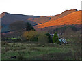
The remains of this chambered cairn are situated in a small clearing on the edge of a forestry plantation. The bracken covered top of the cairn is level with the surrounding ground and the cairn edge is difficult to recognise. The north west (downhill) side, however, is visible as a grassy scarp 0.8m high.
More information can be found on Canmore ID 40204.
The Northern Antiquarian (TNA) also feature a page for this site - see their entry for Glenrickard, Brodick, Isle of Arran, Argyll, which gives directions for finding this site, together with a photograph, the 1868 OS map showing the location of the cairn, a 1972 ground plan and a brief archaeology & history of the site.
You may be viewing yesterday's version of this page. To see the most up to date information please register for a free account.
Do not use the above information on other web sites or publications without permission of the contributor.
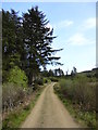
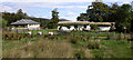
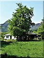
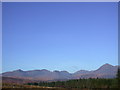
Nearby Images from Geograph Britain and Ireland:
©2012(licence)
©2006(licence)
©2018(licence)
©2005(licence)
©2008(licence)
The above images may not be of the site on this page, they are loaded from Geograph.
Please Submit an Image of this site or go out and take one for us!
Click here to see more info for this site
Nearby sites
Key: Red: member's photo, Blue: 3rd party photo, Yellow: other image, Green: no photo - please go there and take one, Grey: site destroyed
Download sites to:
KML (Google Earth)
GPX (GPS waypoints)
CSV (Garmin/Navman)
CSV (Excel)
To unlock full downloads you need to sign up as a Contributory Member. Otherwise downloads are limited to 50 sites.
Turn off the page maps and other distractions
Nearby sites listing. In the following links * = Image available
1.3km N 6° Auchrannie, Glen Cloy* Souterrain (Fogou, Earth House) (NS007359)
1.5km NE 54° Mayish* Standing Stone (Menhir) (NS01813551)
1.7km N 350° Stronach Ridge Rock Art* Rock Art (NS00303636)
1.8km SE 130° Lamlash* Stone Circle (NS0188233419)
2.0km NNE 12° Stronach Standing Stone* Standing Stone (Menhir) (NS0100236608)
2.0km NW 309° Glen Shurig (Kilbride) Stone Circle (NR9936)
2.4km NNW 345° Glen Shirag Stone Circle (NS000370)
2.6km ESE 121° Dunan Mor* Chambered Cairn (NS027332)
2.8km SE 125° Dunan Beag* Chambered Cairn (NS0270932974)
2.8km N 360° Glen Shiel* Stone Row / Alignment (NS0061337447)
3.1km SE 125° North Blairmore* Standing Stone (Menhir) (NS0293432791)
3.4km NNE 14° Replica Bronze Age Round House at Brodick Castle Modern Stone Circle etc (NS015379)
4.8km NNE 24° Merkland Cist Cist (NS02693896)
5.9km SSE 165° Monamore* Chambered Cairn (NS0175228890)
6.4km W 273° Moinechoill* Chambered Cairn (NR941353)
6.5km W 273° Monyquil* Standing Stones (NR9405735284)
7.6km SW 232° Clauchan Glen Standing Stone (Menhir) (NR94283029)
8.4km WSW 251° Shiskine* Stone Circle (NR92443225)
8.5km WSW 243° Ballymichael Standing Stones* Standing Stones (NR92723119)
8.6km S 187° Carn Ban (Arran)* Chambered Cairn (NR991262)
8.7km WSW 243° Uaigh Finnach* Standing Stone (Menhir) (NR9261631040)
8.7km N 3° Corrie possible Four-Poster Stone Circle (NS01404334)
8.8km WSW 253° Ballymichael Bridge* Stone Circle (NR91913252)
9.5km W 267° Cnoc Na Ceille* Standing Stone (Menhir) (NR9101034553)
9.5km WSW 254° Machrie Moor 6* Stone Circle (NR91223242)
View more nearby sites and additional images


 We would like to know more about this location. Please feel free to add a brief description and any relevant information in your own language.
 Wir möchten mehr über diese Stätte erfahren. Bitte zögern Sie nicht, eine kurze Beschreibung und relevante Informationen in Deutsch hinzuzufügen.
 Nous aimerions en savoir encore un peu sur les lieux. S'il vous plaît n'hesitez pas à ajouter une courte description et tous les renseignements pertinents dans votre propre langue.
 Quisieramos informarnos un poco más de las lugares. No dude en añadir una breve descripción y otros datos relevantes en su propio idioma.