

<< Our Photo Pages >> Twyn Y Post Milestone and boundary stone - Marker Stone in Wales in Powys
Submitted by geoffstickland on Friday, 14 February 2020 Page Views: 858
Multi-periodSite Name: Twyn Y Post Milestone and boundary stone Alternative Name: TregynonCountry: Wales County: Powys Type: Marker Stone
Nearest Town: Builth Wells Nearest Village: Upper Chapel
Map Ref: SO02844106
Latitude: 52.059370N Longitude: 3.418565W
Condition:
| 5 | Perfect |
| 4 | Almost Perfect |
| 3 | Reasonable but with some damage |
| 2 | Ruined but still recognisable as an ancient site |
| 1 | Pretty much destroyed, possibly visible as crop marks |
| 0 | No data. |
| -1 | Completely destroyed |
| 5 | Superb |
| 4 | Good |
| 3 | Ordinary |
| 2 | Not Good |
| 1 | Awful |
| 0 | No data. |
| 5 | Can be driven to, probably with disabled access |
| 4 | Short walk on a footpath |
| 3 | Requiring a bit more of a walk |
| 2 | A long walk |
| 1 | In the middle of nowhere, a nightmare to find |
| 0 | No data. |
| 5 | co-ordinates taken by GPS or official recorded co-ordinates |
| 4 | co-ordinates scaled from a detailed map |
| 3 | co-ordinates scaled from a bad map |
| 2 | co-ordinates of the nearest village |
| 1 | co-ordinates of the nearest town |
| 0 | no data |
Internal Links:
External Links:
I have visited· I would like to visit
geoffstickland has visited here
")
You may be viewing yesterday's version of this page. To see the most up to date information please register for a free account.
Do not use the above information on other web sites or publications without permission of the contributor.
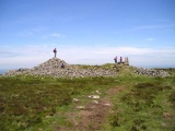
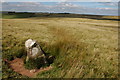
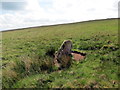
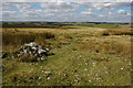
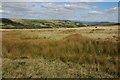
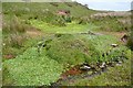
Nearby Images from Geograph Britain and Ireland:
©2007(licence)
©2017(licence)
©2007(licence)
©2007(licence)
©2008(licence)
The above images may not be of the site on this page, they are loaded from Geograph.
Please Submit an Image of this site or go out and take one for us!
Click here to see more info for this site
Nearby sites
Key: Red: member's photo, Blue: 3rd party photo, Yellow: other image, Green: no photo - please go there and take one, Grey: site destroyed
Download sites to:
KML (Google Earth)
GPX (GPS waypoints)
CSV (Garmin/Navman)
CSV (Excel)
To unlock full downloads you need to sign up as a Contributory Member. Otherwise downloads are limited to 50 sites.
Turn off the page maps and other distractions
Nearby sites listing. In the following links * = Image available
165m SSW 193° Twyn y Post Ring Cairn* Ring Cairn (SO028409)
262m E 80° Gwaun Ymrys, Cairn ll* Cairn (SO031411)
277m WNW 299° Blaen Llwyn Ddu* Cairn (SO026412)
361m E 83° Gwaun Ymryson* Ring Cairn (SO032411)
665m SE 146° Cefn Clawdd near Twyn y Post Ring Cairn (SO032405)
762m S 174° Cornelau Uchaf Hillfort (SO029403)
1.2km SSE 166° Cefn Clawdd CairnIII* Cairn (SO03123985)
1.6km ESE 116° Cefn Clawdd, Cairn ll Cairn (SO043403)
1.8km S 172° Bailey Bach* Ring Cairn (SO0304639278)
3.1km SSW 192° Gaer Fawr (Lower Chapel)* Hillfort (SO021380)
3.3km E 88° Wanu Gunllwch Ring Cairn (SO061411)
3.3km NNE 15° Nant-yr-Offeiriad-Fawr cairn 1 Cairn (SO0374044220)
3.5km N 349° Cwm Owen stone III (possible)* Standing Stone (Menhir) (SO02254451)
3.7km SW 229° Llwyn Llwyd* Ancient Village or Settlement (SN99963869)
4.8km NNE 21° Twyn y Big cairn* Cairn (SO04634548)
4.8km SSW 202° Gaer Fach (Merthyr Cynog)* Hillfort (SO00913663)
5.4km NNE 18° Allt Mawr chambered cairn* Chambered Cairn (SO0461546136)
5.8km NNE 23° Banc y Celyn* Stone Circle (SO05174634)
5.8km WSW 248° Cefn Merthyr Cynog Mound* Cairn (SN97393902)
5.8km WSW 248° Cefn Merthyr Cynog Cairn (East)* Cairn (SN97383894)
6.0km WSW 248° Cefn Merthy Cynog Cairn (West)* Cairn (SN97223894)
6.0km E 79° Camp (Powys)* Hillfort (SO088421)
6.4km SSE 155° Twyn-y-Gaer (Llaneglwys)* Hillfort (SO054352)
7.1km SW 216° Carn y Fan* Hillfort (SN985354)
8.0km SSW 193° Battle Hill Cairn 2* Cairn (SO00853331)
View more nearby sites and additional images


 We would like to know more about this location. Please feel free to add a brief description and any relevant information in your own language.
 Wir möchten mehr über diese Stätte erfahren. Bitte zögern Sie nicht, eine kurze Beschreibung und relevante Informationen in Deutsch hinzuzufügen.
 Nous aimerions en savoir encore un peu sur les lieux. S'il vous plaît n'hesitez pas à ajouter une courte description et tous les renseignements pertinents dans votre propre langue.
 Quisieramos informarnos un poco más de las lugares. No dude en añadir una breve descripción y otros datos relevantes en su propio idioma.