

<< Text Pages >> Arrowe Park standing stones - Standing Stones in England in Merseyside
Submitted by Anonymous on Tuesday, 04 February 2020 Page Views: 3149
Neolithic and Bronze AgeSite Name: Arrowe Park standing stones Alternative Name: Arrowe Park stone circleCountry: England County: Merseyside Type: Standing Stones
Map Ref: SJ27058596
Latitude: 53.365453N Longitude: 3.097745W
Condition:
| 5 | Perfect |
| 4 | Almost Perfect |
| 3 | Reasonable but with some damage |
| 2 | Ruined but still recognisable as an ancient site |
| 1 | Pretty much destroyed, possibly visible as crop marks |
| 0 | No data. |
| -1 | Completely destroyed |
| 5 | Superb |
| 4 | Good |
| 3 | Ordinary |
| 2 | Not Good |
| 1 | Awful |
| 0 | No data. |
| 5 | Can be driven to, probably with disabled access |
| 4 | Short walk on a footpath |
| 3 | Requiring a bit more of a walk |
| 2 | A long walk |
| 1 | In the middle of nowhere, a nightmare to find |
| 0 | No data. |
| 5 | co-ordinates taken by GPS or official recorded co-ordinates |
| 4 | co-ordinates scaled from a detailed map |
| 3 | co-ordinates scaled from a bad map |
| 2 | co-ordinates of the nearest village |
| 1 | co-ordinates of the nearest town |
| 0 | no data |
Internal Links:
External Links:
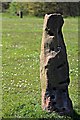
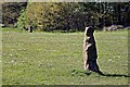
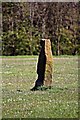
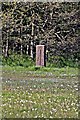
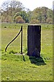
There are two standing stones, in poor condition, by the playground in Arrowe Park, adjacent to the hospital.
It is hypothesised that they form part of a much larger pair of concentric circles extending across Arrrowe Brook Farm and intersecting with the Meols-Chester Roman Road, the site of the Battle of Brunanburh and the mesolithic settlement at Greasby Copse.
The largest of the stone circles is reported to be over 4000 feet across, which would exceed Avebury. However, others dismiss these as 'a pair of gateposts, not neolithic'.
From another site: At Arrowe Park there are two concentric circles and a third circle and all together 13 stones seem to be involved. The inner circle also appears to host hexagonal geometry.
Three page document containing pictures of the Upton and Arrowe Park sites (PDF)
A book about the standing stones: The Overchurch Mystery: Pagan Stones & Ancient Churches by David P Gregg
You may be viewing yesterday's version of this page. To see the most up to date information please register for a free account.
Do not use the above information on other web sites or publications without permission of the contributor.
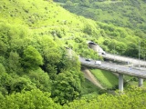
Nearby Images from Geograph Britain and Ireland:
©2012(licence)
©2012(licence)
©2012(licence)
©2012(licence)
©2012(licence)
The above images may not be of the site on this page, they are loaded from Geograph.
Please Submit an Image of this site or go out and take one for us!
Click here to see more info for this site
Nearby sites
Key: Red: member's photo, Blue: 3rd party photo, Yellow: other image, Green: no photo - please go there and take one, Grey: site destroyed
Download sites to:
KML (Google Earth)
GPX (GPS waypoints)
CSV (Garmin/Navman)
CSV (Excel)
To unlock full downloads you need to sign up as a Contributory Member. Otherwise downloads are limited to 50 sites.
Turn off the page maps and other distractions
Nearby sites listing. In the following links * = Image available
1.4km WNW 297° Greasby Copse Ancient Village or Settlement (SJ25788664)
2.8km WSW 247° Thor's Stone* Natural Stone / Erratic / Other Natural Feature (SJ2447484933)
2.9km NNW 346° Overchurch* Stone Circle (SJ264888)
4.0km W 261° Face Stone (Stapledon Wood)* Rock Outcrop (SJ23088536)
4.4km NNE 22° Bidston Hill Rock Carvings* Carving (SJ288900)
4.5km NE 45° The Bonks Barrow Cemetery (SJ303891)
4.9km W 277° The Column* Chambered Tomb (SJ222866)
5.0km W 279° West Kirby Cremation Burial Cist (SJ22158678)
5.2km W 274° St Bridget (West Kirby)* Early Christian Sculptured Stone (SJ21828641)
6.1km NW 319° Great Meols* Ancient Village or Settlement (SJ231906)
7.1km WNW 289° Red Rocks Ancient Mine, Quarry or other Industry (SJ20328843)
8.0km ESE 111° St Patrick's Well (Bromborough)* Holy Well or Sacred Spring (SJ34538295)
8.7km ESE 115° St Barnabas (Bromborough)* Ancient Cross (SJ3491082212)
8.7km SSE 165° St Mary and St Helen (Neston)* Ancient Cross (SJ29157749)
8.7km WNW 282° Hilbre Island (Wirral Peninsula) Ancient Cross (SJ185879)
8.8km SE 142° Raby Mound Round Barrow(s) (SJ32377891)
9.1km ENE 57° World Museum Liverpool* Museum (SJ348908)
12.0km E 87° Solomon's Tomb Modern Stone Circle etc (SJ391865)
12.3km SSE 160° Hampston's Well* Holy Well or Sacred Spring (SJ3099074309)
12.5km NE 44° St Mary (Walton on the Hill) Ancient Cross (SJ35889482)
12.7km ENE 73° Monk's Well (Wavertree)* Holy Well or Sacred Spring (SJ39288959)
12.7km SSE 165° Burton Point* Promontory Fort / Cliff Castle (SJ302736)
12.8km NE 49° Modern stone circle on Cherry Avenue* Modern Stone Circle etc (SJ3687894265)
12.9km SW 220° St Winefrides Well* Holy Well or Sacred Spring (SJ18517627)
12.9km E 87° Robin Hood's Stone* Standing Stone (Menhir) (SJ3997886383)
View more nearby sites and additional images


 We would like to know more about this location. Please feel free to add a brief description and any relevant information in your own language.
 Wir möchten mehr über diese Stätte erfahren. Bitte zögern Sie nicht, eine kurze Beschreibung und relevante Informationen in Deutsch hinzuzufügen.
 Nous aimerions en savoir encore un peu sur les lieux. S'il vous plaît n'hesitez pas à ajouter une courte description et tous les renseignements pertinents dans votre propre langue.
 Quisieramos informarnos un poco más de las lugares. No dude en añadir una breve descripción y otros datos relevantes en su propio idioma.