


<< Text Pages >> Warren Hill/Middle Brow Tumuli Group - Artificial Mound in England in East Sussex
Submitted by jonm on Wednesday, 07 August 2019 Page Views: 437
Multi-periodSite Name: Warren Hill/Middle Brow Tumuli GroupCountry: England County: East Sussex Type: Artificial Mound
Nearest Town: Eastbourne
Map Ref: TV58269748
Latitude: 50.755346N Longitude: 0.242297E
Condition:
| 5 | Perfect |
| 4 | Almost Perfect |
| 3 | Reasonable but with some damage |
| 2 | Ruined but still recognisable as an ancient site |
| 1 | Pretty much destroyed, possibly visible as crop marks |
| 0 | No data. |
| -1 | Completely destroyed |
| 5 | Superb |
| 4 | Good |
| 3 | Ordinary |
| 2 | Not Good |
| 1 | Awful |
| 0 | No data. |
| 5 | Can be driven to, probably with disabled access |
| 4 | Short walk on a footpath |
| 3 | Requiring a bit more of a walk |
| 2 | A long walk |
| 1 | In the middle of nowhere, a nightmare to find |
| 0 | No data. |
| 5 | co-ordinates taken by GPS or official recorded co-ordinates |
| 4 | co-ordinates scaled from a detailed map |
| 3 | co-ordinates scaled from a bad map |
| 2 | co-ordinates of the nearest village |
| 1 | co-ordinates of the nearest town |
| 0 | no data |
Internal Links:
External Links:
Artificial Mound in East Sussex
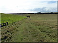
Site in middle of field, recorded as Pastscape Monument No. 971112 and Pastscape Monument No. 1565904. These two barrow locations are taken from cropmark and/or old RAF photos and can be found in a line leading west along the (slight) ridge falling from Warren Hill
You may be viewing yesterday's version of this page. To see the most up to date information please register for a free account.
Do not use the above information on other web sites or publications without permission of the contributor.
Nearby Images from Geograph Britain and Ireland:
©2013(licence)
©2006(licence)
©2011(licence)
©2011(licence)
©2017(licence)
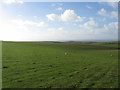
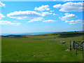
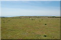
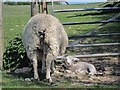
The above images may not be of the site on this page, they are loaded from Geograph.
Please Submit an Image of this site or go out and take one for us!
Click here to see more info for this site
Nearby sites
Key: Red: member's photo, Blue: 3rd party photo, Yellow: other image, Green: no photo - please go there and take one, Grey: site destroyed
Download sites to:
KML (Google Earth)
GPX (GPS waypoints)
CSV (Garmin/Navman)
CSV (Excel)
To unlock full downloads you need to sign up as a Contributory Member. Otherwise downloads are limited to 50 sites.
Turn off the page maps and other distractions
Nearby sites listing. In the following links * = Image available
541m ENE 69° Warren Hill Upper Tumuli Group* Artificial Mound (TV58769769)
594m E 99° Warren Hill/ Black Robin Tumuli Group* Misc. Earthwork (TV58859740)
679m E 94° Warren Hill Low Tumulus (Black Robin Farm)* Artificial Mound (TV58949745)
911m NE 36° Pashley Cross-Dyke* Misc. Earthwork (TV58789823)
954m ESE 103° Black Robin Bottom Tumulus* Round Barrow(s) (TV592973)
1.0km NE 47° Warren Tumuli and Cross Dyke* Barrow Cemetery (TV590982)
1.1km NNE 14° Eastbourne Downs Upper Tumuli group* Artificial Mound (TV585986)
1.3km NNE 12° Eastbourne Downs Tumuli* Barrow Cemetery (TV585988)
1.4km NNE 12° Eastbourne Downs Staging Tumuli Artificial Mound (TV5851698886)
1.5km SE 143° Heathy Brow Tumulus* Round Barrow(s) (TV592963)
1.6km N 4° Crunden's Bottom Summit* Artificial Mound (TV58329907)
1.6km ESE 109° Well Combe Tumuli* Barrow Cemetery (TV598970)
1.7km SW 236° Long Down Tumulus Round Barrow(s) (TV569965)
1.7km S 180° West Brow Field System* Misc. Earthwork (TV583958)
1.8km SSE 160° Beachy Head Lower North Barrow Group* Artificial Mound (TV58939579)
1.9km ESE 109° Holy Well (Eastbourne) Holy Well or Sacred Spring (TV601969)
1.9km SSE 157° Beachy Head Upper Earthwork Group* Artificial Mound (TV59069571)
2.2km N 3° Beachy Brow Tumulus* Round Barrow(s) (TV5830099690)
2.3km SW 225° Frost Hill Tumulus* Round Barrow(s) (TV567958)
2.5km N 1° Foxholes-Beachy Brow Tumuli* Round Barrow(s) (TQ58210003)
2.8km SW 232° Belle Tout Settlement* Ancient Village or Settlement (TV56109570)
2.9km SW 236° Belle Tout Tumuli Group* Artificial Mound (TV55949581)
2.9km SW 233° Belle Tout Tumulus Round Barrow(s) (TV560957)
2.9km SW 234° Belle Tout Enclosures* Misc. Earthwork (TV5596895728)
2.9km N 358° Foxholes-Beachy intermediate tumulus* Round Barrow(s) (TQ58090042)
View more nearby sites and additional images


 We would like to know more about this location. Please feel free to add a brief description and any relevant information in your own language.
 Wir möchten mehr über diese Stätte erfahren. Bitte zögern Sie nicht, eine kurze Beschreibung und relevante Informationen in Deutsch hinzuzufügen.
 Nous aimerions en savoir encore un peu sur les lieux. S'il vous plaît n'hesitez pas à ajouter une courte description et tous les renseignements pertinents dans votre propre langue.
 Quisieramos informarnos un poco más de las lugares. No dude en añadir una breve descripción y otros datos relevantes en su propio idioma.