

<< Text Pages >> Burley Moor Ringcairn 1 - Ring Cairn in England in Yorkshire (West)
Submitted by vicky on Sunday, 21 July 2002 Page Views: 9021
Neolithic and Bronze AgeSite Name: Burley Moor Ringcairn 1Country: England County: Yorkshire (West) Type: Ring Cairn
Map Ref: SE141455 Landranger Map Number: 104
Latitude: 53.905472N Longitude: 1.786873W
Condition:
| 5 | Perfect |
| 4 | Almost Perfect |
| 3 | Reasonable but with some damage |
| 2 | Ruined but still recognisable as an ancient site |
| 1 | Pretty much destroyed, possibly visible as crop marks |
| 0 | No data. |
| -1 | Completely destroyed |
| 5 | Superb |
| 4 | Good |
| 3 | Ordinary |
| 2 | Not Good |
| 1 | Awful |
| 0 | No data. |
| 5 | Can be driven to, probably with disabled access |
| 4 | Short walk on a footpath |
| 3 | Requiring a bit more of a walk |
| 2 | A long walk |
| 1 | In the middle of nowhere, a nightmare to find |
| 0 | No data. |
| 5 | co-ordinates taken by GPS or official recorded co-ordinates |
| 4 | co-ordinates scaled from a detailed map |
| 3 | co-ordinates scaled from a bad map |
| 2 | co-ordinates of the nearest village |
| 1 | co-ordinates of the nearest town |
| 0 | no data |
Be the first person to rate this site - see the 'Contribute!' box in the right hand menu.
Internal Links:
External Links:
Ringcairn in West Yorkshire
Have you visited this site? Please add a comment below.
You may be viewing yesterday's version of this page. To see the most up to date information please register for a free account.
Do not use the above information on other web sites or publications without permission of the contributor.
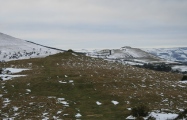
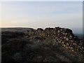
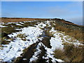
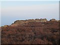
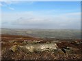
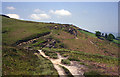
Nearby Images from Geograph Britain and Ireland:
©2016(licence)
©2012(licence)
©2016(licence)
©2020(licence)
©2010(licence)
The above images may not be of the site on this page, they are loaded from Geograph.
Please Submit an Image of this site or go out and take one for us!
Click here to see more info for this site
Nearby sites
Key: Red: member's photo, Blue: 3rd party photo, Yellow: other image, Green: no photo - please go there and take one, Grey: site destroyed
Download sites to:
KML (Google Earth)
GPX (GPS waypoints)
CSV (Garmin/Navman)
CSV (Excel)
To unlock full downloads you need to sign up as a Contributory Member. Otherwise downloads are limited to 50 sites.
Turn off the page maps and other distractions
Nearby sites listing. In the following links * = Image available
62m ENE 74° Stead Crag 03* Rock Art (SE1416045517)
90m NNE 25° Stead Crag 02* Rock Art (SE1413845582)
92m SW 230° Rushy Beck Spring (Burley Moor) Holy Well or Sacred Spring (SE14034544)
93m NNE 13° Stead Crag 01* Rock Art (SE1412045591)
95m W 270° Woofa Bank 18* Rock Art (SE1400545500)
116m SW 219° Woofa Bank 19* Rock Art (SE1402745409)
121m S 171° Woofa Bank 20* Rock Art (SE1412045381)
151m ESE 116° Cold Stone (Burley Moor)* Standing Stone (Menhir) (SE1423645433)
179m W 268° Woofa Bank 17a* Rock Art (SE1392145494)
201m W 266° Woofa Bank 17.* Rock Art (SE1389945487)
201m W 266° Woofa Bank 16* Rock Art (SE1389945486)
202m W 268° Woofa Bank 15* Rock Art (SE1389845493)
206m W 265° Woofa Bank 14* Rock Art (SE1389445481)
210m W 264° Woof Bank 13* Rock Art (SE1389145476)
211m W 266° Woofa Bank 12* Rock Art (SE1388945484)
215m W 272° Woofa Bank 11* Rock Art (SE1388445507)
217m W 273° Woofa Bank 10* Rock Art (SE1388345509)
218m W 273° Woofa Bank 09a* Rock Art (SE1388245509)
220m W 267° Woofa Bank 09.* Rock Art (SE1388045488)
223m WNW 297° Woofa Bank* Ancient Village or Settlement (SE13904560)
229m W 279° Woofa Bank 08a* Rock Art (SE1387345537)
231m W 279° Woofa Bank 08.* Rock Art (SE1387145536)
242m W 265° Woofa Bank 07* Rock Art (SE1385845477)
245m W 264° Woofa Bank 05* Rock Art (SE1385645474)
251m WNW 284° Woofa Bank 06* Rock Art (SE1385645562)
View more nearby sites and additional images


 We would like to know more about this location. Please feel free to add a brief description and any relevant information in your own language.
 Wir möchten mehr über diese Stätte erfahren. Bitte zögern Sie nicht, eine kurze Beschreibung und relevante Informationen in Deutsch hinzuzufügen.
 Nous aimerions en savoir encore un peu sur les lieux. S'il vous plaît n'hesitez pas à ajouter une courte description et tous les renseignements pertinents dans votre propre langue.
 Quisieramos informarnos un poco más de las lugares. No dude en añadir una breve descripción y otros datos relevantes en su propio idioma.