

<< Our Photo Pages >> Højevejen Kanonhøjen - Round Barrow(s) in Denmark in Bornholm
Submitted by Boeddel on Sunday, 17 February 2019 Page Views: 661
Neolithic and Bronze AgeSite Name: Højevejen KanonhøjenCountry: Denmark County: Bornholm Type: Round Barrow(s)
Nearest Town: Svaneke
Latitude: 55.124662N Longitude: 15.109034E
Condition:
| 5 | Perfect |
| 4 | Almost Perfect |
| 3 | Reasonable but with some damage |
| 2 | Ruined but still recognisable as an ancient site |
| 1 | Pretty much destroyed, possibly visible as crop marks |
| 0 | No data. |
| -1 | Completely destroyed |
| 5 | Superb |
| 4 | Good |
| 3 | Ordinary |
| 2 | Not Good |
| 1 | Awful |
| 0 | No data. |
| 5 | Can be driven to, probably with disabled access |
| 4 | Short walk on a footpath |
| 3 | Requiring a bit more of a walk |
| 2 | A long walk |
| 1 | In the middle of nowhere, a nightmare to find |
| 0 | No data. |
| 5 | co-ordinates taken by GPS or official recorded co-ordinates |
| 4 | co-ordinates scaled from a detailed map |
| 3 | co-ordinates scaled from a bad map |
| 2 | co-ordinates of the nearest village |
| 1 | co-ordinates of the nearest town |
| 0 | no data |
Internal Links:
External Links:
I have visited· I would like to visit
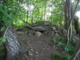
Boeddel visited on 21st Oct 2018 - their rating: Amb: 4 Access: 4
")
There is no path to the grave. Therefore it can be visited only after the harvest, but it is also easy to see from the road.
You may be viewing yesterday's version of this page. To see the most up to date information please register for a free account.
")
")
")
Do not use the above information on other web sites or publications without permission of the contributor.
Nearby Images from Flickr

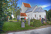
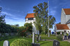
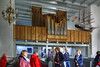
The above images may not be of the site on this page, but were taken nearby. They are loaded from Flickr so please click on them for image credits.
Click here to see more info for this site
Nearby sites
Click here to view sites on an interactive map of the areaKey: Red: member's photo, Blue: 3rd party photo, Yellow: other image, Green: no photo - please go there and take one, Grey: site destroyed
Download sites to:
KML (Google Earth)
GPX (GPS waypoints)
CSV (Garmin/Navman)
CSV (Excel)
To unlock full downloads you need to sign up as a Contributory Member. Otherwise downloads are limited to 50 sites.
Turn off the page maps and other distractions
Nearby sites listing. In the following links * = Image available
119m SE 140° Højene Modern Stone Maze* Turf Maze
182m S 188° Gaia + Blåfuglen* Rock Art
337m NE 50° Højevejen Sønderhøj* Round Barrow(s)
442m NE 38° Højevejen Bavnehøj* Round Barrow(s)
458m SSE 168° Grydehøj Rundhøj* Round Barrow(s)
1.1km E 93° Grisby Hallebrøndshøj Jættestue* Passage Grave
1.1km NE 49° Svendshøj Rundhøj* Round Barrow(s)
1.5km SE 143° Skovholm Rundhøj* Round Barrow(s)
1.6km SE 134° Ibsker Rundhøj* Round Barrow(s)
1.8km ESE 124° Ormehøj Langdysse med Stenkiste* Long Barrow
2.0km E 83° Frennegård Skåltegn 1* Rock Art
2.1km SSE 152° Skåningehøj og Bautasten* Round Barrow(s)
2.1km NNE 18° Listed Bautasten* Standing Stones
2.1km NW 315° Kurehøj Svaneke* Round Barrow(s)
2.2km N 357° Lillehøj Listed* Round Barrow(s)
2.4km ENE 67° Ved Parken Skåltegn 1* Rock Art
2.4km ENE 63° Gyldensåstenen* Carving
2.4km E 98° Bautasten på Frennemark* Standing Stones
2.5km E 84° Frenne Bautasten* Standing Stones
2.5km WSW 237° Rømersminde Skåltegn* Rock Art
2.6km N 351° Listed væltet Bautasten* Standing Stone (Menhir)
2.6km NNW 330° Skottehjem Rundhøj* Round Barrow(s)
2.6km NE 41° Hammerslet Bautasten 2* Standing Stone (Menhir)
2.7km NE 41° Hammerslet Bautasten 1* Standing Stone (Menhir)
2.8km NNW 344° Styrmandshjem Bautasten* Standing Stone (Menhir)
View more nearby sites and additional images


 We would like to know more about this location. Please feel free to add a brief description and any relevant information in your own language.
 Wir möchten mehr über diese Stätte erfahren. Bitte zögern Sie nicht, eine kurze Beschreibung und relevante Informationen in Deutsch hinzuzufügen.
 Nous aimerions en savoir encore un peu sur les lieux. S'il vous plaît n'hesitez pas à ajouter une courte description et tous les renseignements pertinents dans votre propre langue.
 Quisieramos informarnos un poco más de las lugares. No dude en añadir una breve descripción y otros datos relevantes en su propio idioma.