<< Our Photo Pages >> Menhir du Suquet - Standing Stone (Menhir) in France in Midi:Lot (46)
Submitted by johnstone on Thursday, 11 January 2018 Page Views: 911
Neolithic and Bronze AgeSite Name: Menhir du SuquetCountry: France Département: Midi:Lot (46) Type: Standing Stone (Menhir)
Nearest Town: Figeac Nearest Village: Corn
Latitude: 44.604270N Longitude: 1.871820E
Condition:
| 5 | Perfect |
| 4 | Almost Perfect |
| 3 | Reasonable but with some damage |
| 2 | Ruined but still recognisable as an ancient site |
| 1 | Pretty much destroyed, possibly visible as crop marks |
| 0 | No data. |
| -1 | Completely destroyed |
| 5 | Superb |
| 4 | Good |
| 3 | Ordinary |
| 2 | Not Good |
| 1 | Awful |
| 0 | No data. |
| 5 | Can be driven to, probably with disabled access |
| 4 | Short walk on a footpath |
| 3 | Requiring a bit more of a walk |
| 2 | A long walk |
| 1 | In the middle of nowhere, a nightmare to find |
| 0 | No data. |
| 5 | co-ordinates taken by GPS or official recorded co-ordinates |
| 4 | co-ordinates scaled from a detailed map |
| 3 | co-ordinates scaled from a bad map |
| 2 | co-ordinates of the nearest village |
| 1 | co-ordinates of the nearest town |
| 0 | no data |
Internal Links:
External Links:
I have visited· I would like to visit
johnstone visited on 24th Jun 2016 - their rating: Cond: 5 Amb: 4 Access: 5
")
Slightly doubtful origin.
On private property, ask permission.
For more informtion Click here.
You may be viewing yesterday's version of this page. To see the most up to date information please register for a free account.
")
Do not use the above information on other web sites or publications without permission of the contributor.
Nearby Images from Flickr
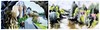

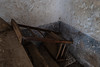

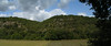
The above images may not be of the site on this page, but were taken nearby. They are loaded from Flickr so please click on them for image credits.
Click here to see more info for this site
Nearby sites
Click here to view sites on an interactive map of the areaKey: Red: member's photo, Blue: 3rd party photo, Yellow: other image, Green: no photo - please go there and take one, Grey: site destroyed
Download sites to:
KML (Google Earth)
GPX (GPS waypoints)
CSV (Garmin/Navman)
CSV (Excel)
To unlock full downloads you need to sign up as a Contributory Member. Otherwise downloads are limited to 50 sites.
Turn off the page maps and other distractions
Nearby sites listing. In the following links * = Image available
542m W 277° Dolmen de Le Suquet Burial Chamber or Dolmen
945m NE 38° Dolmen du Puech d'Arsou Burial Chamber or Dolmen
1.2km S 175° Grotte de Sainte-Eulalie Cave or Rock Shelter
1.5km SE 139° Dolmen d'Auriac Burial Chamber or Dolmen
1.6km SSE 152° Dolmen Janick Burial Chamber or Dolmen
1.8km NNE 23° Dolmen de Corn Burial Chamber or Dolmen
1.8km WNW 291° Dolmen de Ligoussou Burial Chamber or Dolmen
1.9km N 356° Dolmen des Pouzats Burial Chamber or Dolmen
2.5km ESE 105° Dolmen de Bullac 2 Burial Chamber or Dolmen
2.6km ENE 57° Dolmen de Peyrelongue Burial Chamber or Dolmen
2.7km ESE 113° Dolmen de Bullac 1 Burial Chamber or Dolmen
3.3km N 8° Dolmen de Cloup Caoud 1 Burial Chamber or Dolmen
3.4km N 8° Dolmen de Cloup Caoud 2 Burial Chamber or Dolmen
3.4km N 357° Dolmen de la Croze Burial Chamber or Dolmen
3.5km NE 38° Dolmen de Cambes 3 Burial Chamber or Dolmen
3.5km N 7° Dolmen Le Cun Burial Chamber or Dolmen
3.5km ESE 115° Causse de Bullac 2 Burial Chamber or Dolmen
3.6km E 92° Noble dolmen* Burial Chamber or Dolmen
3.6km NE 43° Dolmen de Cambes 2 Burial Chamber or Dolmen
3.6km NNW 344° Belinac Menhir* Standing Stone (Menhir)
3.6km NE 49° Dolmen de Pierre Levée (Cambes) Burial Chamber or Dolmen
3.8km WNW 292° Cloup des Périès* Burial Chamber or Dolmen
3.9km SE 124° Dolmen du Mas de Brézat* Burial Chamber or Dolmen
3.9km NE 52° Dolmen de Cambes 1 Burial Chamber or Dolmen
4.0km W 266° Lapeyrière* Chambered Tomb
View more nearby sites and additional images


 We would like to know more about this location. Please feel free to add a brief description and any relevant information in your own language.
 Wir möchten mehr über diese Stätte erfahren. Bitte zögern Sie nicht, eine kurze Beschreibung und relevante Informationen in Deutsch hinzuzufügen.
 Nous aimerions en savoir encore un peu sur les lieux. S'il vous plaît n'hesitez pas à ajouter une courte description et tous les renseignements pertinents dans votre propre langue.
 Quisieramos informarnos un poco más de las lugares. No dude en añadir una breve descripción y otros datos relevantes en su propio idioma.