

<< Our Photo Pages >> Cayton Gill carving - Modern Stone Circle etc in England in Yorkshire (North)
Submitted by rogerkread on Saturday, 14 October 2017 Page Views: 2291
Modern SitesSite Name: Cayton Gill carvingCountry: England County: Yorkshire (North) Type: Modern Stone Circle etc
Nearest Town: Ripon Nearest Village: Markington
Map Ref: SE284632
Latitude: 54.063966N Longitude: 1.567578W
Condition:
| 5 | Perfect |
| 4 | Almost Perfect |
| 3 | Reasonable but with some damage |
| 2 | Ruined but still recognisable as an ancient site |
| 1 | Pretty much destroyed, possibly visible as crop marks |
| 0 | No data. |
| -1 | Completely destroyed |
| 5 | Superb |
| 4 | Good |
| 3 | Ordinary |
| 2 | Not Good |
| 1 | Awful |
| 0 | No data. |
| 5 | Can be driven to, probably with disabled access |
| 4 | Short walk on a footpath |
| 3 | Requiring a bit more of a walk |
| 2 | A long walk |
| 1 | In the middle of nowhere, a nightmare to find |
| 0 | No data. |
| 5 | co-ordinates taken by GPS or official recorded co-ordinates |
| 4 | co-ordinates scaled from a detailed map |
| 3 | co-ordinates scaled from a bad map |
| 2 | co-ordinates of the nearest village |
| 1 | co-ordinates of the nearest town |
| 0 | no data |
Internal Links:
External Links:
")
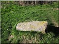
A series of concentric circles around a central depression - but clearly done with a chisel so no 'cup and ring' I'm afraid. On the other hand it isn't all that recent either.
The fallen stone looks like an old gatepost to me, and it is close to where a gate would once have been, where two public footpaths meet, just to the south west of High Cayton farm. I have passed it so many times and always find it a pleasure so thought it could be worth having on the webste in an area with little in the way of megaliths.
You may be viewing yesterday's version of this page. To see the most up to date information please register for a free account.
")
Do not use the above information on other web sites or publications without permission of the contributor.
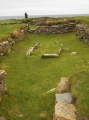
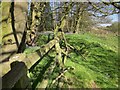
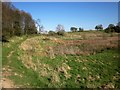
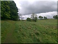
Nearby Images from Geograph Britain and Ireland:
©2014(licence)
©2014(licence)
©2011(licence)
©2014(licence)
©2021(licence)
The above images may not be of the site on this page, they are loaded from Geograph.
Please Submit an Image of this site or go out and take one for us!
Click here to see more info for this site
Nearby sites
Key: Red: member's photo, Blue: 3rd party photo, Yellow: other image, Green: no photo - please go there and take one, Grey: site destroyed
Download sites to:
KML (Google Earth)
GPX (GPS waypoints)
CSV (Garmin/Navman)
CSV (Excel)
To unlock full downloads you need to sign up as a Contributory Member. Otherwise downloads are limited to 50 sites.
Turn off the page maps and other distractions
Nearby sites listing. In the following links * = Image available
2.5km SE 144° Yarmer Head (Nidd) Standing Stone (Menhir) (SE299612)
2.7km S 182° Weeping Cross* Ancient Cross (SE283605)
2.8km SW 221° Deb Well* Holy Well or Sacred Spring (SE266611)
3.2km WSW 256° Cowgate Manor Barn (Shaw Mills) Rock Art (SE2525562397)
5.1km N 352° Robin Hood's Well ( Yorkshire)* Holy Well or Sacred Spring (SE2767868295)
6.2km E 90° Devil's Stone (Copgrove)* Sculptured Stone (SE346632)
6.3km E 85° St Mungo's Well (Copgrove)* Holy Well or Sacred Spring (SE34706378)
6.7km NW 310° Wine Wife Well* Holy Well or Sacred Spring (SE23216742)
7.2km W 267° Hartwith Moor* Standing Stone (Menhir) (SE2123362737)
7.3km W 278° Graffa Plain (Hartwith) Cairn (SE211642)
7.6km WNW 283° Brimham Rocks* Rock Outcrop (SE210649)
7.9km E 94° All Saints (Staveley) Ancient Cross (SE36266266)
8.0km WNW 284° Brimham Rocks Circle Stone Circle (SE20566507)
8.1km WNW 282° Brimham Rocks Rock Art Rock Art (SE2039764782)
8.2km NNE 18° St Wilfrid's Holy Well* Holy Well or Sacred Spring (SE30857102)
8.5km NNE 21° Ripon Cathedral* Ancient Cross (SE31457112)
8.7km SE 136° Mother Shipton's Cave and Petrifying Well * Holy Well or Sacred Spring (SE345570)
9.8km W 265° Bryan's Wood 01 Rock Art (SE1866362280)
9.9km W 264° Eastwoods Farm 02 (Heyshaw) Rock Art (SE1857262168)
9.9km W 265° Eastwoods Farm 01 (Heyshaw) Rock Art (SE1855662240)
9.9km W 265° Fertility Stone (CR-638)* Rock Art (SE1855262228)
9.9km W 261° Tadpole Stone (Eastwoods Rough)* Rock Art (SE1860161644)
9.9km W 262° Morphing Stone (Dacre)* Rock Art (SE1855961795)
9.9km W 263° Eastwoods Farm Cup (Heyshaw)* Rock Art (SE1852062010)
9.9km W 263° Eastwoods Cross Base (Summerbridge) Rock Art (SE1850662013)
View more nearby sites and additional images


 We would like to know more about this location. Please feel free to add a brief description and any relevant information in your own language.
 Wir möchten mehr über diese Stätte erfahren. Bitte zögern Sie nicht, eine kurze Beschreibung und relevante Informationen in Deutsch hinzuzufügen.
 Nous aimerions en savoir encore un peu sur les lieux. S'il vous plaît n'hesitez pas à ajouter une courte description et tous les renseignements pertinents dans votre propre langue.
 Quisieramos informarnos un poco más de las lugares. No dude en añadir una breve descripción y otros datos relevantes en su propio idioma.