Featured: Current Archaeology Book of the Year 2019!

Current Archaeology Book of the Year 2019!

Random Image


Kingston Russell

Avebury Archaeology Map

Avebury Archaeology Map

Who's Online

There are currently, 542 guests and 1 members online.

You are a guest. To join in, please register for free by clicking here

Sponsors

<< Our Photo Pages >> Moelfre (Gwynedd) - Round Cairn in Wales in Gwynedd

Submitted by Postman on Monday, 02 July 2018  Page Views: 3496

Neolithic and Bronze AgeSite Name: Moelfre (Gwynedd)
Country: Wales County: Gwynedd Type: Round Cairn
Nearest Town: Barmouth  Nearest Village: Dyffryn Ardudwy
Map Ref: SH62612458
Latitude: 52.801229N  Longitude: 4.039374W
Condition:
5Perfect
4Almost Perfect
3Reasonable but with some damage
2Ruined but still recognisable as an ancient site
1Pretty much destroyed, possibly visible as crop marks
0No data.
-1Completely destroyed
4 Ambience:
5Superb
4Good
3Ordinary
2Not Good
1Awful
0No data.
5 Access:
5Can be driven to, probably with disabled access
4Short walk on a footpath
3Requiring a bit more of a walk
2A long walk
1In the middle of nowhere, a nightmare to find
0No data.
3 Accuracy:
5co-ordinates taken by GPS or official recorded co-ordinates
4co-ordinates scaled from a detailed map
3co-ordinates scaled from a bad map
2co-ordinates of the nearest village
1co-ordinates of the nearest town
0no data
4

Internal Links:
External Links:

Moelfre (Gwynedd)
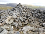
Moelfre (Gwynedd) submitted by w650marion : Circling around the large cairn on Moelfre, you can see that the stones have been disturbed and moved (Vote or comment on this photo)
Round Cairn in Gwynedd

Astounding views abound after a steep slog to reach the cairn. Please use the car park which is provided at Gors yGedol.
You may be viewing yesterday's version of this page. To see the most up to date information please register for a free account.
Moelfre (Gwynedd)
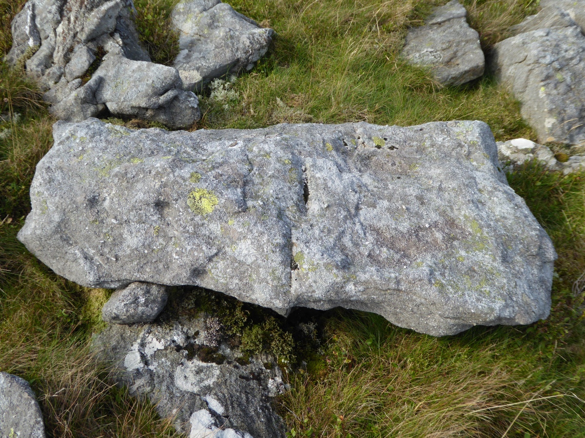
Moelfre (Gwynedd) submitted by w650marion : Close up of the slab with what could possibly be "cup marks" but I doubt that they are. There were no peck marks inside them. Just an unusual bit of weathering? And the stone slab is just lying on top of the ground. Must go back and have another look - when I can face the climb up again! (Vote or comment on this photo)

Moelfre (Gwynedd)
Moelfre (Gwynedd) submitted by w650marion : I don't remember seeing this cup marked stone slab alongside Moelfre cairn last time I was up here - but I don't come up here very often! There is nothing in the historical records, so it can't be cup marks. Perhaps it was left by the wall builders. There has been a lot of disturbance to this cairn over the years. (Vote or comment on this photo)

Moelfre (Gwynedd)
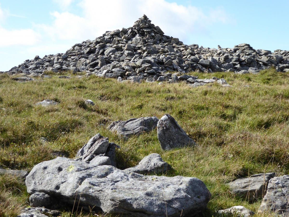
Moelfre (Gwynedd) submitted by w650marion : Moelfre cairn seen from across the flattened top of the hill, most of which is grassy and mossy - there are two small boggy pools in the low point in the middle. Two small piles of stones are on the grassy northern edge, they don't look ancient to me. (Vote or comment on this photo)

Moelfre (Gwynedd)
Moelfre (Gwynedd) submitted by w650marion : Another hollowed out area, still big enough to climb inside. (Vote or comment on this photo)

Moelfre (Gwynedd)
Moelfre (Gwynedd) submitted by w650marion : Closer view of the flat slab at the base, but I cannot tell if it is natural or the lid to a cist

Moelfre (Gwynedd)
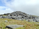
Moelfre (Gwynedd) submitted by w650marion : Two large hollows have been created inside the cairn. This larger hollow could be used by a group as a shelter from the stormy weather. Perhaps the stones were removed by someone looking for a cist or treasure. There is a flat slab at the base, but I cannot tell if it is natural or the lid to a cist

Moelfre (Gwynedd)
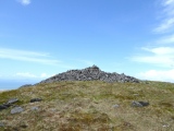
Moelfre (Gwynedd) submitted by w650marion : Viewing from the south, we were fortunate to be up here on a fine day

Moelfre (Gwynedd)
Moelfre (Gwynedd) submitted by w650marion : Approaching from the west after a steep climb

Moelfre (Gwynedd)
Moelfre (Gwynedd) submitted by Postman : Zoomed at from Craig y Dinas hill fort.

Do not use the above information on other web sites or publications without permission of the contributor.
Click here to see more info for this site

Nearby sites

Click here to view sites on an interactive OS map

Key: Red: member's photo, Blue: 3rd party photo, Yellow: other image, Green: no photo - please go there and take one, Grey: site destroyed

Download sites to:
KML (Google Earth)
GPX (GPS waypoints)
CSV (Garmin/Navman)
CSV (Excel)

To unlock full downloads you need to sign up as a Contributory Member. Otherwise downloads are limited to 50 sites.


Turn off the page maps and other distractions

Nearby sites listing. In the following links * = Image available
 775m SSE 156° Pont Scethin Double Cairn* Cairn (SH62902386)
 905m SW 221° Hut Group and Enclosures on SW Slope of Moelfre* Ancient Village or Settlement (SH62002391)
 927m SSE 167° Pont Scethin B* Standing Stone (Menhir) (SH62792367)
 947m S 171° Pont Scethin A* Standing Stone (Menhir) (SH62732364)
 1.1km S 179° Cairns North of Craig Y Dinas* Cairn (SH626235)
 1.3km N 358° Cwm Nantcol Tumuli* Cairn (SH626259)
 1.3km SW 222° Cors Uchaf E Hut Group* Ancient Village or Settlement (SH61682361)
 1.6km NW 306° Ffynnon Enddwyn* Holy Well or Sacred Spring (SH61372552)
 1.6km WNW 284° Bron Y Foel Recumbent Stone* Portal Tomb (SH611250)
 1.6km S 185° Craig-y-Dinas (Dyffryn Ardudwy)* Hillfort (SH62432300)
 1.6km SSW 206° Craig-y-Dinas W* Cairn (SH61852315)
 1.6km S 179° Hut Circle Settlement East of Craig Y Dinas* Ancient Village or Settlement (SH62602295)
 1.6km SE 146° Enclosure and Hut Circle, Pont Scethin* Ancient Village or Settlement (SH63502320)
 1.8km WSW 250° Waun Hir* Ring Cairn (SH609240)
 1.8km W 269° Bron y Foel Isaf* Portal Tomb (SH608246)
 1.9km SW 225° Cors Uchaf S* Cairn (SH61232330)
 1.9km WSW 257° Romano British Homestead with Enclosure, Dyffryn Ardudwy* Ancient Village or Settlement (SH60762420)
 1.9km WNW 297° Uwchlaw'r Coed enclosures* Ancient Village or Settlement (SH609255)
 2.0km SW 220° Cors-Y-Gedol E* Cairn (SH61252305)
 2.3km SW 222° Hut Circle, N of Afon Ysgethin* Ancient Village or Settlement (SH61062293)
 2.3km S 182° Llyn Irddyn W* Ancient Village or Settlement (SH62462229)
 2.3km WNW 298° Uwchlaw'r Coed Hut Circles* Ancient Village or Settlement (SH606257)
 2.4km S 188° Tumulus, Llyn Irddyn* Round Barrow(s) (SH62232225)
 2.6km SW 222° Pont Fadog N Hut Circles* Ancient Village or Settlement (SH60842272)
 2.6km SSW 209° Ponfadog Bridge* Natural Stone / Erratic / Other Natural Feature (SH61312235)
View more nearby sites and additional images

<< St Mary's Church (Wycliffe)

Visby (Gotland) >>

Please add your thoughts on this site

Newgrange: Archaeology, Art and Legend

Newgrange: Archaeology, Art and Legend

Sponsors

Auto-Translation (Google)

Translate from English into:

"Moelfre (Gwynedd)" | Login/Create an Account | 9 News and Comments
  
Go back to top of page    Comments are owned by the poster. We aren't responsible for their content.
Re: Moelfre (Gwynedd) & Cors y Gedol by AngieLake on Tuesday, 28 September 2021
(User Info | Send a Message)
It may be useful to link this photo taken by pab at Cors y Gedol to show Moelfre's aspect from that important site?
https://www.megalithic.co.uk/modules.php?op=modload&name=a312&file=index&do=showpic&pid=45701
It seems that Cors y Gedol's tomb entrance faced the dominant mountain (or hill). I'd interpreted that angle at NE on the streetmap at the top of the site page. There was also a settlement near this lovely little tomb, so they'd have a good view of Moelfre's cairn.
[ Reply to This ]
    Re: Moelfre (Gwynedd) & Cors y Gedol by w650marion on Tuesday, 28 September 2021
    (User Info | Send a Message)
    Yes!!! I’ve just been reading “Prehistoric Funerary and Ritual Sites Survey: Meirionnydd, 2000-2001”
    http://www.walesher1974.org/her/groups/GAT/media/GAT_Reports/GATreport_415_compressed.pdf
    and on page 59, their photo is exactly the same as pab’s! (pab’s is much better!) It says “The next nearest tomb, at Cors y Gedol, is oriented slightly more north of east than the rest and this gives it a striking alignment exactly on the hill of Moelfre (Fig. 31)). This rather regularly shaped. dome-like hill is a very prominent feature in the landscape over a considerable distance “ I’ve often thought about the people in the settlement looking up at this cairn, also the cairns SE from Pont Fadog which are in the opposite direction and shine bright on the skyline as the sun sets.
    [ Reply to This ]
      Re: Moelfre (Gwynedd) & Cors y Gedol by AngieLake on Tuesday, 28 September 2021
      (User Info | Send a Message)
      That's great w650marion. I rarely get to visit sites now, but back in the day it was always interesting to see what the main landscape feature was, in case it was a focal point for the builders. Sometimes my ritual movement dowsing plans would indicate that important view.
      [ Reply to This ]

Re: Moelfre (Gwynedd) by w650marion on Tuesday, 28 September 2021
(User Info | Send a Message)
info -
Coflein -
https://coflein.gov.uk/en/site/89023/

GAT-
https://archwilio.org.uk/arch/query/page.php?watprn=GAT2918&dbname=gat&tbname=core

interesting info from document on GAT report - . Surprisingly. those on major summits are commonly set on slight false crests. which immediately suggests that they were built in order to be seen from a particular direction. presumably the area of the associated settlement. For instance. the cairn on Moelfre (PRN 2918) is situated on the southern side of the summit. providing a prospect over the Hengwm plateau (Fig. 34). The dome-shape of Moelfre also means that the cairn is only visible from the Hengwm side (Fig. 35)
[ Reply to This ]

Re: Moelfre (Gwynedd) by w650marion on Friday, 24 September 2021
(User Info | Send a Message)
Please remove “you can now drive all the way up to the Pont Scethin standing stones “ as unauthorised vehicular access has been a problem in this area. A car park is provided at Gors yGedol.
[ Reply to This ]
    Re: Moelfre (Gwynedd) by Runemage on Friday, 24 September 2021
    (User Info | Send a Message)
    Is that okay Marion, or would you prefer it was worded differently?
    [ Reply to This ]
      Re: Moelfre (Gwynedd) by w650marion on Sunday, 26 September 2021
      (User Info | Send a Message)
      Thanks Runemage, that’s great. Best not to upset the locals, especially when they provide a nice car park!
      [ Reply to This ]

Re: Moelfre (Gwynedd) by w650marion on Wednesday, 21 November 2018
(User Info | Send a Message)
There is now a sign on the gate saying “no unauthorised vehicle access “ so you can’t drive up to the Pont Sethin standing stones. But no matter, the farmer provides a spot at Gods y Gedol with beautiful views and parking for £1. Sadly we noticed parts of the beautiful Ysgethin valley had been churned up with 4x4s, trail bikes and unauthorised camping. Walking here is a treat with ancient history everywhere.
[ Reply to This ]

Re: Moelfre (Gwynedd) by w650marion on Tuesday, 03 July 2018
(User Info | Send a Message)
Moelfre always draws the eye - sometimes the top is in cloud, but the round smooth shape looks relatively easy to walk up. Ha! It’s steep!
There's parking at Gors y Gedol (£1 for the farmer) and a flattish walk along 1 mile of track keeping Moelfre in view. The dog leg in this track around a very large field has always puzzled me, but I think that field is special. There’s a glacial moraine on the north side and the scattered stones in the middle form into perfect circles and lines at times! Nothing is noted on the OS map or Coflein for this field, and I know nothing! My climb up Moelfre starts through the gate signposted Ardudwy Way, past the “settlement” and “enclosure” (pause to take photos), then zigzagging up the steep grassy slope. To catch my breath I sit down on a convenient stone and look for circles on the landscape below, again they are not marked on the map.
At the top there are stiles, where the wire fence meets the wall, and over the wall. The cairn is big, but much has been disturbed, remodelled and removed. Two large hollows could provide shelter from the winds for those caught out, or perhaps it’s the old story of cairn robbers. The largest hollow has a flat slab at its base. Again I know nothing.
And how does it feel to be up here at this special place? To see the views, bask in the sun, king of the castle? In sun, it’s perfection, in stormy weather.....
Scouting the flattened top of the hill, most is mossy grass with a tendency to bog and pool rainwater in the lower centre. At the grassy northern end opposite to the cairn, there are two small piles of stones which look as if they had been robbed from the big cain. Also some metal supports driven into the ground. Perhaps these stones mark a path down but I didn’t try it. You can get caught out around here by sudden cliffs, large boulders, high walls and the inevitable bog.
Next time I want to come up here I think I will explore the route up from the parking in Cwm Nantcol. There are more high stone walls and boulders on that side, but it will be interesting.
[ Reply to This ]

Your Name: Anonymous [ Register Now ]
Subject:


Add your comment or contribution to this page. Spam or offensive posts are deleted immediately, don't even bother

<<< What is five plus one as a number? (Please type the answer to this question in the little box on the left)
You can also embed videos and other things. For Youtube please copy and paste the 'embed code'.
For Google Street View please include Street View in the text.
Create a web link like this: <a href="https://www.megalithic.co.uk">This is a link</a>  

Allowed HTML is:
<p> <b> <i> <a> <img> <em> <br> <strong> <blockquote> <tt> <li> <ol> <ul> <object> <param> <embed> <iframe>

We would like to know more about this location. Please feel free to add a brief description and any relevant information in your own language.
Wir möchten mehr über diese Stätte erfahren. Bitte zögern Sie nicht, eine kurze Beschreibung und relevante Informationen in Deutsch hinzuzufügen.
Nous aimerions en savoir encore un peu sur les lieux. S'il vous plaît n'hesitez pas à ajouter une courte description et tous les renseignements pertinents dans votre propre langue.
Quisieramos informarnos un poco más de las lugares. No dude en añadir una breve descripción y otros datos relevantes en su propio idioma.