<< Our Photo Pages >> Kobbeå Gravfelt - Cist in Denmark in Bornholm
Submitted by Boeddel on Monday, 05 September 2016 Page Views: 1212
Neolithic and Bronze AgeSite Name: Kobbeå GravfeltCountry: Denmark County: Bornholm Type: Cist
Nearest Town: Gudhjem
Latitude: 55.192593N Longitude: 14.990149E
Condition:
| 5 | Perfect |
| 4 | Almost Perfect |
| 3 | Reasonable but with some damage |
| 2 | Ruined but still recognisable as an ancient site |
| 1 | Pretty much destroyed, possibly visible as crop marks |
| 0 | No data. |
| -1 | Completely destroyed |
| 5 | Superb |
| 4 | Good |
| 3 | Ordinary |
| 2 | Not Good |
| 1 | Awful |
| 0 | No data. |
| 5 | Can be driven to, probably with disabled access |
| 4 | Short walk on a footpath |
| 3 | Requiring a bit more of a walk |
| 2 | A long walk |
| 1 | In the middle of nowhere, a nightmare to find |
| 0 | No data. |
| 5 | co-ordinates taken by GPS or official recorded co-ordinates |
| 4 | co-ordinates scaled from a detailed map |
| 3 | co-ordinates scaled from a bad map |
| 2 | co-ordinates of the nearest village |
| 1 | co-ordinates of the nearest town |
| 0 | no data |
Internal Links:
External Links:
I have visited· I would like to visit
Boeddel visited on 31st Aug 2016 - their rating: Amb: 4 Access: 5
")
You may be viewing yesterday's version of this page. To see the most up to date information please register for a free account.
")
")
")
")
Do not use the above information on other web sites or publications without permission of the contributor.
Nearby Images from Flickr
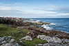

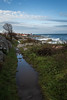
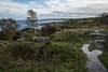
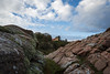
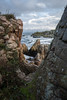
The above images may not be of the site on this page, but were taken nearby. They are loaded from Flickr so please click on them for image credits.
Click here to see more info for this site
Nearby sites
Click here to view sites on an interactive map of the areaKey: Red: member's photo, Blue: 3rd party photo, Yellow: other image, Green: no photo - please go there and take one, Grey: site destroyed
Download sites to:
KML (Google Earth)
GPX (GPS waypoints)
CSV (Garmin/Navman)
CSV (Excel)
To unlock full downloads you need to sign up as a Contributory Member. Otherwise downloads are limited to 50 sites.
Turn off the page maps and other distractions
Nearby sites listing. In the following links * = Image available
684m SE 126° Loftsgård Stenkiste* Cist
1.5km S 183° Gamlevælde Skåltegn* Rock Art
1.9km NNW 335° Gravpladsen Sletten* Barrow Cemetery
2.5km NW 317° Gråmyr Bautasten* Standing Stones
2.9km W 277° Lehnsgård Helleristninger* Rock Art
3.0km SW 218° Østerlarsstenen 1* Sculptured Stone
3.0km SW 218° Østerlarsstenen 3* Sculptured Stone
3.0km SW 218° Østerlarsstenen 2* Sculptured Stone
3.0km NW 319° Gudhjem Bautasten* Standing Stone (Menhir)
3.1km NW 317° Hestestenene* Standing Stones
3.2km NW 307° Salene* Cairn
4.3km SE 141° Randkløve Rundhøj* Round Barrow(s)
4.3km SSE 152° Risehøj Skåltegn* Rock Art
4.4km SE 143° Mølbjerg Skåltegn* Rock Art
4.5km SE 143° Mølbjerg Rundhøj* Round Barrow(s)
4.6km SE 134° Randkløve skåltegn* Rock Art
5.0km S 174° Brændesgård* Rock Art
5.1km SSW 203° Burial Place at Bøgebjerg* Chambered Tomb
5.3km S 187° Skrulle Skåltegn* Rock Art
5.3km W 263° Høilyngen Bautasten* Standing Stones
5.4km S 183° Bruunsgaard Skåltegn* Rock Art
5.5km W 263° Borgehoved i Rø Plantage* Hillfort
5.5km SSW 199° Højsten Bautasten* Standing Stone (Menhir)
6.3km SSE 165° Østermariestenen 2* Sculptured Stone
6.3km SSE 165° Østermariestenen 3* Sculptured Stone
View more nearby sites and additional images


 We would like to know more about this location. Please feel free to add a brief description and any relevant information in your own language.
 Wir möchten mehr über diese Stätte erfahren. Bitte zögern Sie nicht, eine kurze Beschreibung und relevante Informationen in Deutsch hinzuzufügen.
 Nous aimerions en savoir encore un peu sur les lieux. S'il vous plaît n'hesitez pas à ajouter une courte description et tous les renseignements pertinents dans votre propre langue.
 Quisieramos informarnos un poco más de las lugares. No dude en añadir una breve descripción y otros datos relevantes en su propio idioma.