
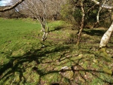

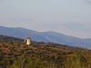
<< Our Photo Pages >> Dolmen du Mas d'Aussel 2 - Burial Chamber or Dolmen in France in Languedoc:Hérault (34)
Submitted by holger_rix on Monday, 07 March 2016 Page Views: 468
Neolithic and Bronze AgeSite Name: Dolmen du Mas d'Aussel 2Country: France Département: Languedoc:Hérault (34) Type: Burial Chamber or Dolmen
Nearest Town: Lodève Nearest Village: Le Caylar
Latitude: 43.888395N Longitude: 3.321321E
Condition:
| 5 | Perfect |
| 4 | Almost Perfect |
| 3 | Reasonable but with some damage |
| 2 | Ruined but still recognisable as an ancient site |
| 1 | Pretty much destroyed, possibly visible as crop marks |
| 0 | No data. |
| -1 | Completely destroyed |
| 5 | Superb |
| 4 | Good |
| 3 | Ordinary |
| 2 | Not Good |
| 1 | Awful |
| 0 | No data. |
| 5 | Can be driven to, probably with disabled access |
| 4 | Short walk on a footpath |
| 3 | Requiring a bit more of a walk |
| 2 | A long walk |
| 1 | In the middle of nowhere, a nightmare to find |
| 0 | No data. |
| 5 | co-ordinates taken by GPS or official recorded co-ordinates |
| 4 | co-ordinates scaled from a detailed map |
| 3 | co-ordinates scaled from a bad map |
| 2 | co-ordinates of the nearest village |
| 1 | co-ordinates of the nearest town |
| 0 | no data |
Be the first person to rate this site - see the 'Contribute!' box in the right hand menu.
Internal Links:
External Links:
")
Le Caylar, Lodève, Hérault, Languedoc-Roussillon-Midi-Pyrénées
Source: T4T35.fr
You may be viewing yesterday's version of this page. To see the most up to date information please register for a free account.
Do not use the above information on other web sites or publications without permission of the contributor.
Nearby Images from Flickr
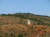

The above images may not be of the site on this page, but were taken nearby. They are loaded from Flickr so please click on them for image credits.
Click here to see more info for this site
Nearby sites
Click here to view sites on an interactive map of the areaKey: Red: member's photo, Blue: 3rd party photo, Yellow: other image, Green: no photo - please go there and take one, Grey: site destroyed
Download sites to:
KML (Google Earth)
GPX (GPS waypoints)
CSV (Garmin/Navman)
CSV (Excel)
To unlock full downloads you need to sign up as a Contributory Member. Otherwise downloads are limited to 50 sites.
Turn off the page maps and other distractions
Nearby sites listing. In the following links * = Image available
139m SE 139° Dolmen du Mas d'Aussel 3* Burial Chamber or Dolmen
164m NW 304° Dolmen du Mas d'Aussel 1* Burial Chamber or Dolmen
181m SE 138° Dolmen du Mas d'Aussel 4* Burial Chamber or Dolmen
514m SSE 164° Dolmen des Monts Lavagnes 1* Burial Chamber or Dolmen
520m SSE 158° Dolmen des Monts Lavagnes 2* Burial Chamber or Dolmen
600m SSE 151° Dolmen des Monts Lavagnes 6 Burial Chamber or Dolmen
604m SE 138° Dolmen des Monts Lavagnes 8 Burial Chamber or Dolmen
614m SE 127° Menhir du Mont Lavagnès* Standing Stone (Menhir)
619m SE 126° Tumulus Mont Lavagnès* Round Cairn
1.1km NNE 14° Dolmen du Serre Plumat Burial Chamber or Dolmen
1.2km ESE 108° Menhir de la Limonesque* Standing Stone (Menhir)
1.3km ENE 66° Menhir de las Planas Standing Stone (Menhir)
1.4km N 351° Dolmen des Fourques Burial Chamber or Dolmen
1.5km NNW 331° Menhir de Mont Aymat Standing Stone (Menhir)
1.6km NNW 342° Dolmen du Mont Aymat Burial Chamber or Dolmen
2.1km NNE 17° Serre-de-la-Guérite Standing Stone (Menhir)
2.2km E 89° Menhir de Cauvarels Standing Stone (Menhir)
2.3km NW 314° Menhir du Mont Merdous Standing Stone (Menhir)
2.4km SSE 153° Dolmen de Peyre Bertrand* Burial Chamber or Dolmen
2.5km NNW 336° Dolmen de Viste 2* Burial Chamber or Dolmen
2.6km WSW 249° Peyre-Plantade (Hérault) Standing Stone (Menhir)
2.7km SE 135° Dolmen du Mont Estremal 1 Burial Chamber or Dolmen
2.7km NNW 338° Dolmen de Viste 1* Burial Chamber or Dolmen
2.8km SE 138° Dolmen du Mont Estremal 2* Burial Chamber or Dolmen
3.1km SSE 165° Dolmen du Theil Burial Chamber or Dolmen
View more nearby sites and additional images


 We would like to know more about this location. Please feel free to add a brief description and any relevant information in your own language.
 Wir möchten mehr über diese Stätte erfahren. Bitte zögern Sie nicht, eine kurze Beschreibung und relevante Informationen in Deutsch hinzuzufügen.
 Nous aimerions en savoir encore un peu sur les lieux. S'il vous plaît n'hesitez pas à ajouter une courte description et tous les renseignements pertinents dans votre propre langue.
 Quisieramos informarnos un poco más de las lugares. No dude en añadir una breve descripción y otros datos relevantes en su propio idioma.