<< Our Photo Pages >> Dolmen de Combecrose - Burial Chamber or Dolmen in France in Midi:Aveyron (12)
Submitted by holger_rix on Tuesday, 09 February 2016 Page Views: 778
Neolithic and Bronze AgeSite Name: Dolmen de CombecroseCountry: France Département: Midi:Aveyron (12) Type: Burial Chamber or Dolmen
Nearest Town: Millau Nearest Village: Mostuéjouls
Latitude: 44.244390N Longitude: 3.158860E
Condition:
| 5 | Perfect |
| 4 | Almost Perfect |
| 3 | Reasonable but with some damage |
| 2 | Ruined but still recognisable as an ancient site |
| 1 | Pretty much destroyed, possibly visible as crop marks |
| 0 | No data. |
| -1 | Completely destroyed |
| 5 | Superb |
| 4 | Good |
| 3 | Ordinary |
| 2 | Not Good |
| 1 | Awful |
| 0 | No data. |
| 5 | Can be driven to, probably with disabled access |
| 4 | Short walk on a footpath |
| 3 | Requiring a bit more of a walk |
| 2 | A long walk |
| 1 | In the middle of nowhere, a nightmare to find |
| 0 | No data. |
| 5 | co-ordinates taken by GPS or official recorded co-ordinates |
| 4 | co-ordinates scaled from a detailed map |
| 3 | co-ordinates scaled from a bad map |
| 2 | co-ordinates of the nearest village |
| 1 | co-ordinates of the nearest town |
| 0 | no data |
Internal Links:
External Links:
I have visited· I would like to visit
johnstone visited on 7th Sep 2021 - their rating: Cond: 2 Amb: 2 Access: 3
")
Combecroze, Mostuéjouls, Millau, Midi-Pyrénées
Very ruined dolmen, situated at the end of an oblong tumulus (14 x 5.5 m). One upright of about 2.4 x 1.3 m still stands, other slabs in fragments on the ground. The chamber would be 1.3 m wide.
Litt: J.Lourdou, Inventaire des mégalithes du Centre de l’Aveyron, Vivre en Rouergue 1998, page 46
Source:Combecrose (T4T35)
You may be viewing yesterday's version of this page. To see the most up to date information please register for a free account.
")
")
Do not use the above information on other web sites or publications without permission of the contributor.
Nearby Images from Flickr


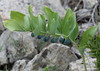
The above images may not be of the site on this page, but were taken nearby. They are loaded from Flickr so please click on them for image credits.
Click here to see more info for this site
Nearby sites
Click here to view sites on an interactive map of the areaKey: Red: member's photo, Blue: 3rd party photo, Yellow: other image, Green: no photo - please go there and take one, Grey: site destroyed
Download sites to:
KML (Google Earth)
GPX (GPS waypoints)
CSV (Garmin/Navman)
CSV (Excel)
To unlock full downloads you need to sign up as a Contributory Member. Otherwise downloads are limited to 50 sites.
Turn off the page maps and other distractions
Nearby sites listing. In the following links * = Image available
129m SE 135° Dolmen les Serres 3* Burial Chamber or Dolmen
1.4km N 359° Dolmen des Bouscaillous (Bombes) Burial Chamber or Dolmen
2.1km N 4° Dolmen de Lou Balcas 1 Burial Chamber or Dolmen
2.5km N 5° Dolmen de Lou Balcas 2 Burial Chamber or Dolmen
2.9km N 4° Dolmen du Serre de la Gardelle Burial Chamber or Dolmen
4.2km N 4° Dolmen de Lous Géans Burial Chamber or Dolmen
4.3km NW 321° Dolmen de Peyrelevade (Novis)* Burial Chamber or Dolmen
5.1km SSE 156° Mostuejouls dolmen Burial Chamber or Dolmen
5.8km WSW 245° Dolmen de Vézouillac 2* Burial Chamber or Dolmen
7.3km S 180° Dolmen de Sonnac* Burial Chamber or Dolmen
7.4km NW 309° Dolmen de Montaliés Burial Chamber or Dolmen
7.5km W 265° Dolmen de Mialas 1* Burial Chamber or Dolmen
7.6km NE 42° Almières Dolmen Burial Chamber or Dolmen
7.9km SE 135° Le Vase de Sèvres* Rock Outcrop
8.0km NW 319° Dolmen de Sermeillets* Burial Chamber or Dolmen
8.0km NE 43° Dolmen de Montcan Burial Chamber or Dolmen
8.0km SE 134° Le Vase de Chine* Rock Outcrop
8.1km NE 39° Dolmen de Roudil Burial Chamber or Dolmen
8.4km W 266° Dolmen de Souque* Burial Chamber or Dolmen
8.5km SE 143° Le Champignon (Peyreleau)* Rock Outcrop
8.6km ESE 107° Grotte de la Baumelle* Cave or Rock Shelter
8.6km ESE 109° Grotte de l'Homme Mort* Cave or Rock Shelter
8.7km ESE 108° Les Arcs de St Pierre 2* Rock Outcrop
8.7km WNW 303° Sermels menhir* Standing Stone (Menhir)
8.7km ESE 112° Les Arcs de St Pierre 1* Rock Outcrop
View more nearby sites and additional images


 We would like to know more about this location. Please feel free to add a brief description and any relevant information in your own language.
 Wir möchten mehr über diese Stätte erfahren. Bitte zögern Sie nicht, eine kurze Beschreibung und relevante Informationen in Deutsch hinzuzufügen.
 Nous aimerions en savoir encore un peu sur les lieux. S'il vous plaît n'hesitez pas à ajouter une courte description et tous les renseignements pertinents dans votre propre langue.
 Quisieramos informarnos un poco más de las lugares. No dude en añadir una breve descripción y otros datos relevantes en su propio idioma.