

<< Text Pages >> Castro do Coto da Cruz - Castro or Chafurdão in Spain in Galicia
Submitted by holger_rix on Thursday, 10 December 2015 Page Views: 629
Iron Age and Later PrehistorySite Name: Castro do Coto da CruzCountry: Spain Region: Galicia Type: Castro or Chafurdão
Latitude: 42.132635N Longitude: 8.554537W
Condition:
| 5 | Perfect |
| 4 | Almost Perfect |
| 3 | Reasonable but with some damage |
| 2 | Ruined but still recognisable as an ancient site |
| 1 | Pretty much destroyed, possibly visible as crop marks |
| 0 | No data. |
| -1 | Completely destroyed |
| 5 | Superb |
| 4 | Good |
| 3 | Ordinary |
| 2 | Not Good |
| 1 | Awful |
| 0 | No data. |
| 5 | Can be driven to, probably with disabled access |
| 4 | Short walk on a footpath |
| 3 | Requiring a bit more of a walk |
| 2 | A long walk |
| 1 | In the middle of nowhere, a nightmare to find |
| 0 | No data. |
| 5 | co-ordinates taken by GPS or official recorded co-ordinates |
| 4 | co-ordinates scaled from a detailed map |
| 3 | co-ordinates scaled from a bad map |
| 2 | co-ordinates of the nearest village |
| 1 | co-ordinates of the nearest town |
| 0 | no data |
Be the first person to rate this site - see the 'Contribute!' box in the right hand menu.
Internal Links:
External Links:
Castro or Chafurdão in Galicia
You may be viewing yesterday's version of this page. To see the most up to date information please register for a free account.
Do not use the above information on other web sites or publications without permission of the contributor.
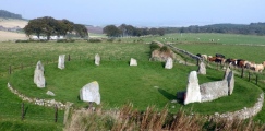
Nearby Images from Flickr
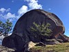

The above images may not be of the site on this page, but were taken nearby. They are loaded from Flickr so please click on them for image credits.
Click here to see more info for this site
Nearby sites
Click here to view sites on an interactive map of the areaKey: Red: member's photo, Blue: 3rd party photo, Yellow: other image, Green: no photo - please go there and take one, Grey: site destroyed
Download sites to:
KML (Google Earth)
GPX (GPS waypoints)
CSV (Garmin/Navman)
CSV (Excel)
To unlock full downloads you need to sign up as a Contributory Member. Otherwise downloads are limited to 50 sites.
Turn off the page maps and other distractions
Nearby sites listing. In the following links * = Image available
666m SSE 156° Castro de O Pomar de Suso Castro or Chafurdão
1.3km NW 325° Castro de San Cibrán . Castro or Chafurdão
1.4km NNW 336° Dolmen de O Couso Burial Chamber or Dolmen
1.7km SW 233° Castro de Ataúde Castro or Chafurdão
4.8km SSW 205° Castro de A Revolta Castro or Chafurdão
5.0km S 191° Castro de Pedrabuxiña Castro or Chafurdão
6.4km NW 307° Castro de Pontellas Castro or Chafurdão
7.1km S 187° Castro do Pouso Castro or Chafurdão
7.3km SE 141° Castro de San Amaro Castro or Chafurdão
7.8km NE 49° Coto do Castro (Ponteareas) Castro or Chafurdão
7.9km NE 49° Pedra Coello Natural Stone / Erratic / Other Natural Feature
7.9km NE 48° Pena do Equilibrio* Natural Stone / Erratic / Other Natural Feature
8.1km NE 52° Pena dos Namorados* Natural Stone / Erratic / Other Natural Feature
8.4km NNE 12° Penedo o Laxe da Cruz Natural Stone / Erratic / Other Natural Feature
8.8km SE 132° Pedra do Zunido (Summstein) Modern Stone Circle etc
9.4km NW 319° Castro de Torroso* Castro or Chafurdão
9.8km W 274° Castro de Herville Castro or Chafurdão
10.5km NNE 30° Castro de Troña* Castro or Chafurdão
10.6km WNW 297° Mámoa de Meixoeiro* Burial Chamber or Dolmen
10.7km ENE 60° Castro de Castromao (Ponteareas) Castro or Chafurdão
11.5km SW 230° Castro do Monte dos Cubos Castro or Chafurdão
11.6km WNW 292° Mámoas d´As Xunqueiras Barrow Cemetery
11.6km SW 231° Castro Cabeza de Francos ou dos Cubos Castro or Chafurdão
12.2km NW 311° Mamoa III de Rebullón Burial Chamber or Dolmen
12.7km NE 37° Dolmen de las Tres Cruces* Burial Chamber or Dolmen
View more nearby sites and additional images


 We would like to know more about this location. Please feel free to add a brief description and any relevant information in your own language.
 Wir möchten mehr über diese Stätte erfahren. Bitte zögern Sie nicht, eine kurze Beschreibung und relevante Informationen in Deutsch hinzuzufügen.
 Nous aimerions en savoir encore un peu sur les lieux. S'il vous plaît n'hesitez pas à ajouter une courte description et tous les renseignements pertinents dans votre propre langue.
 Quisieramos informarnos un poco más de las lugares. No dude en añadir una breve descripción y otros datos relevantes en su propio idioma.