

<< Text Pages >> Andatza 3 Zista - Cist in Spain in Pais Vasco
Submitted by holger_rix on Friday, 27 November 2015 Page Views: 478
Neolithic and Bronze AgeSite Name: Andatza 3 ZistaCountry: Spain Region: Pais Vasco Type: Cist
Latitude: 43.245367N Longitude: 2.073793W
Condition:
| 5 | Perfect |
| 4 | Almost Perfect |
| 3 | Reasonable but with some damage |
| 2 | Ruined but still recognisable as an ancient site |
| 1 | Pretty much destroyed, possibly visible as crop marks |
| 0 | No data. |
| -1 | Completely destroyed |
| 5 | Superb |
| 4 | Good |
| 3 | Ordinary |
| 2 | Not Good |
| 1 | Awful |
| 0 | No data. |
| 5 | Can be driven to, probably with disabled access |
| 4 | Short walk on a footpath |
| 3 | Requiring a bit more of a walk |
| 2 | A long walk |
| 1 | In the middle of nowhere, a nightmare to find |
| 0 | No data. |
| 5 | co-ordinates taken by GPS or official recorded co-ordinates |
| 4 | co-ordinates scaled from a detailed map |
| 3 | co-ordinates scaled from a bad map |
| 2 | co-ordinates of the nearest village |
| 1 | co-ordinates of the nearest town |
| 0 | no data |
Be the first person to rate this site - see the 'Contribute!' box in the right hand menu.
Internal Links:
External Links:
Cist in Pais Vasco
You may be viewing yesterday's version of this page. To see the most up to date information please register for a free account.
Do not use the above information on other web sites or publications without permission of the contributor.
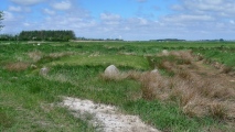
Nearby Images from Flickr
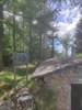

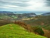
The above images may not be of the site on this page, but were taken nearby. They are loaded from Flickr so please click on them for image credits.
Click here to see more info for this site
Nearby sites
Click here to view sites on an interactive map of the areaKey: Red: member's photo, Blue: 3rd party photo, Yellow: other image, Green: no photo - please go there and take one, Grey: site destroyed
Download sites to:
KML (Google Earth)
GPX (GPS waypoints)
CSV (Garmin/Navman)
CSV (Excel)
To unlock full downloads you need to sign up as a Contributory Member. Otherwise downloads are limited to 50 sites.
Turn off the page maps and other distractions
Nearby sites listing. In the following links * = Image available
10m W 280° Andatza 2 Trikuharria Burial Chamber or Dolmen
389m ENE 61° Andatza 1 Trikuharria Burial Chamber or Dolmen
1.1km WNW 288° Loatzu 2 Trikuharria Burial Chamber or Dolmen
1.3km ENE 75° Karramiolotz Trikuharria Burial Chamber or Dolmen
1.4km WNW 289° Loatzu 1 Trikuharria Burial Chamber or Dolmen
2.0km SSW 193° Venta De Zarate Trikuharria* Burial Chamber or Dolmen
2.0km WNW 283° Beldarrain Trikuharria Burial Chamber or Dolmen
2.2km ENE 71° Olaiko Trikuharria Burial Chamber or Dolmen
2.6km ENE 76° Arkutxa Trikuharria Burial Chamber or Dolmen
3.3km SE 143° Belkoain Trikuharria Burial Chamber or Dolmen
3.7km SW 219° Palankaleku Trikuharria Burial Chamber or Dolmen
5.5km N 350° Tontortxiki 1 Tumulua Round Barrow(s)
5.5km N 349° Tontortxiki 3 Tumulua* Round Barrow(s)
5.5km N 354° Aitzazate Trikuharria Burial Chamber or Dolmen
5.5km N 349° Tontortxiki 4 Tumulua Round Barrow(s)
5.5km NNW 348° Tontortxiki 2 Tumulua* Round Barrow(s)
5.7km N 355° Aitzazate 1 Harrespila Stone Circle
5.7km N 360° Mendizorrotz 1 Harrespila* Stone Circle
6.1km N 8° Mendizorrotz 2 Trikuharria Burial Chamber or Dolmen
6.2km NNE 12° Arrobizar Trikuharria Burial Chamber or Dolmen
6.3km NNE 13° Txalin Zutarria Standing Stone (Menhir)
6.9km W 259° Arreta Tumulua Round Barrow(s)
7.0km NNE 19° Iturrieta Trikuharria Burial Chamber or Dolmen
7.7km SE 143° Oindolar 2 Trikuharria Burial Chamber or Dolmen
7.7km WSW 255° Olarteta Trikuharria Burial Chamber or Dolmen
View more nearby sites and additional images


 We would like to know more about this location. Please feel free to add a brief description and any relevant information in your own language.
 Wir möchten mehr über diese Stätte erfahren. Bitte zögern Sie nicht, eine kurze Beschreibung und relevante Informationen in Deutsch hinzuzufügen.
 Nous aimerions en savoir encore un peu sur les lieux. S'il vous plaît n'hesitez pas à ajouter une courte description et tous les renseignements pertinents dans votre propre langue.
 Quisieramos informarnos un poco más de las lugares. No dude en añadir una breve descripción y otros datos relevantes en su propio idioma.