

<< Our Photo Pages >> Petroglyphs of Pegtymel River - Rock Art in Russia
Submitted by AlexAssa on Wednesday, 11 November 2015 Page Views: 5221
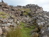
Rock ArtSite Name: Petroglyphs of Pegtymel River Alternative Name: Arctic Rock carving of ChukotkaCountry: Russia
NOTE: This site is 345.088 km away from the location you searched for.
Type: Rock Art
Nearest Town: Anadyr Nearest Village: Billings
Latitude: 69.583580N Longitude: 174.437221E
Condition:
| 5 | Perfect |
| 4 | Almost Perfect |
| 3 | Reasonable but with some damage |
| 2 | Ruined but still recognisable as an ancient site |
| 1 | Pretty much destroyed, possibly visible as crop marks |
| 0 | No data. |
| -1 | Completely destroyed |
| 5 | Superb |
| 4 | Good |
| 3 | Ordinary |
| 2 | Not Good |
| 1 | Awful |
| 0 | No data. |
| 5 | Can be driven to, probably with disabled access |
| 4 | Short walk on a footpath |
| 3 | Requiring a bit more of a walk |
| 2 | A long walk |
| 1 | In the middle of nowhere, a nightmare to find |
| 0 | No data. |
| 5 | co-ordinates taken by GPS or official recorded co-ordinates |
| 4 | co-ordinates scaled from a detailed map |
| 3 | co-ordinates scaled from a bad map |
| 2 | co-ordinates of the nearest village |
| 1 | co-ordinates of the nearest town |
| 0 | no data |
Internal Links:
External Links:
")
It was found here no less than 300 prints
Chronology: 2'000/1'000 BC
You may be viewing yesterday's version of this page. To see the most up to date information please register for a free account.
")
")
")
")
")
")
")
")
Do not use the above information on other web sites or publications without permission of the contributor.
Click here to see more info for this site
Nearby sites
Click here to view sites on an interactive map of the areaKey: Red: member's photo, Blue: 3rd party photo, Yellow: other image, Green: no photo - please go there and take one, Grey: site destroyed
Download sites to:
KML (Google Earth)
GPX (GPS waypoints)
CSV (Garmin/Navman)
CSV (Excel)
To unlock full downloads you need to sign up as a Contributory Member. Otherwise downloads are limited to 50 sites.
Turn off the page maps and other distractions
Nearby sites listing. In the following links * = Image available
687.3km SE 136° Un'en'en Ancient Village or Settlement
1032.8km ESE 113° Snake River Sandspit Pithouses Ancient Village or Settlement
1088.1km ENE 66° Birnirk National Historic Landmark* Artificial Mound
1089.1km E 85° Feniak Lake* Rock Art
1144.2km E 91° Onion Portage Archaeological District* Ancient Village or Settlement
1385.4km WSW 250° Berelekh* Ancient Village or Settlement
1454.1km WNW 293° Yana RHS* Ancient Village or Settlement
1550.2km ESE 123° Nunalleq* Ancient Village or Settlement
1566.6km WSW 237° Magadan Regional Museum* Museum
1798.1km E 90° Swan Point Archaeological Site* Ancient Village or Settlement
1799.5km E 90° Upward Sun River* Ancient Village or Settlement
1813.5km ENE 77° Bluefish Caves* Cave or Rock Shelter
1867.9km E 93° Tangle Lakes Archaeological District* Ancient Village or Settlement
1994.1km SE 141° Amaknak Bridge Ancient Village or Settlement
2009.4km SSW 212° Kamchatka Geological Museum* Museum
2281.1km W 269° Deering Yuryakh* Ancient Village or Settlement
2286.0km N 360° Termas Romanas Toledo* Museum
2467.0km E 88° Yukon Beringia Interpretive Centre* Museum
2769.3km E 94° Hidden Falls Ancient Village or Settlement
2820.9km WSW 248° Dolmens Bureinski reserve* Chambered Tomb
2832.7km NE 38° Resolute Thule Houses Ancient Village or Settlement
2886.2km E 94° On-Your-Knees Cave* Cave or Rock Shelter
2919.7km E 93° Petroglyph Beach* Rock Art
3100.4km WSW 242° Sikachi-Alyan Petroglyphs* Rock Art
3148.1km WSW 242° Khabarovsk Archaeology Museum* Museum
View more nearby sites and additional images


 We would like to know more about this location. Please feel free to add a brief description and any relevant information in your own language.
 Wir möchten mehr über diese Stätte erfahren. Bitte zögern Sie nicht, eine kurze Beschreibung und relevante Informationen in Deutsch hinzuzufügen.
 Nous aimerions en savoir encore un peu sur les lieux. S'il vous plaît n'hesitez pas à ajouter une courte description et tous les renseignements pertinents dans votre propre langue.
 Quisieramos informarnos un poco más de las lugares. No dude en añadir una breve descripción y otros datos relevantes en su propio idioma.