


<< Our Photo Pages >> Izumizaki Yokoana - Rock Cut Tomb in Japan in Honshū
Submitted by Aska on Tuesday, 03 November 2015 Page Views: 1616
Rock ArtSite Name: Izumizaki Yokoana Alternative Name: 泉崎横穴Country: Japan Region: Honshū Type: Rock Cut Tomb
Nearest Town: Izumizaki-mura (Fukushima pref.) Nearest Village: Izumizaki 泉崎
Latitude: 37.152670N Longitude: 140.317110E
Condition:
| 5 | Perfect |
| 4 | Almost Perfect |
| 3 | Reasonable but with some damage |
| 2 | Ruined but still recognisable as an ancient site |
| 1 | Pretty much destroyed, possibly visible as crop marks |
| 0 | No data. |
| -1 | Completely destroyed |
| 5 | Superb |
| 4 | Good |
| 3 | Ordinary |
| 2 | Not Good |
| 1 | Awful |
| 0 | No data. |
| 5 | Can be driven to, probably with disabled access |
| 4 | Short walk on a footpath |
| 3 | Requiring a bit more of a walk |
| 2 | A long walk |
| 1 | In the middle of nowhere, a nightmare to find |
| 0 | No data. |
| 5 | co-ordinates taken by GPS or official recorded co-ordinates |
| 4 | co-ordinates scaled from a detailed map |
| 3 | co-ordinates scaled from a bad map |
| 2 | co-ordinates of the nearest village |
| 1 | co-ordinates of the nearest town |
| 0 | no data |
Internal Links:
External Links:
")
A rock cut tombs discovered during a road construction in 1933. Figures of men, horses and spirals are painted on the wall and the celling of the chamber of a tomb.
Usually closed to public, a disclosure day was held in 10th October 2015.
You may be viewing yesterday's version of this page. To see the most up to date information please register for a free account.
")
Do not use the above information on other web sites or publications without permission of the contributor.
Nearby Images from Flickr

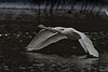


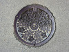
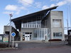
The above images may not be of the site on this page, but were taken nearby. They are loaded from Flickr so please click on them for image credits.
Click here to see more info for this site
Nearby sites
Click here to view sites on an interactive map of the areaKey: Red: member's photo, Blue: 3rd party photo, Yellow: other image, Green: no photo - please go there and take one, Grey: site destroyed
Download sites to:
KML (Google Earth)
GPX (GPS waypoints)
CSV (Garmin/Navman)
CSV (Excel)
To unlock full downloads you need to sign up as a Contributory Member. Otherwise downloads are limited to 50 sites.
Turn off the page maps and other distractions
Nearby sites listing. In the following links * = Image available
3.3km SW 236° Nojikubo Kofun* Passage Grave
59.9km ESE 106° Nakata Yokoana* Rock Cut Tomb
64.2km SSE 148° Jūōmae Yokoana* Rock Cut Tomb
67.0km S 170° Mi Kofun* Passage Grave
68.1km SSE 168° Nekobuchi Yokoana* Rock Cut Tomb
69.0km NW 318° Nagai MaenoYama Kofun* Long Barrow
69.4km SW 216° KamiYokokura* Standing Stones
69.5km ENE 61° History and Folklore Museum Futaba-Machi* Museum
71.3km SSE 164° Hata Bakke Yokoana* Rock Cut Tomb
73.1km SSW 212° Nagaoka Hyakuana* Rock Cut Tomb
75.7km S 169° Shirakōchi Kofungun* Passage Grave
77.7km SW 236° Taiyū-in shrine* Modern Stone Circle etc
78.2km S 176° Masui Kofun* Passage Grave
84.8km S 177° Kurefushi-no-Sato Kofun Kōen park* Passage Grave
86.2km SSE 165° Mawatari Haniwa Seisaku Iseki* Ancient Mine, Quarry or other Industry
87.8km S 184° Shumpū Banri-sō* Modern Stone Circle etc
89.4km S 171° Yoshida Kofun* Passage Grave
89.5km SSE 165° Torazuka Kofun* Long Barrow
89.6km SSW 192° Hanazono Kofungun* Passage Grave
94.3km WNW 302° Kosegasawa Cave Cave or Rock Shelter
94.4km NNE 20° IshiButai open air theater* Modern Stone Circle etc
97.8km S 175° Obata Kitayama Haniwa Serisaku Iseki* Ancient Mine, Quarry or other Industry
99.8km N 354° Matsuzawa kofungun* Chambered Cairn
104.4km SSW 201° Funadama Kofun* Passage Grave
110.1km NNE 25° Takenohana Yokoana* Rock Cut Tomb
View more nearby sites and additional images


 We would like to know more about this location. Please feel free to add a brief description and any relevant information in your own language.
 Wir möchten mehr über diese Stätte erfahren. Bitte zögern Sie nicht, eine kurze Beschreibung und relevante Informationen in Deutsch hinzuzufügen.
 Nous aimerions en savoir encore un peu sur les lieux. S'il vous plaît n'hesitez pas à ajouter une courte description et tous les renseignements pertinents dans votre propre langue.
 Quisieramos informarnos un poco más de las lugares. No dude en añadir una breve descripción y otros datos relevantes en su propio idioma.