

<< Other Photo Pages >> Cista del Suro del Rei - Burial Chamber or Dolmen in Spain in Cataluña
Submitted by holger_rix on Monday, 02 November 2015 Page Views: 882
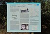
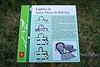
Neolithic and Bronze AgeSite Name: Cista del Suro del ReiCountry: Spain Region: Cataluña Type: Burial Chamber or Dolmen
Latitude: 41.846594N Longitude: 2.987316E
Condition:
| 5 | Perfect |
| 4 | Almost Perfect |
| 3 | Reasonable but with some damage |
| 2 | Ruined but still recognisable as an ancient site |
| 1 | Pretty much destroyed, possibly visible as crop marks |
| 0 | No data. |
| -1 | Completely destroyed |
| 5 | Superb |
| 4 | Good |
| 3 | Ordinary |
| 2 | Not Good |
| 1 | Awful |
| 0 | No data. |
| 5 | Can be driven to, probably with disabled access |
| 4 | Short walk on a footpath |
| 3 | Requiring a bit more of a walk |
| 2 | A long walk |
| 1 | In the middle of nowhere, a nightmare to find |
| 0 | No data. |
| 5 | co-ordinates taken by GPS or official recorded co-ordinates |
| 4 | co-ordinates scaled from a detailed map |
| 3 | co-ordinates scaled from a bad map |
| 2 | co-ordinates of the nearest village |
| 1 | co-ordinates of the nearest town |
| 0 | no data |
Be the first person to rate this site - see the 'Contribute!' box in the right hand menu.
Internal Links:
External Links:
")
You may be viewing yesterday's version of this page. To see the most up to date information please register for a free account.
Do not use the above information on other web sites or publications without permission of the contributor.
Nearby Images from Flickr
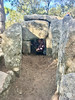
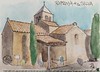
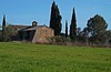

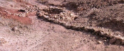
The above images may not be of the site on this page, but were taken nearby. They are loaded from Flickr so please click on them for image credits.
Click here to see more info for this site
Nearby sites
Click here to view sites on an interactive map of the areaKey: Red: member's photo, Blue: 3rd party photo, Yellow: other image, Green: no photo - please go there and take one, Grey: site destroyed
Download sites to:
KML (Google Earth)
GPX (GPS waypoints)
CSV (Garmin/Navman)
CSV (Excel)
To unlock full downloads you need to sign up as a Contributory Member. Otherwise downloads are limited to 50 sites.
Turn off the page maps and other distractions
Nearby sites listing. In the following links * = Image available
44m WNW 303° Cista d'en Guitó* Burial Chamber or Dolmen
550m SSE 158° Dolmen de La Cova d'en Riera* Burial Chamber or Dolmen
1.1km NNE 24° Cista de la Carretera de Calonge* Burial Chamber or Dolmen
1.1km N 9° Paradolmen Pedres Grosses* Burial Chamber or Dolmen
1.2km N 356° Menhir de la Murtra* Standing Stone (Menhir)
1.2km NNW 332° Dolmen de la Feixa d'en Guitó* Burial Chamber or Dolmen
1.2km NNW 331° Cista de l'Oliveret Cist
1.3km NNE 21° Cova d'en Daina Dolmen* Chambered Tomb
1.6km SSE 168° Pedra dels Sacrificis de les Gavarres Natural Stone / Erratic / Other Natural Feature
1.8km SSW 207° Menhir de la Font Picant Standing Stone (Menhir)
1.8km SSE 155° Dolmen del Mas Bouserenys* Burial Chamber or Dolmen
2.1km SSW 197° Menhir de Bell-lloc Standing Stone (Menhir)
2.3km N 2° Cista del Bosc d'en Roquet* Burial Chamber or Dolmen
2.5km SSW 212° Menhir Pedra Ramera* Standing Stone (Menhir)
2.9km SSE 149° Dolmen de Pedres Dretes d'en Lloveres Burial Chamber or Dolmen
3.1km ESE 113° Menhir del Mas Veguer Standing Stone (Menhir)
3.4km ESE 114° Menhir Pedra de les Goges* Standing Stone (Menhir)
4.5km SSW 207° Cova de Solius Cave or Rock Shelter
4.8km N 10° Puig d'Arques Dolmen* Burial Chamber or Dolmen
5.0km SSW 197° Menhir de Can Llaurador* Standing Stone (Menhir)
5.5km ENE 69° Menhir de Can Mont Standing Stone (Menhir)
5.7km E 92° Dolmen Cova de les Perdius Burial Chamber or Dolmen
5.9km SE 126° Menhir Vall d'Aro Standing Stone (Menhir)
6.1km S 184° Sant Feliu de Guixols* Natural Stone / Erratic / Other Natural Feature
6.2km E 97° Menhir de Mas Ros* Standing Stone (Menhir)
View more nearby sites and additional images


 We would like to know more about this location. Please feel free to add a brief description and any relevant information in your own language.
 Wir möchten mehr über diese Stätte erfahren. Bitte zögern Sie nicht, eine kurze Beschreibung und relevante Informationen in Deutsch hinzuzufügen.
 Nous aimerions en savoir encore un peu sur les lieux. S'il vous plaît n'hesitez pas à ajouter une courte description et tous les renseignements pertinents dans votre propre langue.
 Quisieramos informarnos un poco más de las lugares. No dude en añadir una breve descripción y otros datos relevantes en su propio idioma.