 with our Megalithic Portal iPhone app")

<< Our Photo Pages >> Sweetworthy settlement - Ancient Village or Settlement in England in Somerset
Submitted by Bladup on Monday, 21 September 2015 Page Views: 2029
Multi-periodSite Name: Sweetworthy settlementCountry: England County: Somerset Type: Ancient Village or Settlement
Map Ref: SS890425
Latitude: 51.170934N Longitude: 3.5891W
Condition:
| 5 | Perfect |
| 4 | Almost Perfect |
| 3 | Reasonable but with some damage |
| 2 | Ruined but still recognisable as an ancient site |
| 1 | Pretty much destroyed, possibly visible as crop marks |
| 0 | No data. |
| -1 | Completely destroyed |
| 5 | Superb |
| 4 | Good |
| 3 | Ordinary |
| 2 | Not Good |
| 1 | Awful |
| 0 | No data. |
| 5 | Can be driven to, probably with disabled access |
| 4 | Short walk on a footpath |
| 3 | Requiring a bit more of a walk |
| 2 | A long walk |
| 1 | In the middle of nowhere, a nightmare to find |
| 0 | No data. |
| 5 | co-ordinates taken by GPS or official recorded co-ordinates |
| 4 | co-ordinates scaled from a detailed map |
| 3 | co-ordinates scaled from a bad map |
| 2 | co-ordinates of the nearest village |
| 1 | co-ordinates of the nearest town |
| 0 | no data |
Internal Links:
External Links:
")
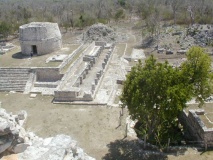
Sweetworthy settlement, A univallate earthwork formed by a bank with outer ditch enclosing a sub-circular area about 62 metres by 50 metres at SS891425, Two other settlements [rounds] are found to the Southwest [SS890424 and SS889423] and partial settlements at SS888425 and SS887424.
A little to the West at SS883426 is Bagley settlement, A iron age settlement with the remains of medieval buildings next to the far older round [settlement].
You may be viewing yesterday's version of this page. To see the most up to date information please register for a free account.
")
")
")
")
")
")
")
")
")
")
")
")
")
")
")
")
")
")
Do not use the above information on other web sites or publications without permission of the contributor.
Click here to see more info for this site
Nearby sites
Key: Red: member's photo, Blue: 3rd party photo, Yellow: other image, Green: no photo - please go there and take one, Grey: site destroyed
Download sites to:
KML (Google Earth)
GPX (GPS waypoints)
CSV (Garmin/Navman)
CSV (Excel)
To unlock full downloads you need to sign up as a Contributory Member. Otherwise downloads are limited to 50 sites.
Turn off the page maps and other distractions
Nearby sites listing. In the following links * = Image available
922m SSE 166° Dunkery Beacon* Barrow Cemetery (SS892416)
1.5km SSW 203° Codsend Moor Multiple Stone Rows / Avenue (SS88364110)
1.7km SW 235° Rowbarrow Group* Barrow Cemetery (SS87544154)
1.8km E 81° Robin How* Cairn (SS90764273)
1.8km E 80° Joaney How Cairn (SS90814279)
3.1km WSW 241° Hoar Moor (E)* Standing Stone (Menhir) (SS86214106)
3.4km W 260° Wilmersham Common South* Multiple Stone Rows / Avenue (SS85664197)
3.4km W 262° Wilmersham Common North* Stone Row / Alignment (SS8561242129)
3.6km WSW 240° Hoar Moor (W) Standing Stone (Menhir) (SS85864075)
3.9km NW 307° Berry Castle (Exmoor) Hillfort (SS859449)
4.5km NNE 21° Pixy Well* Holy Well or Sacred Spring (SS9066646634)
4.7km W 259° Almsworthy* Stone Circle (SS8430941698)
4.9km WNW 295° Porlock Common SW* Multiple Stone Rows / Avenue (SS8457544654)
5.0km WNW 295° Porlock Circle* Stone Circle (SS84514467)
5.1km NNE 16° St Agnes Fountain Holy Well or Sacred Spring (SS905474)
5.2km NW 314° Whit Stones* Standing Stones (SS8532846255)
5.3km WNW 290° Coley Water, South* Stone Row / Alignment (SS84074438)
5.3km W 267° Alderman's Barrow* Round Barrow(s) (SS837423)
5.4km NNE 29° Bury Castle (Exmoor)* Hillfort (SS91744716)
5.4km WNW 293° Porlock Allotment NE* Standing Stones (SS84014471)
5.8km WNW 282° Porlock Allotment SW* Multiple Stone Rows / Avenue (SS8335543785)
5.8km NW 306° Porlock Common North East* Stone Row / Alignment (SS8434946032)
5.9km W 269° Madacombe* Stone Row / Alignment (SS831425)
6.0km W 270° Madacombe Barrows Barrow Cemetery (SS830426)
6.0km WNW 282° Hoscombe SE* Stone Row / Alignment (SS8311443876)
View more nearby sites and additional images


 We would like to know more about this location. Please feel free to add a brief description and any relevant information in your own language.
 Wir möchten mehr über diese Stätte erfahren. Bitte zögern Sie nicht, eine kurze Beschreibung und relevante Informationen in Deutsch hinzuzufügen.
 Nous aimerions en savoir encore un peu sur les lieux. S'il vous plaît n'hesitez pas à ajouter une courte description et tous les renseignements pertinents dans votre propre langue.
 Quisieramos informarnos un poco más de las lugares. No dude en añadir una breve descripción y otros datos relevantes en su propio idioma.