

<< Other Photo Pages >> Dolmen de Can Gol II - Chambered Tomb in Spain in Cataluña
Submitted by Martin_L on Thursday, 06 November 2014 Page Views: 1452
Neolithic and Bronze AgeSite Name: Dolmen de Can Gol IICountry: Spain Region: Cataluña Type: Chambered Tomb
Nearest Town: Granollers Nearest Village: El Bosc de Ruscalleda
Latitude: 41.564890N Longitude: 2.318072E
Condition:
| 5 | Perfect |
| 4 | Almost Perfect |
| 3 | Reasonable but with some damage |
| 2 | Ruined but still recognisable as an ancient site |
| 1 | Pretty much destroyed, possibly visible as crop marks |
| 0 | No data. |
| -1 | Completely destroyed |
| 5 | Superb |
| 4 | Good |
| 3 | Ordinary |
| 2 | Not Good |
| 1 | Awful |
| 0 | No data. |
| 5 | Can be driven to, probably with disabled access |
| 4 | Short walk on a footpath |
| 3 | Requiring a bit more of a walk |
| 2 | A long walk |
| 1 | In the middle of nowhere, a nightmare to find |
| 0 | No data. |
| 5 | co-ordinates taken by GPS or official recorded co-ordinates |
| 4 | co-ordinates scaled from a detailed map |
| 3 | co-ordinates scaled from a bad map |
| 2 | co-ordinates of the nearest village |
| 1 | co-ordinates of the nearest town |
| 0 | no data |
Internal Links:
External Links:
")
Examined by J.Estrada et al. from Granollers Museum in 1946. A flint knife has been discovered.
Reference: http://www.laroca.cat/projectes/parc/ruta_element3.php
Read More at Laroca.
You may be viewing yesterday's version of this page. To see the most up to date information please register for a free account.
")
Do not use the above information on other web sites or publications without permission of the contributor.
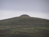
Nearby Images from Flickr
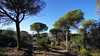
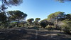
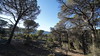
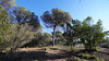
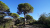
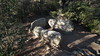
The above images may not be of the site on this page, but were taken nearby. They are loaded from Flickr so please click on them for image credits.
Click here to see more info for this site
Nearby sites
Click here to view sites on an interactive map of the areaKey: Red: member's photo, Blue: 3rd party photo, Yellow: other image, Green: no photo - please go there and take one, Grey: site destroyed
Download sites to:
KML (Google Earth)
GPX (GPS waypoints)
CSV (Garmin/Navman)
CSV (Excel)
To unlock full downloads you need to sign up as a Contributory Member. Otherwise downloads are limited to 50 sites.
Turn off the page maps and other distractions
Nearby sites listing. In the following links * = Image available
148m S 186° Pedra Foradada* Rock Cut Tomb
367m WSW 247° Dolmen de Can Gol I* Burial Chamber or Dolmen
543m NE 55° Pedra de les Creus Rock Outcrop
568m ENE 69° Pedra de les Orenetes* Rock Outcrop
1.1km E 80° Dolmen de Céllecs* Burial Chamber or Dolmen
1.2km ENE 68° El Plat del Rei* Carving
3.0km NE 38° Dolmen de Can Planes* Burial Chamber or Dolmen
3.5km SE 137° Menhir de Cal Camat* Standing Stone (Menhir)
4.1km SSE 151° Dolmen de la Roca d'en Toni* Burial Chamber or Dolmen
4.5km SSE 168° Menhir Pedra del Diable* Standing Stone (Menhir)
5.3km WSW 252° Mons Observans Ancient Village or Settlement
5.6km S 188° Paradolmen d'en Boter Burial Chamber or Dolmen
6.2km SSW 210° Dolmen de Can Gurri* Burial Chamber or Dolmen
7.2km SW 216° Dolmen de Castellruf* Burial Chamber or Dolmen
7.3km NNE 31° Cromlec de Pins Rosers Stone Circle
7.4km SW 226° Menhir de Castellruf* Standing Stone (Menhir)
7.7km W 272° Menhir La Pedra Serrada* Standing Stone (Menhir)
8.6km ENE 68° Hipogeu de la Costa de Can Martorell Burial Chamber or Dolmen
8.7km ENE 68° Menhir Costa de can Martorell Standing Stone (Menhir)
9.5km WSW 251° Mollet del Vallès menhir* Standing Stone (Menhir)
11.6km W 279° Menhir de la Pedra Llarga* Standing Stone (Menhir)
12.2km ENE 69° Pou de Glaç de Canyamars Ancient Village or Settlement
13.3km ENE 64° Dolmen de Ca l'Arenes II Burial Chamber or Dolmen
13.4km WNW 286° Menhir de Can Tarragona Standing Stone (Menhir)
13.7km NE 45° Pedra de l'Arca Dolmen* Burial Chamber or Dolmen
View more nearby sites and additional images


 We would like to know more about this location. Please feel free to add a brief description and any relevant information in your own language.
 Wir möchten mehr über diese Stätte erfahren. Bitte zögern Sie nicht, eine kurze Beschreibung und relevante Informationen in Deutsch hinzuzufügen.
 Nous aimerions en savoir encore un peu sur les lieux. S'il vous plaît n'hesitez pas à ajouter une courte description et tous les renseignements pertinents dans votre propre langue.
 Quisieramos informarnos un poco más de las lugares. No dude en añadir una breve descripción y otros datos relevantes en su propio idioma.