<< Our Photo Pages >> Menhir de Kerlivio - Standing Stone (Menhir) in France in Bretagne:Morbihan (56)
Submitted by ogham on Friday, 12 September 2014 Page Views: 1519
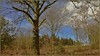
Neolithic and Bronze AgeSite Name: Menhir de KerlivioCountry: France Département: Bretagne:Morbihan (56) Type: Standing Stone (Menhir)
Nearest Town: Lorient Nearest Village: Berné
Latitude: 47.955217N Longitude: 3.387717W
Condition:
| 5 | Perfect |
| 4 | Almost Perfect |
| 3 | Reasonable but with some damage |
| 2 | Ruined but still recognisable as an ancient site |
| 1 | Pretty much destroyed, possibly visible as crop marks |
| 0 | No data. |
| -1 | Completely destroyed |
| 5 | Superb |
| 4 | Good |
| 3 | Ordinary |
| 2 | Not Good |
| 1 | Awful |
| 0 | No data. |
| 5 | Can be driven to, probably with disabled access |
| 4 | Short walk on a footpath |
| 3 | Requiring a bit more of a walk |
| 2 | A long walk |
| 1 | In the middle of nowhere, a nightmare to find |
| 0 | No data. |
| 5 | co-ordinates taken by GPS or official recorded co-ordinates |
| 4 | co-ordinates scaled from a detailed map |
| 3 | co-ordinates scaled from a bad map |
| 2 | co-ordinates of the nearest village |
| 1 | co-ordinates of the nearest town |
| 0 | no data |
Internal Links:
External Links:
I have visited· I would like to visit
Ogham has visited here
")
It is a very thin menhir with a height of 4.50 meters, width at the base of 1.5 metre
Wikipedia article
Liste des sites mégalithiques du Morbihan
You may be viewing yesterday's version of this page. To see the most up to date information please register for a free account.
")
")
Do not use the above information on other web sites or publications without permission of the contributor.
Nearby Images from Flickr


The above images may not be of the site on this page, but were taken nearby. They are loaded from Flickr so please click on them for image credits.
Click here to see more info for this site
Nearby sites
Click here to view sites on an interactive map of the areaKey: Red: member's photo, Blue: 3rd party photo, Yellow: other image, Green: no photo - please go there and take one, Grey: site destroyed
Download sites to:
KML (Google Earth)
GPX (GPS waypoints)
CSV (Garmin/Navman)
CSV (Excel)
To unlock full downloads you need to sign up as a Contributory Member. Otherwise downloads are limited to 50 sites.
Turn off the page maps and other distractions
Nearby sites listing. In the following links * = Image available
9.1km SSE 161° Menhir de Keranroué Standing Stone (Menhir)
9.8km SSE 160° Dolmen de Kerpendu Burial Chamber or Dolmen
9.9km N 352° Dolmen de Rostren Cist
10.9km NNW 330° Allée Couverte de Botquenven* Passage Grave
12.4km N 1° Dolmen de Moustérien Burial Chamber or Dolmen
13.6km W 259° Dolmen de Kernobis Burial Chamber or Dolmen
13.7km SW 223° Dolmen de Roscasquen* Burial Chamber or Dolmen
14.4km SW 227° Dolmen de Keransquer Burial Chamber or Dolmen
15.1km WNW 294° Allée Couverte de Keroual Passage Grave
15.8km SSE 161° Dolmen de Saint-Coner Burial Chamber or Dolmen
15.8km S 178° Dolmen de Nelhouët* Burial Chamber or Dolmen
16.1km SSE 167° Menhir du Monument* Standing Stone (Menhir)
16.3km NNW 329° Coat ar Ran tumulus Chambered Tomb
16.4km E 80° Menhir de Plomedec* Standing Stone (Menhir)
16.5km SSE 165° Dolmen de Mané Guillo* Burial Chamber or Dolmen
16.8km SW 223° Forêt de Carnoët 1 tumulus Chambered Tomb
17.0km NNW 330° Bodéro Menhir* Standing Stone (Menhir)
17.1km SSW 200° Lesvariel Dolmen* Burial Chamber or Dolmen
17.1km SE 143° Bunz Dolmen* Burial Chamber or Dolmen
17.1km S 184° Dolmen de Kerscant Burial Chamber or Dolmen
17.2km SW 225° Pierre Redressée Standing Stone (Menhir)
17.4km SW 224° Dolmen de Toulfoën Burial Chamber or Dolmen
17.5km S 187° Le Trou des Chouans* Burial Chamber or Dolmen
17.6km S 188° Menhir de Kerroc'h (Quéven) Standing Stone (Menhir)
17.8km NNW 344° Kermain tumulus* Chambered Tomb
View more nearby sites and additional images


 We would like to know more about this location. Please feel free to add a brief description and any relevant information in your own language.
 Wir möchten mehr über diese Stätte erfahren. Bitte zögern Sie nicht, eine kurze Beschreibung und relevante Informationen in Deutsch hinzuzufügen.
 Nous aimerions en savoir encore un peu sur les lieux. S'il vous plaît n'hesitez pas à ajouter une courte description et tous les renseignements pertinents dans votre propre langue.
 Quisieramos informarnos un poco más de las lugares. No dude en añadir una breve descripción y otros datos relevantes en su propio idioma.