


<< Our Photo Pages >> Moyai Dōri promenade - Modern Stone Circle etc in Japan in Kyūshū
Submitted by Aska on Sunday, 08 September 2013 Page Views: 3268
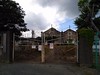
Modern SitesSite Name: Moyai Dōri promenade Alternative Name: もやい通り, 屋根のない博物館 Yane no nai HakubutsukanCountry: Japan Region: Kyūshū Type: Modern Stone Circle etc
Nearest Town: Nakama (Fukuoka pref.) Nearest Village: Chūō 中央
Latitude: 33.822420N Longitude: 130.710710E
Condition:
| 5 | Perfect |
| 4 | Almost Perfect |
| 3 | Reasonable but with some damage |
| 2 | Ruined but still recognisable as an ancient site |
| 1 | Pretty much destroyed, possibly visible as crop marks |
| 0 | No data. |
| -1 | Completely destroyed |
| 5 | Superb |
| 4 | Good |
| 3 | Ordinary |
| 2 | Not Good |
| 1 | Awful |
| 0 | No data. |
| 5 | Can be driven to, probably with disabled access |
| 4 | Short walk on a footpath |
| 3 | Requiring a bit more of a walk |
| 2 | A long walk |
| 1 | In the middle of nowhere, a nightmare to find |
| 0 | No data. |
| 5 | co-ordinates taken by GPS or official recorded co-ordinates |
| 4 | co-ordinates scaled from a detailed map |
| 3 | co-ordinates scaled from a bad map |
| 2 | co-ordinates of the nearest village |
| 1 | co-ordinates of the nearest town |
| 0 | no data |
Internal Links:
External Links:
")
"Moyai" derived from Moai on the Easter island and the Japanese word for linkage (of the ships).
You may be viewing yesterday's version of this page. To see the most up to date information please register for a free account.
Do not use the above information on other web sites or publications without permission of the contributor.
Nearby Images from Flickr

The above images may not be of the site on this page, but were taken nearby. They are loaded from Flickr so please click on them for image credits.
Click here to see more info for this site
Nearby sites
Click here to view sites on an interactive map of the areaKey: Red: member's photo, Blue: 3rd party photo, Yellow: other image, Green: no photo - please go there and take one, Grey: site destroyed
Download sites to:
KML (Google Earth)
GPX (GPS waypoints)
CSV (Garmin/Navman)
CSV (Excel)
To unlock full downloads you need to sign up as a Contributory Member. Otherwise downloads are limited to 50 sites.
Turn off the page maps and other distractions
Nearby sites listing. In the following links * = Image available
6.0km NE 45° Ichinomiya Jinja shrine (in KitaKyūshū city)* Cairn
13.7km E 91° Kobiki Jizō* Burial Chamber or Dolmen
16.1km S 173° Kakeno'uma* Hillfort
21.6km NE 52° Hikoshima Hachiman Jinja shrine* Carving
22.8km ENE 58° Sugita* Carving
26.1km SE 129° Goshogatani* Hillfort
26.4km S 190° Ōzuka Kofun (in Fukuoka)* Passage Grave
26.7km NE 55° Akama Jingū Shrine* Ancient Temple
29.1km NE 42° Kajikurihama* Cist
31.6km WSW 258° Ainoshima* Chambered Cairn
33.3km SW 226° Himamori Jinja shrine* Burial Chamber or Dolmen
35.7km SSW 210° Ōnoki* Hillfort
37.6km SSW 206° Kōmyō zen-ji temple* Modern Stone Circle etc
38.1km SSW 202° Matoishi* Burial Chamber or Dolmen
38.7km SSW 201° Ashiki* Hillfort
38.8km SSW 211° Mizuki* Artificial Mound
39.6km S 183° Kuno Family Residence garden* Modern Stone Circle etc
39.7km SW 217° Sugu-Okamoto* Burial Chamber or Dolmen
40.1km SSW 207° Shōgyō-ji temple* Modern Stone Circle etc
40.7km SW 229° Ōhori park* Modern Stone Circle etc
41.7km NNE 27° Nakanohama* Burial Chamber or Dolmen
41.8km SSE 154° Hikosan temples complex* Modern Stone Circle etc
42.4km SW 231° Genkō-Bōrui* Artificial Mound
44.0km SSW 200° Gorōyama Kofun* Passage Grave
45.6km S 186° Hatada* Burial Chamber or Dolmen
View more nearby sites and additional images


 We would like to know more about this location. Please feel free to add a brief description and any relevant information in your own language.
 Wir möchten mehr über diese Stätte erfahren. Bitte zögern Sie nicht, eine kurze Beschreibung und relevante Informationen in Deutsch hinzuzufügen.
 Nous aimerions en savoir encore un peu sur les lieux. S'il vous plaît n'hesitez pas à ajouter une courte description et tous les renseignements pertinents dans votre propre langue.
 Quisieramos informarnos un poco más de las lugares. No dude en añadir una breve descripción y otros datos relevantes en su propio idioma.