


<< Our Photo Pages >> Beltrana - Ancient Temple in Spain in Balearic Isles (Menorca / Minorca)
Submitted by Aska on Tuesday, 20 August 2013 Page Views: 2288
Multi-periodSite Name: BeltranaCountry: Spain Region: Balearic Isles (Menorca / Minorca) Type: Ancient Temple
Nearest Town: Ferreries Nearest Village: La Beltrana
Latitude: 39.978750N Longitude: 3.980080E
Condition:
| 5 | Perfect |
| 4 | Almost Perfect |
| 3 | Reasonable but with some damage |
| 2 | Ruined but still recognisable as an ancient site |
| 1 | Pretty much destroyed, possibly visible as crop marks |
| 0 | No data. |
| -1 | Completely destroyed |
| 5 | Superb |
| 4 | Good |
| 3 | Ordinary |
| 2 | Not Good |
| 1 | Awful |
| 0 | No data. |
| 5 | Can be driven to, probably with disabled access |
| 4 | Short walk on a footpath |
| 3 | Requiring a bit more of a walk |
| 2 | A long walk |
| 1 | In the middle of nowhere, a nightmare to find |
| 0 | No data. |
| 5 | co-ordinates taken by GPS or official recorded co-ordinates |
| 4 | co-ordinates scaled from a detailed map |
| 3 | co-ordinates scaled from a bad map |
| 2 | co-ordinates of the nearest village |
| 1 | co-ordinates of the nearest town |
| 0 | no data |
Internal Links:
External Links:
")
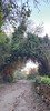
Under the tree shade in a meadow, lies the supporting pillar of a taula (T-shaped stone setting) and the fragments of surrounding walls.
You may be viewing yesterday's version of this page. To see the most up to date information please register for a free account.
Do not use the above information on other web sites or publications without permission of the contributor.
Nearby Images from Flickr
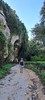

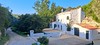
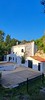
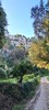
The above images may not be of the site on this page, but were taken nearby. They are loaded from Flickr so please click on them for image credits.
Click here to see more info for this site
Nearby sites
Click here to view sites on an interactive map of the areaKey: Red: member's photo, Blue: 3rd party photo, Yellow: other image, Green: no photo - please go there and take one, Grey: site destroyed
Download sites to:
KML (Google Earth)
GPX (GPS waypoints)
CSV (Garmin/Navman)
CSV (Excel)
To unlock full downloads you need to sign up as a Contributory Member. Otherwise downloads are limited to 50 sites.
Turn off the page maps and other distractions
Nearby sites listing. In the following links * = Image available
1.8km SE 140° Binimassó* Ancient Temple
1.8km SE 141° Binicalsitx* Broch or Nuraghe
2.1km W 272° Son Guillem* Standing Stone (Menhir)
2.2km SE 138° Calafi* Ancient Village or Settlement
3.0km ESE 116° Son Mercer de Dalt* Rock Cut Tomb
3.5km SE 141° Son Mercer de Baix* Ancient Village or Settlement
4.8km WNW 284° Torre Trencada* Ancient Village or Settlement
5.0km W 268° Bellaventura Ancient Village or Settlement
5.4km WNW 295° Torre Llafuda* Ancient Village or Settlement
6.2km ESE 122° Binicodrell Nou* Standing Stone (Menhir)
6.8km SE 128° Es Mestall* Broch or Nuraghe
6.8km NNW 345° Ses Tanquetes Ancient Village or Settlement
6.9km SE 124° Binicodrell de Darrera* Broch or Nuraghe
7.3km SE 133° Sa Pedrola d'en Magi* Broch or Nuraghe
7.3km SE 140° Sant Agustí Vell* Ancient Village or Settlement
7.8km WNW 282° Es Tudons taula Standing Stone (Menhir)
7.9km SE 128° Santa Mònica* Broch or Nuraghe
8.0km WNW 290° Es Tudons naveta* Chambered Tomb
8.0km NNW 336° Pujol de sa Taula* Ancient Village or Settlement
8.1km WNW 299° Ses Arenes de Baix* Chambered Tomb
9.4km WSW 253° Son Catlar* Ancient Village or Settlement
9.5km W 264° Santa Rosa Talayot* Ancient Village or Settlement
10.3km ESE 107° Turmaden d'es Capita* Broch or Nuraghe
10.4km WNW 287° Montefi* Ancient Village or Settlement
11.5km NW 314° Cala Morell Necropolis* Rock Cut Tomb
View more nearby sites and additional images


 We would like to know more about this location. Please feel free to add a brief description and any relevant information in your own language.
 Wir möchten mehr über diese Stätte erfahren. Bitte zögern Sie nicht, eine kurze Beschreibung und relevante Informationen in Deutsch hinzuzufügen.
 Nous aimerions en savoir encore un peu sur les lieux. S'il vous plaît n'hesitez pas à ajouter une courte description et tous les renseignements pertinents dans votre propre langue.
 Quisieramos informarnos un poco más de las lugares. No dude en añadir una breve descripción y otros datos relevantes en su propio idioma.