<< Our Photo Pages >> Butterdon Down West - Standing Stone (Menhir) in England in Devon
Submitted by Andy B on Thursday, 28 February 2019 Page Views: 4573
Neolithic and Bronze AgeSite Name: Butterdon Down WestCountry: England County: Devon Type: Standing Stone (Menhir)
Nearest Town: Moretonhampstead
Map Ref: SX74788840
Latitude: 50.681745N Longitude: 3.773803W
Condition:
| 5 | Perfect |
| 4 | Almost Perfect |
| 3 | Reasonable but with some damage |
| 2 | Ruined but still recognisable as an ancient site |
| 1 | Pretty much destroyed, possibly visible as crop marks |
| 0 | No data. |
| -1 | Completely destroyed |
| 5 | Superb |
| 4 | Good |
| 3 | Ordinary |
| 2 | Not Good |
| 1 | Awful |
| 0 | No data. |
| 5 | Can be driven to, probably with disabled access |
| 4 | Short walk on a footpath |
| 3 | Requiring a bit more of a walk |
| 2 | A long walk |
| 1 | In the middle of nowhere, a nightmare to find |
| 0 | No data. |
| 5 | co-ordinates taken by GPS or official recorded co-ordinates |
| 4 | co-ordinates scaled from a detailed map |
| 3 | co-ordinates scaled from a bad map |
| 2 | co-ordinates of the nearest village |
| 1 | co-ordinates of the nearest town |
| 0 | no data |
Internal Links:
External Links:
I have visited· I would like to visit
lauraaurora visited on 4th Apr 2022 - their rating: Cond: 4 Amb: 5 Access: 3
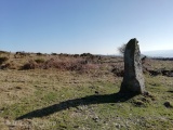
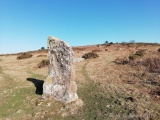
TheCaptain visited on 26th Feb 2019 - their rating: Cond: 4 Amb: 4 Access: 3 Crikey, an easy to reach Dartmoor standing stone which has no pictures on the Portal, so I'd better go visit it. It's not the easiest place to park at Butterdon, but I find somewhere not blocking anything, and it’s a beautiful spot. Walk westwards up the lovely, almost tunnel like bridleway before getting onto the open downland, and head around the hillside until I find the stone, my first view of it being nothing like I was expecting, a tall thin curved shape presenting itself to me. The stone is taller than me, being just over 2 metres tall, and a nice granite slab, crystals sparkling in the bright sunlight, and a good crop of lichen hair on top.
About 40 metres south from the stone is a fairly large triangular slab standing on edge. A closer look at this, and I am not convinced it is an old standing stone, perhaps more of a large slab once making up part of a reave or boundary, as it looks to be in a fairly straight line of some kind with many more large stones present. Further walking around on this hillide, and it is seen that there are lots of these stones over the place, and fairly obviously many of them being in straight rows with each other.
Average ratings for this site from all visit loggers: Condition: 4 Ambience: 4.5 Access: 3
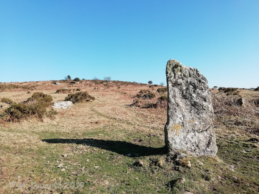
From Pastscape Monument No. 445554: "A granite monolith situated on the lower west slope of Butterdon Hill. It is 2.3 meters high, tapering from a trigged base measuring 1.0 meters by 0.8 meters. The local farmer (at Bowden) maintains that it is a rubbing stone and cattle clearly use it as such. Nevertheless, it seems far too massive to have been erected for that purpose (there are enough smaller stones in the vicinity) and it has the appearance of a prehistoric standing stone."
A smaller triangular slab stands upright approximately 40 yards to the south and scattered around on the flanks of the hill are other smaller erect slabs, less convincing as true standing stones.
This stone is also featured on the Prehistoric Dartmoor Walks website - see their entry for the Butterdon Hill (nr. Moretonhampstead) Standing Stone. PDW also gives a link to the Devon & Dartmoor HER: MDV8278 (Standing stone on western side of Butterdon Down), which adds "this site is included in the local list of Nationally Important Dartmoor sites".
Note: On a gorgeous winters February day, I decided to find this Dartmoor standing stone which had no pictures on the Portal, and it’s a beautiful spot.
You may be viewing yesterday's version of this page. To see the most up to date information please register for a free account.

Do not use the above information on other web sites or publications without permission of the contributor.
Click here to see more info for this site
Nearby sites
Key: Red: member's photo, Blue: 3rd party photo, Yellow: other image, Green: no photo - please go there and take one, Grey: site destroyed
Download sites to:
KML (Google Earth)
GPX (GPS waypoints)
CSV (Garmin/Navman)
CSV (Excel)
To unlock full downloads you need to sign up as a Contributory Member. Otherwise downloads are limited to 50 sites.
Turn off the page maps and other distractions
Nearby sites listing. In the following links * = Image available
241m E 81° Butterdon Down Cairns* Barrow Cemetery (SX75028843)
1.1km WNW 302° Cranbrook Castle* Hillfort (SX7386889010)
1.2km NNW 329° Charles Cross* Ancient Cross (SX742894)
1.6km N 358° Prestonbury Castle* Hillfort (SX7477490045)
2.0km ENE 61° Wooston Castle* Hillfort (SX76608935)
2.1km ESE 109° Mardon Down N* Stone Circle (SX76758768)
2.2km ESE 114° The Giant's Grave Mardon Down* Cairn (SX76768746)
2.2km ESE 115° Mardon Down Cairn 3* Cairn (SX7677487432)
2.3km ESE 119° Mardon Down Ring Cairn* Ring Cairn (SX7672987264)
2.3km ESE 109° Marden Down East* Ring Cairn (SX76908760)
2.3km ESE 116° Mardon Down Mortar Pit* Modern Stone Circle etc (SX76808735)
2.3km ESE 120° Mardon Down S* Stone Circle (SX76768719)
2.3km ESE 121° Mardon Down Cairn 1* Cairn (SX76768716)
2.3km ESE 103° Headless Cross (Moretonhampstead)* Modern Stone Circle etc (SX77068781)
2.5km SSE 162° Moretonhampstead Cross* Ancient Cross (SX7550886039)
2.7km SW 235° Meacombe Cist* Burial Chamber or Dolmen (SX7249486904)
2.8km SW 231° Meacombe Cist Landscape Natural Stone / Erratic / Other Natural Feature (SX726867)
3.3km SSE 152° One Mill Bridge Cross* Ancient Cross (SX76268544)
3.7km S 186° Horspit Cross* Ancient Cross (SX7430684741)
3.8km SW 234° Chagford Druid's Well* Holy Well or Sacred Spring (SX71658625)
3.9km WSW 239° Shorter Cross* Ancient Cross (SX7136886437)
4.1km WSW 241° Week Down Cross* Ancient Cross (SX7115886534)
4.6km S 189° North Bovey* Ancient Cross (SX7399083879)
4.6km WSW 258° Chagford Cross* Ancient Cross (SX7020187542)
4.7km WSW 246° Natterdon Common fort* Hillfort (SX70488660)
View more nearby sites and additional images


 We would like to know more about this location. Please feel free to add a brief description and any relevant information in your own language.
 Wir möchten mehr über diese Stätte erfahren. Bitte zögern Sie nicht, eine kurze Beschreibung und relevante Informationen in Deutsch hinzuzufügen.
 Nous aimerions en savoir encore un peu sur les lieux. S'il vous plaît n'hesitez pas à ajouter une courte description et tous les renseignements pertinents dans votre propre langue.
 Quisieramos informarnos un poco más de las lugares. No dude en añadir una breve descripción y otros datos relevantes en su propio idioma.