<< Text Pages >> Menhir de Kerguen 1 - Standing Stone (Menhir) in France in Bretagne:Côtes-D'Armor (22)
Submitted by davidmorgan on Thursday, 28 March 2013 Page Views: 1544
Neolithic and Bronze AgeSite Name: Menhir de Kerguen 1Country: France Département: Bretagne:Côtes-D'Armor (22) Type: Standing Stone (Menhir)
Nearest Town: Guingamp Nearest Village: Peumerit Quintin
Latitude: 48.355300N Longitude: 3.2661W
Condition:
| 5 | Perfect |
| 4 | Almost Perfect |
| 3 | Reasonable but with some damage |
| 2 | Ruined but still recognisable as an ancient site |
| 1 | Pretty much destroyed, possibly visible as crop marks |
| 0 | No data. |
| -1 | Completely destroyed |
| 5 | Superb |
| 4 | Good |
| 3 | Ordinary |
| 2 | Not Good |
| 1 | Awful |
| 0 | No data. |
| 5 | Can be driven to, probably with disabled access |
| 4 | Short walk on a footpath |
| 3 | Requiring a bit more of a walk |
| 2 | A long walk |
| 1 | In the middle of nowhere, a nightmare to find |
| 0 | No data. |
| 5 | co-ordinates taken by GPS or official recorded co-ordinates |
| 4 | co-ordinates scaled from a detailed map |
| 3 | co-ordinates scaled from a bad map |
| 2 | co-ordinates of the nearest village |
| 1 | co-ordinates of the nearest town |
| 0 | no data |
Be the first person to rate this site - see the 'Contribute!' box in the right hand menu.
Internal Links:
External Links:
Standing Stone (Menhir) in Bretagne:Côtes-D'Armor (22)
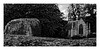
A 5.5 metre tall granite menhir.
Location Source: T4T35
Information and Pictures:
t4t35.fr
Note: Note: Different location on geoportail
You may be viewing yesterday's version of this page. To see the most up to date information please register for a free account.
Do not use the above information on other web sites or publications without permission of the contributor.
Nearby Images from Flickr
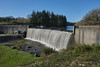
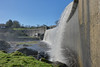
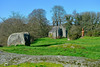
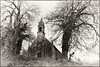
The above images may not be of the site on this page, but were taken nearby. They are loaded from Flickr so please click on them for image credits.
Click here to see more info for this site
Nearby sites
Click here to view sites on an interactive map of the areaKey: Red: member's photo, Blue: 3rd party photo, Yellow: other image, Green: no photo - please go there and take one, Grey: site destroyed
Download sites to:
KML (Google Earth)
GPX (GPS waypoints)
CSV (Garmin/Navman)
CSV (Excel)
To unlock full downloads you need to sign up as a Contributory Member. Otherwise downloads are limited to 50 sites.
Turn off the page maps and other distractions
Nearby sites listing. In the following links * = Image available
471m S 190° Kerguen 2 Standing Stone (Menhir)
1.5km SSE 162° Lampaul Huellan* Standing Stones
2.7km N 353° Allée Couverte de Pempoul* Passage Grave
2.9km NW 325° Dolmen de Roc'h Toul* Burial Chamber or Dolmen
2.9km NW 324° Stèle de Kerroland* Standing Stone (Menhir)
2.9km S 182° Pierre de Tremargat* Rock Outcrop
3.0km S 183° Menhir de Parc-ar-Menhir Standing Stone (Menhir)
3.3km NE 42° Menhir de Guer An Moch Standing Stone (Menhir)
3.7km NE 42° Menhir de Leur Min* Standing Stone (Menhir)
4.2km ENE 66° Menhir de Kerlagadec* Standing Stone (Menhir)
4.4km NE 40° Menhir de Kerbalenou* Standing Stone (Menhir)
5.0km NNW 334° Pierre de Coat-ar-Men-Sul Natural Stone / Erratic / Other Natural Feature
5.7km NE 42° Menhir de Kerien Standing Stone (Menhir)
5.9km NNE 34° Menhir de Crech Quenez Bras* Standing Stone (Menhir)
6.1km NE 40° Menhir de Kerohou Vraz Standing Stone (Menhir)
6.5km WNW 304° Menhir de Kernaëret* Standing Stone (Menhir)
7.0km WSW 243° Cupules du Bois de Follezou Sculptured Stone
7.1km NNE 12° Menhir de Kerligan 1* Standing Stone (Menhir)
7.1km WSW 241° Menhir du Bois de Follezou Standing Stone (Menhir)
7.3km WSW 243° Menhir de Follezou Braz Standing Stone (Menhir)
7.4km NNE 18° Menhir de Kerligan 3 Standing Stone (Menhir)
7.4km NE 50° St Gildas Well (Magoar)* Holy Well or Sacred Spring
7.4km NNE 23° Menhir de Magourou Standing Stone (Menhir)
7.8km WSW 251° Menhir Quélénec* Standing Stone (Menhir)
7.9km N 6° Alignement de Kersaliou Stone Row / Alignment
View more nearby sites and additional images


 We would like to know more about this location. Please feel free to add a brief description and any relevant information in your own language.
 Wir möchten mehr über diese Stätte erfahren. Bitte zögern Sie nicht, eine kurze Beschreibung und relevante Informationen in Deutsch hinzuzufügen.
 Nous aimerions en savoir encore un peu sur les lieux. S'il vous plaît n'hesitez pas à ajouter une courte description et tous les renseignements pertinents dans votre propre langue.
 Quisieramos informarnos un poco más de las lugares. No dude en añadir una breve descripción y otros datos relevantes en su propio idioma.