

<< Our Photo Pages >> Ōjizuka - Chambered Cairn in Japan in Honshū
Submitted by aska on Saturday, 12 January 2013 Page Views: 1838
Neolithic and Bronze AgeSite Name: Ōjizuka Alternative Name: 王子塚 OjizukaCountry: Japan Region: Honshū Type: Chambered Cairn
Nearest Town: Onomichi (Hiroshima pref.) Nearest Village: Innoshima-Mitsunoshōchō
Latitude: 34.288480N Longitude: 133.200130E
Condition:
| 5 | Perfect |
| 4 | Almost Perfect |
| 3 | Reasonable but with some damage |
| 2 | Ruined but still recognisable as an ancient site |
| 1 | Pretty much destroyed, possibly visible as crop marks |
| 0 | No data. |
| -1 | Completely destroyed |
| 5 | Superb |
| 4 | Good |
| 3 | Ordinary |
| 2 | Not Good |
| 1 | Awful |
| 0 | No data. |
| 5 | Can be driven to, probably with disabled access |
| 4 | Short walk on a footpath |
| 3 | Requiring a bit more of a walk |
| 2 | A long walk |
| 1 | In the middle of nowhere, a nightmare to find |
| 0 | No data. |
| 5 | co-ordinates taken by GPS or official recorded co-ordinates |
| 4 | co-ordinates scaled from a detailed map |
| 3 | co-ordinates scaled from a bad map |
| 2 | co-ordinates of the nearest village |
| 1 | co-ordinates of the nearest town |
| 0 | no data |
Internal Links:
External Links:
")
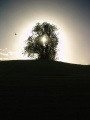
In the precinct of Itsuhashira Jinja (五柱神社) shinto shrine on a tip of a cape, a chambered cairn lies on a hill. The cairn is a pile of round seashore pebbles, and it seems like a brand new one because no leaves nor grass cover its surface.
You may be viewing yesterday's version of this page. To see the most up to date information please register for a free account.
Do not use the above information on other web sites or publications without permission of the contributor.
Nearby Images from Flickr


The above images may not be of the site on this page, but were taken nearby. They are loaded from Flickr so please click on them for image credits.
Click here to see more info for this site
Nearby sites
Click here to view sites on an interactive map of the areaKey: Red: member's photo, Blue: 3rd party photo, Yellow: other image, Green: no photo - please go there and take one, Grey: site destroyed
Download sites to:
KML (Google Earth)
GPX (GPS waypoints)
CSV (Garmin/Navman)
CSV (Excel)
To unlock full downloads you need to sign up as a Contributory Member. Otherwise downloads are limited to 50 sites.
Turn off the page maps and other distractions
Nearby sites listing. In the following links * = Image available
13.8km N 4° Jōdo-ji temple* Modern Stone Circle etc
18.7km WSW 256° Ōmishima Bijutsukan art gallery* Modern Stone Circle etc
19.9km NE 56° Ankoku-ji temple* Modern Stone Circle etc
20.2km NE 44° Jōkoku-ji temple* Modern Stone Circle etc
30.2km NNW 339° Kui-no Gankai* Natural Stone / Erratic / Other Natural Feature
35.4km W 281° Tonkararin (in Hiroshima)* Souterrain (Fogou, Earth House)
35.6km SW 224° Myōkensan Kofun* Long Barrow
35.7km NNE 12° Oichi Kofun* Passage Grave
36.9km SSW 201° Einōsan* Hillfort
36.9km SSW 211° Takinomiya Kofungun* Chambered Cairn
42.3km N 349° Yano-no Gankai* Natural Stone / Erratic / Other Natural Feature
44.2km S 182° Hōkoku-ji temple* Modern Stone Circle etc
44.6km ESE 112° Kōshōjiyama Kofungun* Passage Grave
44.8km S 190° Busshin-ji temple* Modern Stone Circle etc
45.1km WNW 289° Mitsujō Kofun* Long Barrow
47.3km SE 131° Uma Mukaiyama Kofun* Long Barrow
49.1km ESE 105° Yaobikuni-tō* Ancient Temple
50.5km E 99° Ōkubo Kyōzuka Kofun* Chambered Cairn
53.1km E 100° Miyagao Kofun* Passage Grave
53.5km E 99° Kawaratani Kofungun* Passage Grave
54.1km E 97° Suriusuyama Kofun* Passage Grave
54.3km E 101° Notanoin Kofun* Chambered Cairn
55.0km E 99° Oka Kofungun* Passage Grave
55.5km E 100° Ōsayama Wankashizuka Kofun* Chambered Cairn
55.5km E 100° Ōsayama Kyōzuka Kofun* Chambered Cairn
View more nearby sites and additional images


 We would like to know more about this location. Please feel free to add a brief description and any relevant information in your own language.
 Wir möchten mehr über diese Stätte erfahren. Bitte zögern Sie nicht, eine kurze Beschreibung und relevante Informationen in Deutsch hinzuzufügen.
 Nous aimerions en savoir encore un peu sur les lieux. S'il vous plaît n'hesitez pas à ajouter une courte description et tous les renseignements pertinents dans votre propre langue.
 Quisieramos informarnos un poco más de las lugares. No dude en añadir una breve descripción y otros datos relevantes en su propio idioma.