

<< Our Photo Pages >> Primrose Hill Fort - Hillfort in Scotland in Scottish Borders
Submitted by durhamnature on Thursday, 20 September 2012 Page Views: 3944
Iron Age and Later PrehistorySite Name: Primrose Hill FortCountry: Scotland County: Scottish Borders Type: Hillfort
Nearest Village: Cumledge Mills
Map Ref: NT79285682
Latitude: 55.804212N Longitude: 2.332114W
Condition:
| 5 | Perfect |
| 4 | Almost Perfect |
| 3 | Reasonable but with some damage |
| 2 | Ruined but still recognisable as an ancient site |
| 1 | Pretty much destroyed, possibly visible as crop marks |
| 0 | No data. |
| -1 | Completely destroyed |
| 5 | Superb |
| 4 | Good |
| 3 | Ordinary |
| 2 | Not Good |
| 1 | Awful |
| 0 | No data. |
| 5 | Can be driven to, probably with disabled access |
| 4 | Short walk on a footpath |
| 3 | Requiring a bit more of a walk |
| 2 | A long walk |
| 1 | In the middle of nowhere, a nightmare to find |
| 0 | No data. |
| 5 | co-ordinates taken by GPS or official recorded co-ordinates |
| 4 | co-ordinates scaled from a detailed map |
| 3 | co-ordinates scaled from a bad map |
| 2 | co-ordinates of the nearest village |
| 1 | co-ordinates of the nearest town |
| 0 | no data |
Internal Links:
External Links:
")
Canmore site 83107
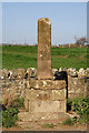
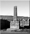
Hillfort, cluster of ancient dwellings and enclosures.
You may be viewing yesterday's version of this page. To see the most up to date information please register for a free account.
Do not use the above information on other web sites or publications without permission of the contributor.
Nearby Images from Geograph Britain and Ireland:
©2023(licence)
©2013(licence)
©2020(licence)
©2009(licence)
©2014(licence)
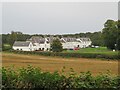
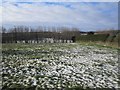
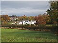
The above images may not be of the site on this page, they are loaded from Geograph.
Please Submit an Image of this site or go out and take one for us!
Click here to see more info for this site
Nearby sites
Key: Red: member's photo, Blue: 3rd party photo, Yellow: other image, Green: no photo - please go there and take one, Grey: site destroyed
Download sites to:
KML (Google Earth)
GPX (GPS waypoints)
CSV (Garmin/Navman)
CSV (Excel)
To unlock full downloads you need to sign up as a Contributory Member. Otherwise downloads are limited to 50 sites.
Turn off the page maps and other distractions
Nearby sites listing. In the following links * = Image available
1.1km WSW 258° Cumledge Cist* Cist (NT782566)
1.5km ESE 111° Broomhouse Souterrain* Souterrain (Fogou, Earth House) (NT80675629)
2.2km SE 124° Manderston cist* Cist (NT81125555)
2.3km SSW 200° Duns Law Hillfort* Hillfort (NT78505468)
2.6km N 6° Preston Cleugh Fort* Hillfort (NT79555941)
3.0km SSW 194° Duns Mercat Cross* Ancient Cross (NT7855253883)
3.7km ESE 106° Edrom Sculptured Stone (NT828558)
3.7km NW 320° Cockburn Law Settlement* Ancient Village or Settlement (NT76915969)
3.7km N 351° Elba copper mines* Ancient Mine, Quarry or other Industry (NT787605)
4.0km NNE 21° Drakemire hillforts* Hillfort (NT80726051)
4.0km NW 317° Cockburn Law Hillfort* Hillfort (NT76565975)
4.0km NNW 329° Edin's Hall* Broch or Nuraghe (NT7724060310)
5.6km ENE 74° The Pech Stane* Standing Stone (Menhir) (NT84685831)
5.9km SW 236° Raecleughhead* Hillfort (NT74355351)
7.4km NW 325° Shannabank Hill Hillfort (NT75096292)
8.4km NNE 12° Grantshouse Rock Art* Rock Art (NT8165)
10.1km NNE 12° Harelawside Rock Art (NT814667)
10.4km NNE 13° Winding Cairn Cairn (NT81666691)
10.9km SW 220° Herriot's Dyke* Misc. Earthwork (NT722485)
11.9km SW 216° Piersknowe Plantation* Cairn (NT72174726)
13.3km NNE 19° Dowlaw (Harlie Darlies)* Misc. Earthwork (NT83636941)
13.8km SE 138° Monk's Well (Upsettlington)* Holy Well or Sacred Spring (NT8849646471)
13.8km SE 137° Nun's Well (Upsettlington)* Holy Well or Sacred Spring (NT8870446652)
13.9km SE 137° St Mary's Well (Upsettlington)* Holy Well or Sacred Spring (NT8865846592)
13.9km N 4° St. Helen's on the Lea (Old Cambus)* Sculptured Stone (NT8037870676)
View more nearby sites and additional images

")
 We would like to know more about this location. Please feel free to add a brief description and any relevant information in your own language.
 Wir möchten mehr über diese Stätte erfahren. Bitte zögern Sie nicht, eine kurze Beschreibung und relevante Informationen in Deutsch hinzuzufügen.
 Nous aimerions en savoir encore un peu sur les lieux. S'il vous plaît n'hesitez pas à ajouter une courte description et tous les renseignements pertinents dans votre propre langue.
 Quisieramos informarnos un poco más de las lugares. No dude en añadir una breve descripción y otros datos relevantes en su propio idioma.