

<< Our Photo Pages >> Kulisteinen - Early Christian Sculptured Stone in Norway in Møre og Romsdal
Submitted by Andy B on Monday, 27 February 2012 Page Views: 5520
Early Medieval (Dark Age)Site Name: Kulisteinen Alternative Name: Kuli stone, N 449Country: Norway Fylke: Møre og Romsdal Type: Early Christian Sculptured Stone
Nearest Town: Smøla Nearest Village: Kuløy
Latitude: 63.299895N Longitude: 8.076858E
Condition:
| 5 | Perfect |
| 4 | Almost Perfect |
| 3 | Reasonable but with some damage |
| 2 | Ruined but still recognisable as an ancient site |
| 1 | Pretty much destroyed, possibly visible as crop marks |
| 0 | No data. |
| -1 | Completely destroyed |
| 5 | Superb |
| 4 | Good |
| 3 | Ordinary |
| 2 | Not Good |
| 1 | Awful |
| 0 | No data. |
| 5 | Can be driven to, probably with disabled access |
| 4 | Short walk on a footpath |
| 3 | Requiring a bit more of a walk |
| 2 | A long walk |
| 1 | In the middle of nowhere, a nightmare to find |
| 0 | No data. |
| 5 | co-ordinates taken by GPS or official recorded co-ordinates |
| 4 | co-ordinates scaled from a detailed map |
| 3 | co-ordinates scaled from a bad map |
| 2 | co-ordinates of the nearest village |
| 1 | co-ordinates of the nearest town |
| 0 | no data |
Internal Links:
External Links:
I have visited· I would like to visit
Andy B has visited here
")
The Kuli Stone is dated to the year 1034 AD and can be viewed in the medieval exhibition at the museum. A copy of the stone has been erected at Kuløy. In 1956 curator Aslak Liestøl noticed that the original stone had a runic inscription along the narrow edge. It reads "Tore and Hallvard erected this stone ..." — Tore og Hallvard reiste denne steinen ..., and "(for) twelve winters/years Christianity had been in Norway" — tolv vintre hadde kristendommen vært i Norge.
In the mid-1990s the inscription was subjected to laser scanning and microcartography in an attempt to arrive at a more sure reading. It was then suggested that the word translated "been" (vært) above should be read Old Norse um rétt, and that this could mean that Christianity had "supplied law and order" for twelve years. The runic stone would then have been propaganda for the new religion, Christianity. There are, however, serious paleographic and philological/linguistic problems with the new reading and interpretation.
It was first suggested by Nils Halan that the inscription refers to a national event, the establishment of the law which formally made Christianity the religion of Norway at the Moster thing in either 1022 or 1024 by King Olaf Haraldsson. The Kuli stone was later dated to 1034 since it was originally found adjacent to a Viking Age boardwalk dated dendrochronologically to that year, assuming the two are contemporaneous. Others have suggested that the inscription refers to the conquest of Norway in 995 by King Olaf Tryggvason and his forced conversions.
The transcription and translation shown at Wikipedia are as accepted in the Rundata database and see also the Vitenskapsmuseet i Trondheim (The Museum of Natural History and Archaeology, NTNU)
Note: Unique runestone is the oldest object yet added to UNESCO Memory of the World Programme [it sounds like they could do with some properly old artefacts!]
You may be viewing yesterday's version of this page. To see the most up to date information please register for a free account.
")
")
")
")
")
")
")
Do not use the above information on other web sites or publications without permission of the contributor.
Click here to see more info for this site
Nearby sites
Click here to view sites on an interactive map of the areaKey: Red: member's photo, Blue: 3rd party photo, Yellow: other image, Green: no photo - please go there and take one, Grey: site destroyed
Download sites to:
KML (Google Earth)
GPX (GPS waypoints)
CSV (Garmin/Navman)
CSV (Excel)
To unlock full downloads you need to sign up as a Contributory Member. Otherwise downloads are limited to 50 sites.
Turn off the page maps and other distractions
Nearby sites listing. In the following links * = Image available
1.3km E 89° Edøyveien Gravfelt* Barrow Cemetery
1.6km E 79° Tittinghaugen-Sør Kuløya* Barrow Cemetery
1.7km ENE 76° Nord-Kuløya barrow cemetery* Barrow Cemetery
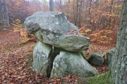
1.8km ENE 74° Kuli Phallic Stone* Standing Stone (Menhir)
15.0km SSW 206° Linvågen* Standing Stone (Menhir)
15.2km SSE 162° Malivika standing stone* Standing Stone (Menhir)
22.9km E 99° Aure Kirke Standing Stone* Standing Stone (Menhir)
32.9km SSW 196° Aspa Standing Stones* Standing Stones
33.6km SSW 204° Frei Standing Stones* Standing Stones
37.2km SSW 209° Kvernes Tingsted* Stone Circle
39.2km SW 222° Søfstadklubben* Rock Art
40.1km SSW 205° Ikornneset* Barrow Cemetery
47.3km SSE 164° Røttingsnes* Barrow Cemetery
49.4km S 175° Honnhammarneset* Rock Art
49.8km SW 216° Håkonrøysa* Cairn
50.6km SW 231° Rullesteinshaugen* Cairn
57.3km SW 233° Sandvikshagen* Barrow Cemetery
62.4km SW 234° Malefeten* Barrow Cemetery
62.5km S 180° Boggestranda* Carving
70.9km SSW 204° Horga Pagan Altar* Sculptured Stone
71.8km SW 232° Gule* Standing Stone (Menhir)
73.6km SSW 211° Jutahaugen* Stone Circle
73.7km SSW 211° The Troll's Arrow* Standing Stone (Menhir)
75.4km SW 225° Reithaugen Round Barrow(s)
76.4km SSW 208° Nesje Standing Stones* Standing Stones
View more nearby sites and additional images


 We would like to know more about this location. Please feel free to add a brief description and any relevant information in your own language.
 Wir möchten mehr über diese Stätte erfahren. Bitte zögern Sie nicht, eine kurze Beschreibung und relevante Informationen in Deutsch hinzuzufügen.
 Nous aimerions en savoir encore un peu sur les lieux. S'il vous plaît n'hesitez pas à ajouter une courte description et tous les renseignements pertinents dans votre propre langue.
 Quisieramos informarnos un poco más de las lugares. No dude en añadir una breve descripción y otros datos relevantes en su propio idioma.