


<< Our Photo Pages >> Knowe Kniffling - Hillfort in Scotland in Scottish Borders
Submitted by SolarMegalith on Wednesday, 16 November 2011 Page Views: 2944
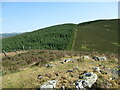
Iron Age and Later PrehistorySite Name: Knowe KnifflingCountry: Scotland County: Scottish Borders Type: Hillfort
Nearest Village: Broughton
Map Ref: NT08163323
Latitude: 55.584024N Longitude: 3.458517W
Condition:
| 5 | Perfect |
| 4 | Almost Perfect |
| 3 | Reasonable but with some damage |
| 2 | Ruined but still recognisable as an ancient site |
| 1 | Pretty much destroyed, possibly visible as crop marks |
| 0 | No data. |
| -1 | Completely destroyed |
| 5 | Superb |
| 4 | Good |
| 3 | Ordinary |
| 2 | Not Good |
| 1 | Awful |
| 0 | No data. |
| 5 | Can be driven to, probably with disabled access |
| 4 | Short walk on a footpath |
| 3 | Requiring a bit more of a walk |
| 2 | A long walk |
| 1 | In the middle of nowhere, a nightmare to find |
| 0 | No data. |
| 5 | co-ordinates taken by GPS or official recorded co-ordinates |
| 4 | co-ordinates scaled from a detailed map |
| 3 | co-ordinates scaled from a bad map |
| 2 | co-ordinates of the nearest village |
| 1 | co-ordinates of the nearest town |
| 0 | no data |
Internal Links:
External Links:
")
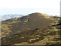
Remains of a hillfort with a stone wall partly preserved in it's NE part.
Read More at ScotlandsPlaces.
You may be viewing yesterday's version of this page. To see the most up to date information please register for a free account.
Do not use the above information on other web sites or publications without permission of the contributor.
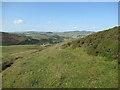
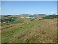
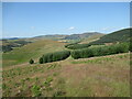
Nearby Images from Geograph Britain and Ireland:
©2012(licence)
©2021(licence)
©2021(licence)
©2021(licence)
©2021(licence)
The above images may not be of the site on this page, they are loaded from Geograph.
Please Submit an Image of this site or go out and take one for us!
Click here to see more info for this site
Nearby sites
Key: Red: member's photo, Blue: 3rd party photo, Yellow: other image, Green: no photo - please go there and take one, Grey: site destroyed
Download sites to:
KML (Google Earth)
GPX (GPS waypoints)
CSV (Garmin/Navman)
CSV (Excel)
To unlock full downloads you need to sign up as a Contributory Member. Otherwise downloads are limited to 50 sites.
Turn off the page maps and other distractions
Nearby sites listing. In the following links * = Image available
473m NE 43° Mill Rings Misc. Earthwork (NT08493357)
2.1km N 2° Parkgatestone Hill Ancient Village or Settlement (NT08293529)
2.1km WNW 295° Mitchelhill Rings Hillfort (NT06283417)
2.3km NNW 344° Cleuch Hill* Cairn (NT07573546)
2.7km ENE 62° Whitslade Hill Burnt Mound Artificial Mound (NT10603447)
3.3km E 82° Rachan Hill Henge (NT11423363)
3.4km ENE 76° Piper's Stone Standing Stone (Menhir) (NT11533400)
3.5km NE 52° Helm End Hillfort (NT10983532)
4.5km ESE 115° Woodend, Mossfennan Farm* Cist (NT12173124)
4.7km WSW 256° Nisbet* Hillfort (NT03543216)
4.8km ENE 61° Dreva Craig* Standing Stone (Menhir) (NT12453545)
5.0km ENE 64° Dreva Craig* Hillfort (NT12673533)
5.2km SE 137° Laigh Hill (Tweeddale)* Ancient Village or Settlement (NT11632933)
5.3km ENE 63° Dreva Hill West (Broughton)* Ancient Village or Settlement (NT12923553)
5.3km SE 144° Patervan Cairn, Buildings & Mound* Cairn (NT11192885)
5.4km SE 138° Norman's Castle* Stone Fort or Dun (NT11722915)
5.6km SE 145° Patervan Settlement* Ancient Village or Settlement (NT11252854)
5.7km W 263° Snaip Hill* Hillfort (NT02463269)
5.9km W 267° Culterpark Hill* Hillfort (NT02213305)
6.1km ENE 77° Tinnis Castle* Hillfort (NT14153444)
6.2km ENE 68° Drumelzier Haugh* Standing Stone (Menhir) (NT13933542)
6.2km NW 317° Moat Park Heritage Centre Museum (NT040378)
7.3km WNW 296° Biggar Cursus Cursus (NT01663657)
7.9km ENE 70° Altar Stone, Stobo* Standing Stone (Menhir) (NT15703573)
8.1km NNW 327° Carwood Farm Ancient Village or Settlement (NT039401)
View more nearby sites and additional images


 We would like to know more about this location. Please feel free to add a brief description and any relevant information in your own language.
 Wir möchten mehr über diese Stätte erfahren. Bitte zögern Sie nicht, eine kurze Beschreibung und relevante Informationen in Deutsch hinzuzufügen.
 Nous aimerions en savoir encore un peu sur les lieux. S'il vous plaît n'hesitez pas à ajouter une courte description et tous les renseignements pertinents dans votre propre langue.
 Quisieramos informarnos un poco más de las lugares. No dude en añadir una breve descripción y otros datos relevantes en su propio idioma.