<< Text Pages >> Ascoile - Henge in Scotland in Highlands
Submitted by Andy B on Saturday, 17 September 2011 Page Views: 3007
Neolithic and Bronze AgeSite Name: Ascoile Alternative Name: GreeananCountry: Scotland County: Highlands Type: Henge
Nearest Village: Clyne
Map Ref: NC83091058
Latitude: 58.068820N Longitude: 3.983468W
Condition:
| 5 | Perfect |
| 4 | Almost Perfect |
| 3 | Reasonable but with some damage |
| 2 | Ruined but still recognisable as an ancient site |
| 1 | Pretty much destroyed, possibly visible as crop marks |
| 0 | No data. |
| -1 | Completely destroyed |
| 5 | Superb |
| 4 | Good |
| 3 | Ordinary |
| 2 | Not Good |
| 1 | Awful |
| 0 | No data. |
| 5 | Can be driven to, probably with disabled access |
| 4 | Short walk on a footpath |
| 3 | Requiring a bit more of a walk |
| 2 | A long walk |
| 1 | In the middle of nowhere, a nightmare to find |
| 0 | No data. |
| 5 | co-ordinates taken by GPS or official recorded co-ordinates |
| 4 | co-ordinates scaled from a detailed map |
| 3 | co-ordinates scaled from a bad map |
| 2 | co-ordinates of the nearest village |
| 1 | co-ordinates of the nearest town |
| 0 | no data |
Internal Links:
External Links:
Possible Henge in Highlands
On the S side of the roadway, one mile W of Allt Smeorail are the remains of a circular earthwork of which rather less than half has been destroyed by the intersection of the road. It consists of a mound 27 feet in diameter, surrounded by a ditch 6 feet wide. The upcast from the ditch has been heaped on the outer perimeter. In the centre are some large stones suggestive of the interior of a cairn, and large stones remain on the outer rampart and in the ditch.
J M Davidson 1948.
The earthwork was considered to be a henge when visited in summer of 1960. The central area is disturbed, and numerous stones protrude through the turf. However the feature displays the characteristics of a hengiform earthwork similar to those at Migdale (NH69SW 36) and Conon Bridge (NH55NW 1).
Considered a doubtful hengi-form earthwork by G J W Wainwright
More at Scotland's Places
You may be viewing yesterday's version of this page. To see the most up to date information please register for a free account.
Do not use the above information on other web sites or publications without permission of the contributor.
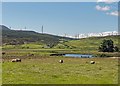
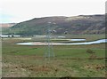
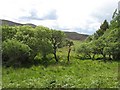
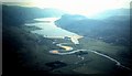
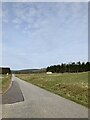
Nearby Images from Geograph Britain and Ireland:
©2019(licence)
©2009(licence)
©2008(licence)
©2008(licence)
©2023(licence)
The above images may not be of the site on this page, they are loaded from Geograph.
Please Submit an Image of this site or go out and take one for us!
Click here to see more info for this site
Nearby sites
Key: Red: member's photo, Blue: 3rd party photo, Yellow: other image, Green: no photo - please go there and take one, Grey: site destroyed
Download sites to:
KML (Google Earth)
GPX (GPS waypoints)
CSV (Garmin/Navman)
CSV (Excel)
To unlock full downloads you need to sign up as a Contributory Member. Otherwise downloads are limited to 50 sites.
Turn off the page maps and other distractions
Nearby sites listing. In the following links * = Image available
1.1km SW 224° Kilbraur Broch* Broch or Nuraghe (NC823098)
4.3km W 272° Coich Burn Broch or Nuraghe (NC78801087)
4.4km SSE 158° Carrol* Broch or Nuraghe (NC84620646)
4.5km NW 307° Caisteal Na Coille* Broch or Nuraghe (NC79571337)
4.7km SE 128° Killin Broch* Broch or Nuraghe (NC867076)
8.0km S 176° Backies Broch* Broch or Nuraghe (NC83450261)
9.7km SSE 166° Dunrobin Castle* Museum (NC85110103)
9.8km SSE 166° Craigton 1 Class I Pictish Symbol Stone (NC85130093)
10.0km SSE 155° Carn Liath (Sutherland)* Broch or Nuraghe (NC8703801376)
10.1km ESE 103° Cinn Trolla* Broch or Nuraghe (NC92930807)
10.3km W 266° Cnoc An Liath-Bhaid* Stone Circle (NC728102)
10.7km ENE 77° Glen Loth* Standing Stones (NC936127)
11.2km E 80° Carn Bran* Broch or Nuraghe (NC94201219)
11.2km WSW 238° Achnagarron Stones Standing Stones (NC7329804978)
11.8km ENE 66° Clach Mhic Mhios* Standing Stone (Menhir) (NC9404515083)
12.3km NE 46° Kilearnan Broch* Broch or Nuraghe (NC92161887)
12.3km SSW 193° St. Carden's Chapel Class I Pictish Symbol Stone (NH79939870)
12.8km NE 48° Kilearnan Hill* Broch or Nuraghe (NC92931882)
13.0km SSW 207° Aberscross* Stone Circle (NH7690399077)
13.7km W 262° West Langwell Cairns Cairn (NC69410917)
13.8km W 263° West Langwell Hut Circle Ancient Village or Settlement (NC69300921)
13.8km W 263° Lang Well Holy Well or Sacred Spring (NC69300921)
14.0km NE 55° Gailiable Broch or Nuraghe (NC94871823)
14.1km SSW 213° Thor's Tower Broch or Nuraghe (NH7599)
14.1km NE 52° Balvalaich* Broch or Nuraghe (NC94521898)
View more nearby sites and additional images


 We would like to know more about this location. Please feel free to add a brief description and any relevant information in your own language.
 Wir möchten mehr über diese Stätte erfahren. Bitte zögern Sie nicht, eine kurze Beschreibung und relevante Informationen in Deutsch hinzuzufügen.
 Nous aimerions en savoir encore un peu sur les lieux. S'il vous plaît n'hesitez pas à ajouter une courte description et tous les renseignements pertinents dans votre propre langue.
 Quisieramos informarnos un poco más de las lugares. No dude en añadir una breve descripción y otros datos relevantes en su propio idioma.