

<< Our Photo Pages >> Dun Chealamy - Broch or Nuraghe in Scotland in Sutherland
Submitted by SolarMegalith on Sunday, 27 March 2011 Page Views: 3898
Iron Age and Later PrehistorySite Name: Dun ChealamyCountry: Scotland County: Sutherland Type: Broch or Nuraghe
Map Ref: NC71995140
Latitude: 58.432108N Longitude: 4.194004W
Condition:
| 5 | Perfect |
| 4 | Almost Perfect |
| 3 | Reasonable but with some damage |
| 2 | Ruined but still recognisable as an ancient site |
| 1 | Pretty much destroyed, possibly visible as crop marks |
| 0 | No data. |
| -1 | Completely destroyed |
| 5 | Superb |
| 4 | Good |
| 3 | Ordinary |
| 2 | Not Good |
| 1 | Awful |
| 0 | No data. |
| 5 | Can be driven to, probably with disabled access |
| 4 | Short walk on a footpath |
| 3 | Requiring a bit more of a walk |
| 2 | A long walk |
| 1 | In the middle of nowhere, a nightmare to find |
| 0 | No data. |
| 5 | co-ordinates taken by GPS or official recorded co-ordinates |
| 4 | co-ordinates scaled from a detailed map |
| 3 | co-ordinates scaled from a bad map |
| 2 | co-ordinates of the nearest village |
| 1 | co-ordinates of the nearest town |
| 0 | no data |
Internal Links:
External Links:
")
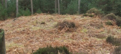
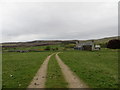
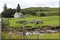
Remains of a broch with traces of a mural gallery.
Read More at ScotlandsPlaces.
You may be viewing yesterday's version of this page. To see the most up to date information please register for a free account.
")
")
")
Do not use the above information on other web sites or publications without permission of the contributor.
Nearby Images from Geograph Britain and Ireland:
©2019(licence)
©2019(licence)
©2015(licence)
©2015(licence)
©2022(licence)
The above images may not be of the site on this page, they are loaded from Geograph.
Please Submit an Image of this site or go out and take one for us!
Click here to see more info for this site
Nearby sites
Key: Red: member's photo, Blue: 3rd party photo, Yellow: other image, Green: no photo - please go there and take one, Grey: site destroyed
Download sites to:
KML (Google Earth)
GPX (GPS waypoints)
CSV (Garmin/Navman)
CSV (Excel)
To unlock full downloads you need to sign up as a Contributory Member. Otherwise downloads are limited to 50 sites.
Turn off the page maps and other distractions
Nearby sites listing. In the following links * = Image available
814m NE 52° Dun Viden* Broch or Nuraghe (NC72655188)
1.3km N 4° Dun Carnachaidh* Broch or Nuraghe (NC72135269)
2.4km NNE 13° Loch Ma Naire* Holy Well or Sacred Spring (NC726537)
4.2km S 185° St Maelrubha's Cross (Skail) Early Christian Sculptured Stone (NC7147047220)
4.5km S 187° Skail Chambered Cairn* Chambered Cairn (NC7129846898)
4.7km N 4° Skelpick Chambered Cairn 3 Chambered Cairn (NC72495605)
4.8km S 183° Inshlampie Broch or Nuraghe (NC71594657)
4.9km N 0° Skelpick Chambered Cairn 2 Chambered Cairn (NC72175635)
5.3km N 1° Skelpick Chambered Cairn 1* Chambered Cairn (NC72255672)
6.0km N 0° Skelpick Stone Rows Multiple Stone Rows / Avenue (NC722574)
6.1km N 1° Allt an Duin (Skelpick)* Broch or Nuraghe (NC72355752)
6.2km N 3° Allt a' Chaisteil* Stone Circle (NC72515756)
6.7km NNE 17° Achamore Chambered Cairn (NC74175779)
7.6km N 355° Coille na Borgie* Chambered Cairn (NC7154359000)
8.0km SSW 200° Langdale, Sutherland Class I Pictish Symbol Stone (NC6944)
8.0km N 354° Achcoillenaborgie Broch or Nuraghe (NC71395942)
9.0km NNW 329° Borgie Souterrain* Souterrain (Fogou, Earth House) (NC67625929)
9.3km SSW 203° Syre B Stone Circle (NC6843)
9.3km SSW 203° Syre A Stone Circle (NC6843)
9.4km NW 320° Borgie Stone Rows* Multiple Stone Rows / Avenue (NC66135874)
9.6km N 352° Cai Dun Broch or Nuraghe (NC7161)
9.8km NNW 345° Baile Mhargaite* Broch or Nuraghe (NC6973560973)
9.9km NNW 346° Baile Mhargaite Cist 1* Cist (NC6990861102)
10.0km NNW 346° Baile Mhargaite Enclosure 1 Ancient Village or Settlement (NC6984361228)
10.5km NNW 340° Dun Riaskidh* Chambered Cairn (NC68766140)
View more nearby sites and additional images


 We would like to know more about this location. Please feel free to add a brief description and any relevant information in your own language.
 Wir möchten mehr über diese Stätte erfahren. Bitte zögern Sie nicht, eine kurze Beschreibung und relevante Informationen in Deutsch hinzuzufügen.
 Nous aimerions en savoir encore un peu sur les lieux. S'il vous plaît n'hesitez pas à ajouter une courte description et tous les renseignements pertinents dans votre propre langue.
 Quisieramos informarnos un poco más de las lugares. No dude en añadir una breve descripción y otros datos relevantes en su propio idioma.