

<< Our Photo Pages >> Schindtaler Fels - Cave or Rock Shelter in Germany in Saarland
Submitted by KaiHofmann on Monday, 14 March 2011 Page Views: 3765
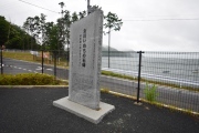
Natural PlacesSite Name: Schindtaler FelsCountry: Germany Land: Saarland Type: Cave or Rock Shelter
Nearest Town: St.Ingbert Nearest Village: Oberwuerzbach
Latitude: 49.242143N Longitude: 7.136496E
Condition:
| 5 | Perfect |
| 4 | Almost Perfect |
| 3 | Reasonable but with some damage |
| 2 | Ruined but still recognisable as an ancient site |
| 1 | Pretty much destroyed, possibly visible as crop marks |
| 0 | No data. |
| -1 | Completely destroyed |
| 5 | Superb |
| 4 | Good |
| 3 | Ordinary |
| 2 | Not Good |
| 1 | Awful |
| 0 | No data. |
| 5 | Can be driven to, probably with disabled access |
| 4 | Short walk on a footpath |
| 3 | Requiring a bit more of a walk |
| 2 | A long walk |
| 1 | In the middle of nowhere, a nightmare to find |
| 0 | No data. |
| 5 | co-ordinates taken by GPS or official recorded co-ordinates |
| 4 | co-ordinates scaled from a detailed map |
| 3 | co-ordinates scaled from a bad map |
| 2 | co-ordinates of the nearest village |
| 1 | co-ordinates of the nearest town |
| 0 | no data |
Internal Links:
External Links:
")
You may be viewing yesterday's version of this page. To see the most up to date information please register for a free account.
")
")
")
")
")
")
")
")
")
Do not use the above information on other web sites or publications without permission of the contributor.
Nearby sites
Click here to view sites on an interactive map of the areaDownload sites to:
KML (Google Earth)
GPX (GPS waypoints)
CSV (Garmin/Navman)
CSV (Excel)
To unlock full downloads you need to sign up as a Contributory Member. Otherwise downloads are limited to 50 sites.
Nearby sites listing. In the following links * = Image available
1.2km NNE 21° Farrenberg Huegelgraeber* Barrow Cemetery
1.3km NE 37° Eichertsfelshoehle* Cave or Rock Shelter
1.5km E 87° Oberthaler Berg* Ancient Village or Settlement
1.9km N 354° Wallburg Reichenbrunn* Hillfort
2.2km N 358° Christkönigsbrunnen* Holy Well or Sacred Spring
2.4km WNW 292° Haensel & Gretel* Rock Art
3.5km WNW 299° Stiefelfels* Natural Stone / Erratic / Other Natural Feature
3.5km WNW 297° Fuenfkantfelsen* Standing Stone (Menhir)
3.7km WNW 293° Stiefel Wallanlage* Hillfort
3.8km SE 146° Ommersheim Huegelgraeberfeld 1* Barrow Cemetery
3.8km SSE 153° Ommersheim Huegelgraeberfeld 2* Barrow Cemetery
4.3km SE 140° Wetzstein Assweiler* Carving
4.7km NW 307° Spellenstein* Standing Stone (Menhir)
5.0km SSE 154° Huegelgraeber Sauerackerwald* Barrow Cemetery
5.8km WNW 285° Bartenberg Wallburg Hillfort
7.1km S 182° Grabhuegel Ormesheim* Round Barrow(s)
7.2km NNW 340° Grabhügel Ruhbachtal* Artificial Mound
7.9km SE 137° Rubenheim Grabhuegelfeld* Barrow Cemetery
8.1km WSW 255° Brebach Heidenkapelle* Ancient Temple
8.2km E 88° Gollenstein* Standing Stone (Menhir)
8.5km E 80° Rother Fels Frauenbrunnenstein Lautzkirchen* Standing Stones
9.0km ENE 61° Frauenbrunnen (Pirmanswald)* Holy Well or Sacred Spring
9.3km NNE 28° Erlenbrunnen Holy Well or Sacred Spring
9.3km ENE 58° Kirkel Fliehburg * Hillfort
9.4km ENE 58° Hoellerloecher* Ancient Mine, Quarry or other Industry


 We would like to know more about this location. Please feel free to add a brief description and any relevant information in your own language.
 Wir möchten mehr über diese Stätte erfahren. Bitte zögern Sie nicht, eine kurze Beschreibung und relevante Informationen in Deutsch hinzuzufügen.
 Nous aimerions en savoir encore un peu sur les lieux. S'il vous plaît n'hesitez pas à ajouter une courte description et tous les renseignements pertinents dans votre propre langue.
 Quisieramos informarnos un poco más de las lugares. No dude en añadir una breve descripción y otros datos relevantes en su propio idioma.