


<< Our Photo Pages >> Menhir dit le Caillou (Boisse) - Standing Stone (Menhir) in France in Aquitaine:Dordogne (24)
Submitted by TheCaptain on Sunday, 16 January 2011 Page Views: 3636
Neolithic and Bronze AgeSite Name: Menhir dit le Caillou (Boisse) Alternative Name: Montgerma menhirCountry: France Département: Aquitaine:Dordogne (24) Type: Standing Stone (Menhir)
Nearest Town: Bergerac Nearest Village: Boisse
Latitude: 44.711910N Longitude: 0.637620E
Condition:
| 5 | Perfect |
| 4 | Almost Perfect |
| 3 | Reasonable but with some damage |
| 2 | Ruined but still recognisable as an ancient site |
| 1 | Pretty much destroyed, possibly visible as crop marks |
| 0 | No data. |
| -1 | Completely destroyed |
| 5 | Superb |
| 4 | Good |
| 3 | Ordinary |
| 2 | Not Good |
| 1 | Awful |
| 0 | No data. |
| 5 | Can be driven to, probably with disabled access |
| 4 | Short walk on a footpath |
| 3 | Requiring a bit more of a walk |
| 2 | A long walk |
| 1 | In the middle of nowhere, a nightmare to find |
| 0 | No data. |
| 5 | co-ordinates taken by GPS or official recorded co-ordinates |
| 4 | co-ordinates scaled from a detailed map |
| 3 | co-ordinates scaled from a bad map |
| 2 | co-ordinates of the nearest village |
| 1 | co-ordinates of the nearest town |
| 0 | no data |
Internal Links:
External Links:
I have visited· I would like to visit
johnstone visited on 17th Jun 2015 - their rating: Cond: 4 Amb: 2 Access: 5
TheCaptain couldn't find on 21st May 2005 Could I find this ? Nope.
LaDragonne visited - their rating: Cond: 5 Amb: 3 Access: 5 Menhir en place, en limite de carrière de pierres et en surplomb de la route. Inclusions de silex. Autre nom = Menhir de Monjerma
Average ratings for this site from all visit loggers: Condition: 4.5 Ambience: 2.5 Access: 5
 (PID:169393)")
Location Source: T4T35
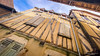
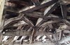
Information and Pictures:
www.t4t35.fr
You may be viewing yesterday's version of this page. To see the most up to date information please register for a free account.
 (PID:177301)")
 (PID:177300)")
 (PID:177299)")
 (PID:169394)")
Do not use the above information on other web sites or publications without permission of the contributor.
Nearby Images from Flickr


The above images may not be of the site on this page, but were taken nearby. They are loaded from Flickr so please click on them for image credits.
Click here to see more info for this site
Nearby sites
Click here to view sites on an interactive map of the areaKey: Red: member's photo, Blue: 3rd party photo, Yellow: other image, Green: no photo - please go there and take one, Grey: site destroyed
Download sites to:
KML (Google Earth)
GPX (GPS waypoints)
CSV (Garmin/Navman)
CSV (Excel)
To unlock full downloads you need to sign up as a Contributory Member. Otherwise downloads are limited to 50 sites.
Turn off the page maps and other distractions
Nearby sites listing. In the following links * = Image available
607m W 261° Dolmen de Pedorat* Burial Chamber or Dolmen
2.6km E 83° Dolmen de Bourdeil* Burial Chamber or Dolmen
3.6km E 86° Le Breil Dolmen* Burial Chamber or Dolmen
4.1km W 273° Roc de la Chevre* Burial Chamber or Dolmen
4.4km W 278° Les neuf pierres* Stone Circle
6.2km E 83° Dolmen de Pincanelle* Burial Chamber or Dolmen
6.4km E 89° Dolmen de Case du Loup* Burial Chamber or Dolmen
6.5km NW 320° Dolmen des Saintongers* Burial Chamber or Dolmen
7.1km NNE 18° Le Bourdil Dolmen* Burial Chamber or Dolmen
7.3km W 281° Dolmen Terme du Pendu* Burial Chamber or Dolmen
7.4km NW 321° Allée couverte de St Cernin de Labarde Passage Grave
7.7km N 10° Dolmen le Roc del Ser (Faux)* Burial Chamber or Dolmen
8.2km S 183° Tumulus de Laprade* Artificial Mound
8.3km N 352° Dolmen de Campguilhem* Burial Chamber or Dolmen
8.5km N 355° Dolmen de la Robertie* Burial Chamber or Dolmen
9.1km SW 218° Lastrespeyres de Douzains* Burial Chamber or Dolmen
9.2km ENE 69° Dolmen de Peyre Nègre* Burial Chamber or Dolmen
9.4km NW 312° Dolmen Peyrelevade de Conne de Labarde* Burial Chamber or Dolmen
9.6km ENE 72° Allée couverte de Blanc* Passage Grave
10.1km N 349° Dolmen Peyrelevade* Burial Chamber or Dolmen
10.4km ENE 74° Dolmen de la Borie Neuve* Burial Chamber or Dolmen
10.7km NE 44° Menhir de Peyroux 2* Standing Stone (Menhir)
10.7km NE 45° Menhir du Peyroux 1* Standing Stone (Menhir)
12.6km ENE 70° Allée couverte de La Bouquerie* Passage Grave
12.7km NE 36° Gisement de la Gravette Cave or Rock Shelter
View more nearby sites and additional images


 We would like to know more about this location. Please feel free to add a brief description and any relevant information in your own language.
 Wir möchten mehr über diese Stätte erfahren. Bitte zögern Sie nicht, eine kurze Beschreibung und relevante Informationen in Deutsch hinzuzufügen.
 Nous aimerions en savoir encore un peu sur les lieux. S'il vous plaît n'hesitez pas à ajouter une courte description et tous les renseignements pertinents dans votre propre langue.
 Quisieramos informarnos un poco más de las lugares. No dude en añadir una breve descripción y otros datos relevantes en su propio idioma.