

<< Text Pages >> Achingoul - Broch or Nuraghe in Scotland in Caithness
Submitted by SolarMegalith on Saturday, 13 November 2010 Page Views: 2202
Iron Age and Later PrehistorySite Name: AchingoulCountry: Scotland County: Caithness Type: Broch or Nuraghe
Nearest Town: Halkirk
Map Ref: ND10475463
Latitude: 58.470690N Longitude: 3.536591W
Condition:
| 5 | Perfect |
| 4 | Almost Perfect |
| 3 | Reasonable but with some damage |
| 2 | Ruined but still recognisable as an ancient site |
| 1 | Pretty much destroyed, possibly visible as crop marks |
| 0 | No data. |
| -1 | Completely destroyed |
| 5 | Superb |
| 4 | Good |
| 3 | Ordinary |
| 2 | Not Good |
| 1 | Awful |
| 0 | No data. |
| 5 | Can be driven to, probably with disabled access |
| 4 | Short walk on a footpath |
| 3 | Requiring a bit more of a walk |
| 2 | A long walk |
| 1 | In the middle of nowhere, a nightmare to find |
| 0 | No data. |
| 5 | co-ordinates taken by GPS or official recorded co-ordinates |
| 4 | co-ordinates scaled from a detailed map |
| 3 | co-ordinates scaled from a bad map |
| 2 | co-ordinates of the nearest village |
| 1 | co-ordinates of the nearest town |
| 0 | no data |
Internal Links:
External Links:
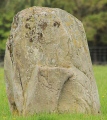
Broch in Caithness
Mound covered with turf located east from farmstead of Achingoul is remain of a broch. The mound has 20 m of diameter and a 10 x 8 m plateau on it's top.
You may be viewing yesterday's version of this page. To see the most up to date information please register for a free account.
Do not use the above information on other web sites or publications without permission of the contributor.
Nearby Images from Geograph Britain and Ireland:
©2012(licence)
©2012(licence)
©2022(licence)
©2012(licence)
©2008(licence)
The above images may not be of the site on this page, they are loaded from Geograph.
Please Submit an Image of this site or go out and take one for us!
Click here to see more info for this site
Nearby sites
Key: Red: member's photo, Blue: 3rd party photo, Yellow: other image, Green: no photo - please go there and take one, Grey: site destroyed
Download sites to:
KML (Google Earth)
GPX (GPS waypoints)
CSV (Garmin/Navman)
CSV (Excel)
To unlock full downloads you need to sign up as a Contributory Member. Otherwise downloads are limited to 50 sites.
Turn off the page maps and other distractions
Nearby sites listing. In the following links * = Image available
2.6km ENE 76° Achies West* Broch or Nuraghe (ND13055522)
3.5km SE 135° Tulach An Fhuarain Broch or Nuraghe (ND12875208)
3.5km SE 137° Tulach Lochain Braiseal Broch or Nuraghe (ND12825203)
3.7km ENE 73° Achies East* Broch or Nuraghe (ND14005565)
3.7km WNW 285° Dorrery* Stone Circle (ND06895565)
3.7km SE 136° Tulach Buaile A' Chroic* Broch or Nuraghe (ND12995186)
4.1km E 80° Achanarras Hill* Stone Circle (ND14545525)
4.6km SE 140° Cairn Na Mairg* Broch or Nuraghe (ND13315103)
4.6km WNW 282° Beinn Freiceadain Hillfort (ND05945574)
4.9km NNE 21° Tulloch of Milton* Chambered Cairn (ND12355911)
5.2km NNE 15° Housle Cairn Broch or Nuraghe (ND11905960)
5.3km NNW 338° Tulloch of Achavarn* Broch or Nuraghe (ND08545962)
5.9km N 2° Upper Sour Broch or Nuraghe (ND10856056)
6.3km SSE 162° Dirlot (North)* Multiple Stone Rows / Avenue (ND1228048560)
6.3km SE 138° Tulach Beag* Broch or Nuraghe (ND14594980)
6.4km SSE 163° Dirlot (South)* Stone Row / Alignment (ND1220748411)
6.5km SE 137° Tormsdale Stone Rows* Multiple Stone Rows / Avenue (ND14834974)
6.6km WNW 303° Sithean Dubh Chambered Cairn (ND04975834)
6.6km E 93° Spittal Quarry* Modern Stone Circle etc (ND171541)
6.7km WNW 290° Tulach Gorm (Forse Water) Broch or Nuraghe (ND04185710)
6.8km SE 139° Tulach Mor* Broch or Nuraghe (ND14854940)
6.9km WNW 289° Shurrery Stone Circle (ND040570)
6.9km NW 305° Monadh Nan Carn* Chambered Cairn (ND04885874)
7.0km N 358° North Calder* Broch or Nuraghe (ND10356160)
7.0km ESE 114° Achkeepster Broch or Nuraghe (ND16805158)
View more nearby sites and additional images


 We would like to know more about this location. Please feel free to add a brief description and any relevant information in your own language.
 Wir möchten mehr über diese Stätte erfahren. Bitte zögern Sie nicht, eine kurze Beschreibung und relevante Informationen in Deutsch hinzuzufügen.
 Nous aimerions en savoir encore un peu sur les lieux. S'il vous plaît n'hesitez pas à ajouter une courte description et tous les renseignements pertinents dans votre propre langue.
 Quisieramos informarnos un poco más de las lugares. No dude en añadir una breve descripción y otros datos relevantes en su propio idioma.