

<< Text Pages >> Charlecote A Cursus - Cursus in England in Warwickshire
Submitted by EssexMan on Wednesday, 07 April 2010 Page Views: 3192
Neolithic and Bronze AgeSite Name: Charlecote A CursusCountry: England County: Warwickshire Type: Cursus
Nearest Town: Stratford-Upon-Avon Nearest Village: Charlecote
Map Ref: SP26895795 Landranger Map Number: 151
Latitude: 52.219109N Longitude: 1.607811W
Condition:
| 5 | Perfect |
| 4 | Almost Perfect |
| 3 | Reasonable but with some damage |
| 2 | Ruined but still recognisable as an ancient site |
| 1 | Pretty much destroyed, possibly visible as crop marks |
| 0 | No data. |
| -1 | Completely destroyed |
| 5 | Superb |
| 4 | Good |
| 3 | Ordinary |
| 2 | Not Good |
| 1 | Awful |
| 0 | No data. |
| 5 | Can be driven to, probably with disabled access |
| 4 | Short walk on a footpath |
| 3 | Requiring a bit more of a walk |
| 2 | A long walk |
| 1 | In the middle of nowhere, a nightmare to find |
| 0 | No data. |
| 5 | co-ordinates taken by GPS or official recorded co-ordinates |
| 4 | co-ordinates scaled from a detailed map |
| 3 | co-ordinates scaled from a bad map |
| 2 | co-ordinates of the nearest village |
| 1 | co-ordinates of the nearest town |
| 0 | no data |
Internal Links:
External Links:
Long Enclosure in Warwickshire
Status: Certain
NMR No. SP 25 NE 52
Extent: 72mx14m
Terminal type: Trapezoidal
You may be viewing yesterday's version of this page. To see the most up to date information please register for a free account.
Do not use the above information on other web sites or publications without permission of the contributor.
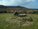
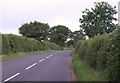
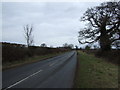
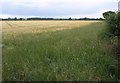
Nearby Images from Geograph Britain and Ireland:
©2011(licence)
©2013(licence)
©2011(licence)
©2010(licence)
©2016(licence)
The above images may not be of the site on this page, they are loaded from Geograph.
Please Submit an Image of this site or go out and take one for us!
Click here to see more info for this site
Nearby sites
Key: Red: member's photo, Blue: 3rd party photo, Yellow: other image, Green: no photo - please go there and take one, Grey: site destroyed
Download sites to:
KML (Google Earth)
GPX (GPS waypoints)
CSV (Garmin/Navman)
CSV (Excel)
To unlock full downloads you need to sign up as a Contributory Member. Otherwise downloads are limited to 50 sites.
Turn off the page maps and other distractions
Nearby sites listing. In the following links * = Image available
673m NW 325° Wasperton Timber Circle (SP265585)
1.5km S 184° Charlecote B Cursus Cursus (SP268565)
1.7km S 183° Charlecote B Cursus Cursus (SP268563)
2.1km SW 234° Hampton Lucy B Timber Circle (SP252567)
2.1km WSW 238° Hampton Lucy A Timber Circle (SP251568)
3.8km N 3° Warwick Cursus Cursus (SP27066176)
3.8km N 0° Longbridge Cursus Cursus (SP269618)
3.9km ENE 72° Oakley Wood Fort* Hillfort (SP306592)
4.1km N 0° Longbridge Cursus Cursus (SP269621)
4.7km NNE 24° Barford Cursus Cursus (SP288623)
5.0km NNE 24° Barford Cursus Cursus (SP289625)
7.6km S 174° Ettington Cursus Cursus (SP277504)
7.8km S 174° Ettington Cursus Cursus (SP277502)
10.5km W 271° Mary Arden's Well* Holy Well or Sacred Spring (SP164581)
11.4km NW 306° Barnmoor Wood Camp* Hillfort (SP17666464)
12.3km ESE 116° Burton Dassett Tumuli Round Barrow(s) (SP380526)
12.5km N 350° Beausale Fort* Hillfort (SP246702)
14.4km ESE 117° Holy Well (Burton Dassett)* Holy Well or Sacred Spring (SP398515)
14.6km N 351° St. John's Well (Warwickshire)* Holy Well or Sacred Spring (SP24487234)
15.2km ENE 77° Holy Well (Southam)* Holy Well or Sacred Spring (SP417615)
15.5km SE 129° Nadbury Camp* Hillfort (SP390482)
15.5km SW 216° Meon Hill* Hillfort (SP177454)
15.6km SSE 147° Red Horse of Tysoe Hill Figure or Geoglyph (SP3539844833)
15.7km NE 44° Wappenbury* Hillfort (SP377693)
20.8km NE 41° Knightlow barrow* Round Barrow(s) (SP405737)
View more nearby sites and additional images


 We would like to know more about this location. Please feel free to add a brief description and any relevant information in your own language.
 Wir möchten mehr über diese Stätte erfahren. Bitte zögern Sie nicht, eine kurze Beschreibung und relevante Informationen in Deutsch hinzuzufügen.
 Nous aimerions en savoir encore un peu sur les lieux. S'il vous plaît n'hesitez pas à ajouter une courte description et tous les renseignements pertinents dans votre propre langue.
 Quisieramos informarnos un poco más de las lugares. No dude en añadir una breve descripción y otros datos relevantes en su propio idioma.