


<< Text Pages >> Marian Ffrith - Hillfort in Wales in Denbighshire
Submitted by coldrum on Wednesday, 27 January 2010 Page Views: 3890
Iron Age and Later PrehistorySite Name: Marian FfrithCountry: Wales County: Denbighshire Type: Hillfort
Map Ref: SJ0746877947
Latitude: 53.290379N Longitude: 3.389593W
Condition:
| 5 | Perfect |
| 4 | Almost Perfect |
| 3 | Reasonable but with some damage |
| 2 | Ruined but still recognisable as an ancient site |
| 1 | Pretty much destroyed, possibly visible as crop marks |
| 0 | No data. |
| -1 | Completely destroyed |
| 5 | Superb |
| 4 | Good |
| 3 | Ordinary |
| 2 | Not Good |
| 1 | Awful |
| 0 | No data. |
| 5 | Can be driven to, probably with disabled access |
| 4 | Short walk on a footpath |
| 3 | Requiring a bit more of a walk |
| 2 | A long walk |
| 1 | In the middle of nowhere, a nightmare to find |
| 0 | No data. |
| 5 | co-ordinates taken by GPS or official recorded co-ordinates |
| 4 | co-ordinates scaled from a detailed map |
| 3 | co-ordinates scaled from a bad map |
| 2 | co-ordinates of the nearest village |
| 1 | co-ordinates of the nearest town |
| 0 | no data |
Be the first person to rate this site - see the 'Contribute!' box in the right hand menu.
Internal Links:
External Links:
Hillfort in Denbighshire (Sir Ddinbych)
"Oval, irregular earthwork enclosure surviving on uncultivated heath. The enclosure measures approx. 88m x 110m, and encloses 0.75 hectare. The rampart is irregular in character and features many gaps in the perimeter; some short lengths of bank are partly discontinuous with their adjacent sections. The enclosure is most likely to be a later prehistoric defended enclosure, but an earlier date cannot be ruled out on the grounds of its unusual character."
Source: Coflein.
You may be viewing yesterday's version of this page. To see the most up to date information please register for a free account.
Do not use the above information on other web sites or publications without permission of the contributor.
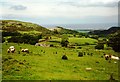
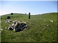
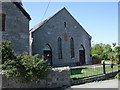
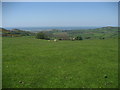
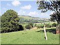
Nearby Images from Geograph Britain and Ireland:
©2008(licence)
©2009(licence)
©2009(licence)
©2009(licence)
©2007(licence)
The above images may not be of the site on this page, they are loaded from Geograph.
Please Submit an Image of this site or go out and take one for us!
Click here to see more info for this site
Nearby sites
Key: Red: member's photo, Blue: 3rd party photo, Yellow: other image, Green: no photo - please go there and take one, Grey: site destroyed
Download sites to:
KML (Google Earth)
GPX (GPS waypoints)
CSV (Garmin/Navman)
CSV (Excel)
To unlock full downloads you need to sign up as a Contributory Member. Otherwise downloads are limited to 50 sites.
Turn off the page maps and other distractions
Nearby sites listing. In the following links * = Image available
287m WSW 243° Marion Bach 2 Round Barrow(s) (SJ07217782)
549m SW 228° Marion Bach 1 Round Barrow(s) (SJ07057759)
770m S 170° Aelwyd Uchaf (Cottage) Barrows Round Barrow(s) (SJ0758577185)
1.3km WNW 294° Moel Hiraddug* Hillfort (SJ063785)
1.3km S 172° Llyn-Y-Gorseddau 3 Round Barrow(s) (SJ07647662)
1.4km S 170° Llyn-Y-Gorseddau 2 Round Barrow(s) (SJ07687657)
1.4km S 172° Llyn-Y-Gorseddau 1 Round Barrow(s) (SJ07657651)
1.5km ENE 79° Cae Bryn Round Barrow(s) (SJ08917821)
1.9km NNE 33° Hen Dy Round Barrow(s) (SJ08547950)
2.2km WNW 303° Dyserth Church* Ancient Cross (SJ056792)
2.4km NNE 28° Gop Caves* Cave or Rock Shelter (SJ08648009)
2.5km NNW 330° Graig Fawr (Dyserth)* Standing Stone (Menhir) (SJ06288013)
2.5km NNE 27° Gop-y-Goleuni* Cairn (SJ08668015)
2.5km NNE 11° Gop Farm Bone Cave Cave or Rock Shelter (SJ08028041)
2.6km SE 134° Criafol* Round Barrow(s) (SJ09317611)
2.6km NNE 33° Gop Wood Mound* Cairn (SJ08928012)
2.8km SE 127° Pany Y Dulath Round Barrow(s) (SJ09677624)
2.9km ESE 114° Hendre Bach Round Barrow(s) (SJ10137671)
3.0km N 6° Ty-Uchaf* Round Barrow(s) (SJ07868095)
3.1km WNW 285° Ffynnon Fair (Rhuddlan)* Holy Well or Sacred Spring (SJ045788)
3.2km NE 39° Bryn-Y-Odyn* Round Barrow(s) (SJ0952380376)
3.5km N 353° Coed-Yr-Esgob Round Barrow(s) (SJ07098146)
3.8km NE 50° Axton Barrows Round Barrow(s) (SJ104803)
3.8km SSE 160° Moel Maen Efa* Barrow Cemetery (SJ087743)
4.2km ESE 118° Traveller's Inn* Round Barrow(s) (SJ111759)
View more nearby sites and additional images


 We would like to know more about this location. Please feel free to add a brief description and any relevant information in your own language.
 Wir möchten mehr über diese Stätte erfahren. Bitte zögern Sie nicht, eine kurze Beschreibung und relevante Informationen in Deutsch hinzuzufügen.
 Nous aimerions en savoir encore un peu sur les lieux. S'il vous plaît n'hesitez pas à ajouter une courte description et tous les renseignements pertinents dans votre propre langue.
 Quisieramos informarnos un poco más de las lugares. No dude en añadir una breve descripción y otros datos relevantes en su propio idioma.