<< Our Photo Pages >> Molmke Steingrab - Chambered Tomb in Germany in Saxony-Anhalt
Submitted by holger_rix on Wednesday, 21 October 2009 Page Views: 2775
Neolithic and Bronze AgeSite Name: Molmke Steingrab Alternative Name: Altmark 34Country: Germany
NOTE: This site is 5.981 km away from the location you searched for.
Land: Saxony-Anhalt Type: Chambered Tomb
Nearest Town: Salzwedel Nearest Village: Molmke
Latitude: 52.733041N Longitude: 10.872320E
Condition:
| 5 | Perfect |
| 4 | Almost Perfect |
| 3 | Reasonable but with some damage |
| 2 | Ruined but still recognisable as an ancient site |
| 1 | Pretty much destroyed, possibly visible as crop marks |
| 0 | No data. |
| -1 | Completely destroyed |
| 5 | Superb |
| 4 | Good |
| 3 | Ordinary |
| 2 | Not Good |
| 1 | Awful |
| 0 | No data. |
| 5 | Can be driven to, probably with disabled access |
| 4 | Short walk on a footpath |
| 3 | Requiring a bit more of a walk |
| 2 | A long walk |
| 1 | In the middle of nowhere, a nightmare to find |
| 0 | No data. |
| 5 | co-ordinates taken by GPS or official recorded co-ordinates |
| 4 | co-ordinates scaled from a detailed map |
| 3 | co-ordinates scaled from a bad map |
| 2 | co-ordinates of the nearest village |
| 1 | co-ordinates of the nearest town |
| 0 | no data |
Internal Links:
External Links:
I have visited· I would like to visit
DrewParsons would like to visit
CharcoalBurner89 visited on 26th Feb 2022 - their rating: Cond: 3 Amb: 3 Access: 3 Like many in this region, this megalithic tomb lies directly on a field. You should therefore arrive before the start of sowing. Ideally in late autumn and winter.
johnstone visited on 31st Aug 2020 - their rating: Cond: 3 Amb: 4 Access: 4
Average ratings for this site from all visit loggers: Condition: 3 Ambience: 3.5 Access: 3.5
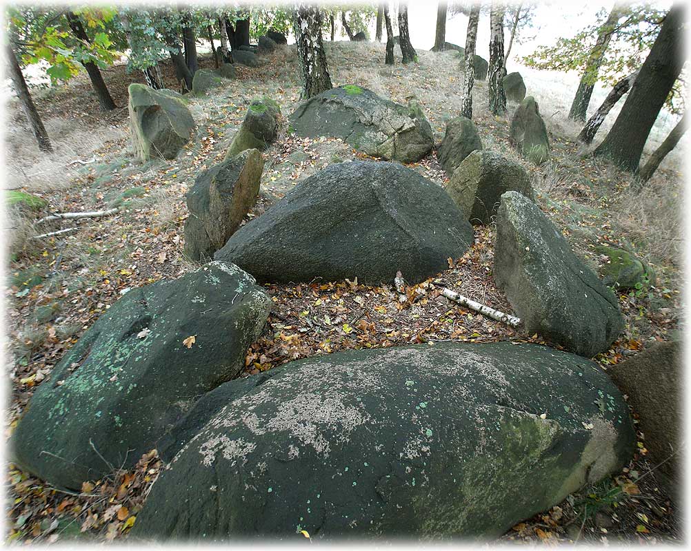
1.4km west of the small village Molmke, south of Diesdorf, not far from Diesdorf Steingrab 3,
there is another typical 'Altmark Grossdolmen' with enclosure.
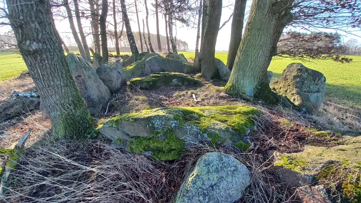
And same as the other barrows in the area, the enclosure has two oversized guardian stones in
the corners of the south-east end. Unfortunately the NW part of the enclosure is missing.
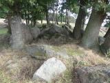
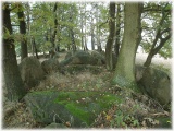
Thats exactly where the comparative well preserved chamber is located.
There is something unusual about this chamber.
It has a trapezoid shape, according to the 'Großsteingräber in der Altmark' book 9.9m x 3.2m/2.1m.
3.2m is a pretty big distance. In fact, I don't know another chamber that wide.
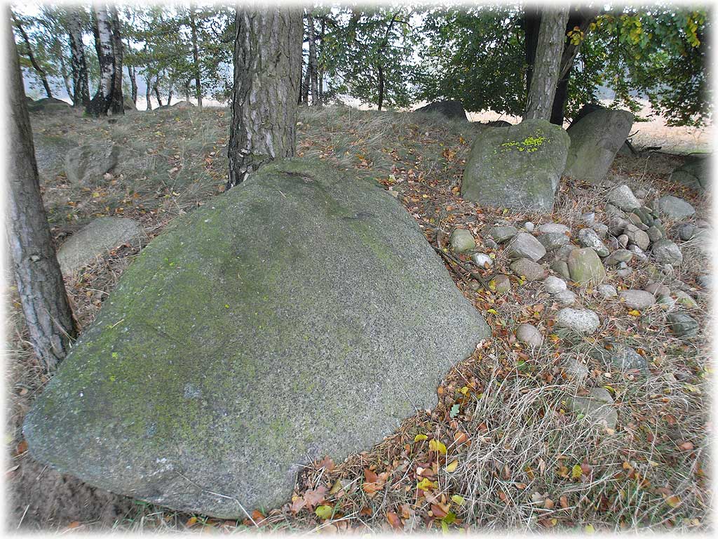
Strange thing is, the widest remaining capstone spans 2.5m - obviously not big enough to cover
the chamber on the wider NW end. Without any doubt, the uprights have moved since the erection,
esp. because the enclosure has been robbed at this end.
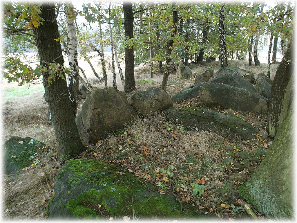
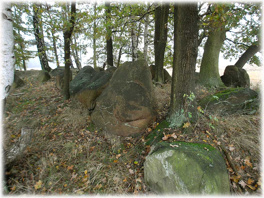
But, if you look at the pictures, the concerning uprights are still...
well... upright. A 'weak' orthostat should tilt in- or outwards.
At first sight, this isn't the case.
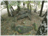
Anyhow, five capstones are still intact, but have sunken into the chamber.
The chamber had (at least) seven uprights on each long side.
References:
Johann Friedrich Danneil
'Specielle Nachweisung der Hünengräber in der Altmark'
Sechster Jahresbericht (Neuhaldensleben-Gardelegen 1843)
No. 42
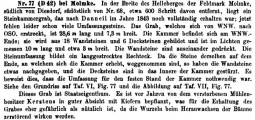
Eduard Krause, Otto Schoetensack
'Die megalithischen Gräber (Steinkammergräber) Deutschlands'
Zeitschrift für Ethnologie
25. Band v. 1893, No. 77, p. 146
Hartmut Bock, Barbara Fritsch, Lothar Mittag
'Großsteingräber in der Altmark'
Landesamt für Denkmalpflege und Archäologie Sachsen-Anhalt
Landesmuseum für Vorgeschichte, Halle (Saale)
2006, No. 34, p. 133
You may be viewing yesterday's version of this page. To see the most up to date information please register for a free account.

Do not use the above information on other web sites or publications without permission of the contributor.
Click here to see more info for this site
Nearby sites
Click here to view sites on an interactive map of the areaKey: Red: member's photo, Blue: 3rd party photo, Yellow: other image, Green: no photo - please go there and take one, Grey: site destroyed
Download sites to:
KML (Google Earth)
GPX (GPS waypoints)
CSV (Garmin/Navman)
CSV (Excel)
To unlock full downloads you need to sign up as a Contributory Member. Otherwise downloads are limited to 50 sites.
Turn off the page maps and other distractions
Nearby sites listing. In the following links * = Image available
522m NW 321° Diesdorf Steingrab 3* Chambered Tomb
788m NNW 333° Diesdorf Steingrab 2* Chambered Tomb
1.7km NNW 332° Diesdorf Steingrab 1* Chambered Tomb
2.0km SE 133° Drebenstedt Langbett* Long Barrow
2.7km NNW 328° Schadewohl Steingrab 3* Chambered Tomb
3.0km NW 326° Schadewohl Steingrab 2* Chambered Tomb
3.4km NW 322° Schadewohl Steingrab 1* Chambered Tomb
3.7km ESE 115° Bornsen Steingrab 2* Chambered Tomb
3.8km SE 133° Bornsen Steingrab 1* Chambered Tomb
6.1km E 92° Mehmke Steingrab 2* Chambered Tomb
6.2km E 91° Mehmke Steingrab 3* Chambered Tomb
6.9km SE 127° Luedelsen Steingrab 6* Long Barrow
7.6km ESE 123° Luedelsen Steingrab 3* Chambered Tomb
7.6km ESE 123° Luedelsen Steingrab 4* Chambered Tomb
7.6km ESE 123° Luedelsen Steingrab 2* Chambered Tomb
7.7km ESE 123° Luedelsen Steingrab 5* Chambered Tomb
7.7km ESE 122° Luedelsen Steingrab 1* Chambered Tomb
8.4km SSE 164° Nettgau Steingrab* Chambered Tomb
8.7km ESE 111° Stoeckheim Steingrab* Passage Grave
9.3km NNW 338° Lenekenstein* Standing Stone (Menhir)
9.9km E 89° Bierstedt Steingrab* Chambered Tomb
11.2km ENE 74° Leetze Steingrab 8* Passage Grave
11.3km ENE 74° Leetze Steingrab 7* Passage Grave
11.3km ENE 72° Leetze Steingrab 6* Long Barrow
11.4km ENE 71° Leetze Steingrab 5* Long Barrow
View more nearby sites and additional images


 We would like to know more about this location. Please feel free to add a brief description and any relevant information in your own language.
 Wir möchten mehr über diese Stätte erfahren. Bitte zögern Sie nicht, eine kurze Beschreibung und relevante Informationen in Deutsch hinzuzufügen.
 Nous aimerions en savoir encore un peu sur les lieux. S'il vous plaît n'hesitez pas à ajouter une courte description et tous les renseignements pertinents dans votre propre langue.
 Quisieramos informarnos un poco más de las lugares. No dude en añadir una breve descripción y otros datos relevantes en su propio idioma.