

<< Our Photo Pages >> Butte-aux-Houx alignement - Stone Row / Alignment in France in Pays de la Loire:Maine-et-Loire 49
Submitted by thecaptain on Tuesday, 04 August 2009 Page Views: 3385
Neolithic and Bronze AgeSite Name: Butte-aux-Houx alignement Alternative Name: Alignement de St GondonCountry: France Département: Pays de la Loire:Maine-et-Loire 49 Type: Stone Row / Alignment
Nearest Town: Saumur Nearest Village: Le Thoureil
Latitude: 47.368600N Longitude: 0.2812W
Condition:
| 5 | Perfect |
| 4 | Almost Perfect |
| 3 | Reasonable but with some damage |
| 2 | Ruined but still recognisable as an ancient site |
| 1 | Pretty much destroyed, possibly visible as crop marks |
| 0 | No data. |
| -1 | Completely destroyed |
| 5 | Superb |
| 4 | Good |
| 3 | Ordinary |
| 2 | Not Good |
| 1 | Awful |
| 0 | No data. |
| 5 | Can be driven to, probably with disabled access |
| 4 | Short walk on a footpath |
| 3 | Requiring a bit more of a walk |
| 2 | A long walk |
| 1 | In the middle of nowhere, a nightmare to find |
| 0 | No data. |
| 5 | co-ordinates taken by GPS or official recorded co-ordinates |
| 4 | co-ordinates scaled from a detailed map |
| 3 | co-ordinates scaled from a bad map |
| 2 | co-ordinates of the nearest village |
| 1 | co-ordinates of the nearest town |
| 0 | no data |
Internal Links:
External Links:
I have visited· I would like to visit
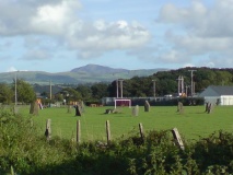
TheCaptain visited on 15th Jul 2005 - their rating: Cond: 3 Amb: 3 Access: 2 Try as I might, I couldn't find any of these menhirs shown on the ign 1:25000 map. The map shows 5 menhirs lined up along the ridge, but the forest and undergrowth here is very thick, and there are many private keep out signs. Some of the area they are shown in is being bulldozed and flattened, no doubt to make more holiday houses for rich Parisiens. Hopefully none of the menhirs are suffering this fate, but I couldn't be sure.
Before I completely gave up and went back to the van, I tried again from another angle, and eventually found a menhir at N47.836, W0.2812. It's about 3 metres tall and in dense undergrowth, but there was no obvious signs of any of the others.
")
When I was visiting in july 2005, some of the area they are shown in was being bulldozed and flattened, no doubt to make more holiday houses for rich Parisiens. Hopefully none of the menhirs are suffering this fate, but I couldn't be sure.
Before I completely gave up and went back to my van, I tried again from another angle, and eventually found a menhir at N47.3686, W0.2812. It's about 3 metres tall and in dense undergrowth, but I could find no obvious signs of any of the others.
You may be viewing yesterday's version of this page. To see the most up to date information please register for a free account.
")
")
Do not use the above information on other web sites or publications without permission of the contributor.
Nearby Images from Flickr

The above images may not be of the site on this page, but were taken nearby. They are loaded from Flickr so please click on them for image credits.
Click here to see more info for this site
Nearby sites
Click here to view sites on an interactive map of the areaKey: Red: member's photo, Blue: 3rd party photo, Yellow: other image, Green: no photo - please go there and take one, Grey: site destroyed
Download sites to:
KML (Google Earth)
GPX (GPS waypoints)
CSV (Garmin/Navman)
CSV (Excel)
To unlock full downloads you need to sign up as a Contributory Member. Otherwise downloads are limited to 50 sites.
Turn off the page maps and other distractions
Nearby sites listing. In the following links * = Image available
71m E 93° Hutte en Pierre de la Butte aux Houx Burial Chamber or Dolmen
71m ESE 104° Menhir de la Butte aux Houx 4 Standing Stone (Menhir)
97m SW 236° Menhir du Bois de la Bodiniére Standing Stone (Menhir)
160m E 90° Menhirs de la Butte aux Houx 2+3 Standing Stone (Menhir)
245m E 89° Menhir de Saint-Gondon 1 Standing Stone (Menhir)
453m WSW 259° Pierre-de-Nézan* Standing Stone (Menhir)
632m SSE 162° Menhir des Varennes de Cumeray* Standing Stone (Menhir)
689m SSE 160° Dolmen des Varennes de Cumeray 2* Burial Chamber or Dolmen
728m SSE 159° Dolmen des Varennes de Cumeray 1* Burial Chamber or Dolmen
779m N 2° La Filousiere* Standing Stone (Menhir)
830m SSE 160° Dolmen des Varennes de Cumeray 3* Burial Chamber or Dolmen
1.2km W 267° Bajouillière Dolmen* Burial Chamber or Dolmen
1.2km E 93° Riche-Bourg dolmen Burial Chamber or Dolmen
1.8km SW 227° La Chaise des Morts* Standing Stone (Menhir)
1.9km S 172° Pierre-qui-Pousse (Le Sale Village)* Standing Stone (Menhir)
2.5km SE 128° Menhir de Bessé Standing Stone (Menhir)
2.8km SE 128° Pierre de Torche Anesse Standing Stone (Menhir)
2.9km S 169° Moulin de la Butte Menhir (Gennes)* Modern Stone Circle etc
2.9km S 169° Dolmen de la Forêt (Gennes)* Burial Chamber or Dolmen
3.6km SE 137° Menhir du Bois Gilbert* Standing Stone (Menhir)
3.6km SSE 159° Pierre Longue du Bouchet* Standing Stone (Menhir)
3.8km SSE 150° Dolmen de la Pagerie* Burial Chamber or Dolmen
3.9km SW 234° Pierre Couverte du Grez Burial Chamber or Dolmen
4.9km SE 139° Amphithéâtre Gallo-Romain (Gennes)* Ancient Village or Settlement
4.9km SE 141° Les Pierres Levées de l'Amphitheatre Standing Stones
View more nearby sites and additional images


 We would like to know more about this location. Please feel free to add a brief description and any relevant information in your own language.
 Wir möchten mehr über diese Stätte erfahren. Bitte zögern Sie nicht, eine kurze Beschreibung und relevante Informationen in Deutsch hinzuzufügen.
 Nous aimerions en savoir encore un peu sur les lieux. S'il vous plaît n'hesitez pas à ajouter une courte description et tous les renseignements pertinents dans votre propre langue.
 Quisieramos informarnos un poco más de las lugares. No dude en añadir una breve descripción y otros datos relevantes en su propio idioma.