 with our Megalithic Portal iPhone app")

<< Our Photo Pages >> Stanbury Hill 06 - Rock Art in England in Yorkshire (West)
Submitted by Andy B on Sunday, 30 November 2008 Page Views: 3579
Rock ArtSite Name: Stanbury Hill 06 Alternative Name: ERA-2518; Boughey & Vickerman (101); SAM 25260; PRN173; Group PRN7219Country: England County: Yorkshire (West) Type: Rock Art
Nearest Town: Bingley Nearest Village: East Morton, Eldwick
Map Ref: SE1098843359
Latitude: 53.886303N Longitude: 1.834316W
Condition:
| 5 | Perfect |
| 4 | Almost Perfect |
| 3 | Reasonable but with some damage |
| 2 | Ruined but still recognisable as an ancient site |
| 1 | Pretty much destroyed, possibly visible as crop marks |
| 0 | No data. |
| -1 | Completely destroyed |
| 5 | Superb |
| 4 | Good |
| 3 | Ordinary |
| 2 | Not Good |
| 1 | Awful |
| 0 | No data. |
| 5 | Can be driven to, probably with disabled access |
| 4 | Short walk on a footpath |
| 3 | Requiring a bit more of a walk |
| 2 | A long walk |
| 1 | In the middle of nowhere, a nightmare to find |
| 0 | No data. |
| 5 | co-ordinates taken by GPS or official recorded co-ordinates |
| 4 | co-ordinates scaled from a detailed map |
| 3 | co-ordinates scaled from a bad map |
| 2 | co-ordinates of the nearest village |
| 1 | co-ordinates of the nearest town |
| 0 | no data |
Be the first person to rate this site - see the 'Contribute!' box in the right hand menu.
Internal Links:
External Links:
I have visited· I would like to visit
SolarMegalith visited on 3rd Aug 2017 - their rating: Cond: 2 Amb: 4 Access: 4
Andy B have visited here
")
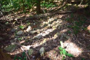
Stanbury Hill, Bingley Moor. Part of Group 2: on west side of hill. The best way to find them is as follows. From the footpath junction, walk roughly West along the ridge of the hill. At the Westerly edge of the ridge, there is a slight rise in the ground before the hill plunges steeply to Fenny Shaw Beck. Just before this slight rise, the main concentration of rocks can be found in a very small area in a rough circle.
This rock art panel is recorded as ERA-2518 Stanbury Hill 06, which includes a description, photographs, a plan of the rock and its motifs, plus photogrammetry.
This rock art panel is located on Open Access land.
You may be viewing yesterday's version of this page. To see the most up to date information please register for a free account.
")
")
Do not use the above information on other web sites or publications without permission of the contributor.
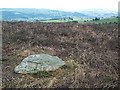
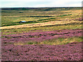
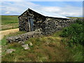
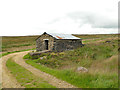
Nearby Images from Geograph Britain and Ireland:
©2005(licence)
©2005(licence)
©2013(licence)
©2020(licence)
©2020(licence)
The above images may not be of the site on this page, they are loaded from Geograph.
Please Submit an Image of this site or go out and take one for us!
Click here to see more info for this site
Nearby sites
Key: Red: member's photo, Blue: 3rd party photo, Yellow: other image, Green: no photo - please go there and take one, Grey: site destroyed
Download sites to:
KML (Google Earth)
GPX (GPS waypoints)
CSV (Garmin/Navman)
CSV (Excel)
To unlock full downloads you need to sign up as a Contributory Member. Otherwise downloads are limited to 50 sites.
Turn off the page maps and other distractions
Nearby sites listing. In the following links * = Image available
6m NE 45° Stanbury Hill 07* Rock Art (SE1099243363)
8m W 277° Stanbury Hill 04* Rock Art (SE10984336)
9m ESE 103° Bingley Moor (104) Rock Art (SE1099743357)
12m NW 325° Stanbury Hill 03* Rock Art (SE1098143369)
15m NNW 341° Stanbury Hill 10.* Rock Art (SE1098343373)
18m W 273° Stanbury Hill 02* Rock Art (SE1097043360)
21m WSW 239° Stanbury Hill 01* Rock Art (SE1097043348)
25m N 351° Stanbury Hill 05* Rock Art (SE1098443384)
43m NNE 16° Stanbury Hill, Bingley Moor* Rock Art (SE110434)
45m ESE 122° Stanbury Hill 08* Rock Art (SE1102643335)
106m SW 236° Stanbury Hill Enclosure (Bingley Moor) Ancient Village or Settlement (SE109433)
181m ESE 120° Stanbury Hill 09* Rock Art (SE1114543269)
255m ENE 60° Littlestone (Bingley Moor)* Rock Art (SE1120943487)
260m NE 55° Fenny Shaw 01* Rock Art (SE11204351)
321m SE 132° Stanbury Hill 11* Rock Art (SE1122643143)
323m SE 131° Stanbury Hill 12* Rock Art (SE1123243147)
323m SE 132° Stanbury Hill 13, 14 & 16* Rock Art (SE1122943143)
324m SE 132° Stanbury Hill 15 Rock Art (SE1123043142)
349m NE 54° Fenny Shaw 02* Rock Art (SE1127143565)
730m SSE 166° Todmor Stones 05* Rock Art (SE1116542650)
749m S 182° Todmore Stone (Bingley Moor) Standing Stone (Menhir) (SE10964261)
761m S 177° Todmor Stones 02* Rock Art (SE1103442599)
765m S 180° Todmor Stones 01* Rock Art (SE1099242594)
773m S 175° Todmor Stones 03* Rock Art (SE1105642589)
774m S 175° Todmor Stones 04* Rock Art (SE1106142588)
View more nearby sites and additional images


 We would like to know more about this location. Please feel free to add a brief description and any relevant information in your own language.
 Wir möchten mehr über diese Stätte erfahren. Bitte zögern Sie nicht, eine kurze Beschreibung und relevante Informationen in Deutsch hinzuzufügen.
 Nous aimerions en savoir encore un peu sur les lieux. S'il vous plaît n'hesitez pas à ajouter une courte description et tous les renseignements pertinents dans votre propre langue.
 Quisieramos informarnos un poco más de las lugares. No dude en añadir una breve descripción y otros datos relevantes en su propio idioma.