


<< Text Pages >> Aitzpulun Dolmen - Burial Chamber or Dolmen in Spain in Navarra
Submitted by Klingon on Monday, 22 September 2008 Page Views: 956
Neolithic and Bronze AgeSite Name: Aitzpulun DolmenCountry: Spain Region: Navarra Type: Burial Chamber or Dolmen
Nearest Town: Baztan Nearest Village: Elizondo
Latitude: 43.136383N Longitude: 1.440273W
Condition:
| 5 | Perfect |
| 4 | Almost Perfect |
| 3 | Reasonable but with some damage |
| 2 | Ruined but still recognisable as an ancient site |
| 1 | Pretty much destroyed, possibly visible as crop marks |
| 0 | No data. |
| -1 | Completely destroyed |
| 5 | Superb |
| 4 | Good |
| 3 | Ordinary |
| 2 | Not Good |
| 1 | Awful |
| 0 | No data. |
| 5 | Can be driven to, probably with disabled access |
| 4 | Short walk on a footpath |
| 3 | Requiring a bit more of a walk |
| 2 | A long walk |
| 1 | In the middle of nowhere, a nightmare to find |
| 0 | No data. |
| 5 | co-ordinates taken by GPS or official recorded co-ordinates |
| 4 | co-ordinates scaled from a detailed map |
| 3 | co-ordinates scaled from a bad map |
| 2 | co-ordinates of the nearest village |
| 1 | co-ordinates of the nearest town |
| 0 | no data |
Be the first person to rate this site - see the 'Contribute!' box in the right hand menu.
Internal Links:
External Links:
Burial Chamber (Dolmen) in Community of Soalar - Autz
Have you visited this site? Please add a comment below.
You may be viewing yesterday's version of this page. To see the most up to date information please register for a free account.
Do not use the above information on other web sites or publications without permission of the contributor.
Nearby Images from Flickr
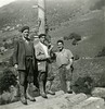
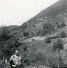
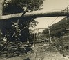
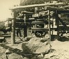
The above images may not be of the site on this page, but were taken nearby. They are loaded from Flickr so please click on them for image credits.
Click here to see more info for this site
Nearby sites
Click here to view sites on an interactive map of the areaKey: Red: member's photo, Blue: 3rd party photo, Yellow: other image, Green: no photo - please go there and take one, Grey: site destroyed
Download sites to:
KML (Google Earth)
GPX (GPS waypoints)
CSV (Garmin/Navman)
CSV (Excel)
To unlock full downloads you need to sign up as a Contributory Member. Otherwise downloads are limited to 50 sites.
Turn off the page maps and other distractions
Nearby sites listing. In the following links * = Image available
171m NNW 345° Aznabasterra Dolmen* Burial Chamber or Dolmen
259m ENE 74° Aizpulun Túmulo Round Barrow(s)
703m WNW 286° Sorginetxoa Dolmen* Burial Chamber or Dolmen
1.2km WSW 254° Oiza Túmulo Round Barrow(s)
1.3km SW 234° Burga Dolmen* Burial Chamber or Dolmen
1.3km SW 225° Basabar Menhir Standing Stone (Menhir)
1.3km SSW 205° Lamizilo Dolmen* Burial Chamber or Dolmen
1.3km SSW 202° Lamizilo Túmulo* Round Barrow(s)
1.3km SSW 197° Errolan Cromlech* Stone Circle
1.3km SSW 196° Errolan Dolmen* Burial Chamber or Dolmen
1.3km SSW 199° Errolan Túmulo Round Barrow(s)
1.6km NE 41° Erregarrimalda Túmulo 1-3 Round Barrow(s)
1.7km SSE 153° Munautz Dolmen* Burial Chamber or Dolmen
1.8km WNW 292° Soalar 2 Menhir Standing Stone (Menhir)
1.9km WNW 285° Burga Menhir* Standing Stone (Menhir)
1.9km WNW 285° Burga Cromlech Stone Circle
1.9km WNW 288° Soalar Dolmen 2* Burial Chamber or Dolmen
1.9km SE 139° Pagozelai Dolmen Burial Chamber or Dolmen
2.0km S 175° Urrixka Dolmen 2 Burial Chamber or Dolmen
2.0km SE 145° Pagozelai Menhir Standing Stone (Menhir)
2.1km WNW 296° Soalar Cromlechs 1-3* Stone Circle
2.1km ESE 120° Abrakuko Zelaia Dolmen Burial Chamber or Dolmen
2.2km WNW 296° Soalar Ekialde Menhir Standing Stone (Menhir)
2.2km WNW 296° Soalar Dolmen 2* Burial Chamber or Dolmen
2.2km WNW 292° Soalar Bizkarra Menhir Standing Stone (Menhir)
View more nearby sites and additional images


 We would like to know more about this location. Please feel free to add a brief description and any relevant information in your own language.
 Wir möchten mehr über diese Stätte erfahren. Bitte zögern Sie nicht, eine kurze Beschreibung und relevante Informationen in Deutsch hinzuzufügen.
 Nous aimerions en savoir encore un peu sur les lieux. S'il vous plaît n'hesitez pas à ajouter une courte description et tous les renseignements pertinents dans votre propre langue.
 Quisieramos informarnos un poco más de las lugares. No dude en añadir una breve descripción y otros datos relevantes en su propio idioma.