


<< Text Pages >> North Hill Tumuli - Barrow Cemetery in England in West Sussex
Submitted by coldrum on Wednesday, 23 July 2008 Page Views: 4081
Neolithic and Bronze AgeSite Name: North Hill TumuliCountry: England County: West Sussex Type: Barrow Cemetery
Nearest Village: Poynings
Map Ref: TQ270120
Latitude: 50.893528N Longitude: 0.195592W
Condition:
| 5 | Perfect |
| 4 | Almost Perfect |
| 3 | Reasonable but with some damage |
| 2 | Ruined but still recognisable as an ancient site |
| 1 | Pretty much destroyed, possibly visible as crop marks |
| 0 | No data. |
| -1 | Completely destroyed |
| 5 | Superb |
| 4 | Good |
| 3 | Ordinary |
| 2 | Not Good |
| 1 | Awful |
| 0 | No data. |
| 5 | Can be driven to, probably with disabled access |
| 4 | Short walk on a footpath |
| 3 | Requiring a bit more of a walk |
| 2 | A long walk |
| 1 | In the middle of nowhere, a nightmare to find |
| 0 | No data. |
| 5 | co-ordinates taken by GPS or official recorded co-ordinates |
| 4 | co-ordinates scaled from a detailed map |
| 3 | co-ordinates scaled from a bad map |
| 2 | co-ordinates of the nearest village |
| 1 | co-ordinates of the nearest town |
| 0 | no data |
Be the first person to rate this site - see the 'Contribute!' box in the right hand menu.
Internal Links:
External Links:
Barrow Cemetery in West Sussex
Tumuli.
You may be viewing yesterday's version of this page. To see the most up to date information please register for a free account.
Do not use the above information on other web sites or publications without permission of the contributor.
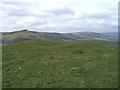
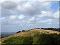
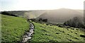
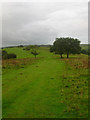
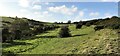
Nearby Images from Geograph Britain and Ireland:
©2007(licence)
©2018(licence)
©2020(licence)
©2008(licence)
©2020(licence)
The above images may not be of the site on this page, they are loaded from Geograph.
Please Submit an Image of this site or go out and take one for us!
Click here to see more info for this site
Nearby sites
Key: Red: member's photo, Blue: 3rd party photo, Yellow: other image, Green: no photo - please go there and take one, Grey: site destroyed
Download sites to:
KML (Google Earth)
GPX (GPS waypoints)
CSV (Garmin/Navman)
CSV (Excel)
To unlock full downloads you need to sign up as a Contributory Member. Otherwise downloads are limited to 50 sites.
Turn off the page maps and other distractions
Nearby sites listing. In the following links * = Image available
1.4km SW 230° Devil's Dyke (West Sussex)* Hillfort (TQ2597311088)
2.2km NE 41° Wolstonbury* Ancient Village or Settlement (TQ28401368)
2.5km WSW 243° Fulking Hill Tumulus 1* Round Barrow(s) (TQ248108)
2.7km SW 223° Adder Bottom Tumulus Round Barrow(s) (TQ252100)
2.9km SW 231° Fulking Hill Tumulus 2 Round Barrow(s) (TQ24771011)
3.4km WSW 254° Edburton Hill Motte and Bailey* Artificial Mound (TQ23771102)
3.5km SW 226° Tenant Hill Fields System Misc. Earthwork (TQ245095)
3.7km WSW 256° Edburton Hill Tumulus* Round Barrow(s) (TQ23381100)
4.4km SW 228° Tenant Hill Tumulus Round Barrow(s) (TQ238090)
4.4km E 80° Tumuli near Ditchling Beacon* Round Barrow(s) (TQ313129)
4.6km E 90° Standean* Natural Stone / Erratic / Other Natural Feature (TQ316121)
5.0km E 80° Ditchling Beacon Tumuli 2* Round Barrow(s) (TQ319130)
5.2km E 85° Ditchling Beacon Field System Misc. Earthwork (TQ322126)
5.4km E 80° Ditchling Beacon Tumuli* Round Barrow(s) (TQ323131)
5.5km SW 228° Thunders Barrow Misc. Earthwork (TQ230082)
5.5km SW 229° Thundersbarrow Hill Hillfort (TQ229083)
5.6km SW 228° Thunders Barrow Field System Misc. Earthwork (TQ229081)
5.8km ESE 111° Rocky Clump* Natural Stone / Erratic / Other Natural Feature (TQ325101)
5.9km SSW 196° Church Hill Standing Stones Natural Stone / Erratic / Other Natural Feature (TQ2554506318)
5.9km SSW 213° Rest And Be Thankful Marker Stone (TQ239070)
6.0km E 87° Ditchling Beacon Tumulus* Round Barrow(s) (TQ3302512474)
6.1km ESE 109° Pudding Bag Tumuli Barrow Cemetery (TQ328102)
6.2km SSE 166° The Goldstone* Natural Stone / Erratic / Other Natural Feature (TQ2868306021)
6.2km E 82° Ditchling Beacon Fort* Hillfort (TQ33151300)
6.4km ENE 59° Lodge Hill Tumulus Round Barrow(s) (TQ324154)
View more nearby sites and additional images


 We would like to know more about this location. Please feel free to add a brief description and any relevant information in your own language.
 Wir möchten mehr über diese Stätte erfahren. Bitte zögern Sie nicht, eine kurze Beschreibung und relevante Informationen in Deutsch hinzuzufügen.
 Nous aimerions en savoir encore un peu sur les lieux. S'il vous plaît n'hesitez pas à ajouter une courte description et tous les renseignements pertinents dans votre propre langue.
 Quisieramos informarnos un poco más de las lugares. No dude en añadir una breve descripción y otros datos relevantes en su propio idioma.