


<< Our Photo Pages >> Rastorf Steingrab 1 - Burial Chamber or Dolmen in Germany in Schleswig-Holstein, Hamburg
Submitted by holger_rix on Sunday, 08 June 2008 Page Views: 2616
Neolithic and Bronze AgeSite Name: Rastorf Steingrab 1 Alternative Name: Sprockhoff 196Country: Germany Land: Schleswig-Holstein, Hamburg Type: Burial Chamber or Dolmen
Nearest Town: Kiel Nearest Village: Rastorf
Latitude: 54.284436N Longitude: 10.291731E
Condition:
| 5 | Perfect |
| 4 | Almost Perfect |
| 3 | Reasonable but with some damage |
| 2 | Ruined but still recognisable as an ancient site |
| 1 | Pretty much destroyed, possibly visible as crop marks |
| 0 | No data. |
| -1 | Completely destroyed |
| 5 | Superb |
| 4 | Good |
| 3 | Ordinary |
| 2 | Not Good |
| 1 | Awful |
| 0 | No data. |
| 5 | Can be driven to, probably with disabled access |
| 4 | Short walk on a footpath |
| 3 | Requiring a bit more of a walk |
| 2 | A long walk |
| 1 | In the middle of nowhere, a nightmare to find |
| 0 | No data. |
| 5 | co-ordinates taken by GPS or official recorded co-ordinates |
| 4 | co-ordinates scaled from a detailed map |
| 3 | co-ordinates scaled from a bad map |
| 2 | co-ordinates of the nearest village |
| 1 | co-ordinates of the nearest town |
| 0 | no data |
Internal Links:
External Links:
")
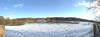
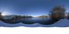
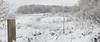
Remains of a Burial Chamber near Rasorf.
Five orthostats still in place, capstone is missing.
You may be viewing yesterday's version of this page. To see the most up to date information please register for a free account.
")
")
")
")
Do not use the above information on other web sites or publications without permission of the contributor.
Nearby Images from Flickr


The above images may not be of the site on this page, but were taken nearby. They are loaded from Flickr so please click on them for image credits.
Click here to see more info for this site
Nearby sites
Click here to view sites on an interactive map of the areaKey: Red: member's photo, Blue: 3rd party photo, Yellow: other image, Green: no photo - please go there and take one, Grey: site destroyed
Download sites to:
KML (Google Earth)
GPX (GPS waypoints)
CSV (Garmin/Navman)
CSV (Excel)
To unlock full downloads you need to sign up as a Contributory Member. Otherwise downloads are limited to 50 sites.
Turn off the page maps and other distractions
Nearby sites listing. In the following links * = Image available
162m S 189° Rastorf Steingrab 2* Burial Chamber or Dolmen
358m NE 36° Lilienthal Steingrab 3* Burial Chamber or Dolmen
389m S 189° Rastorf Steingrab 3* Burial Chamber or Dolmen
918m ESE 116° Lilienthal Huegelgrab* Round Barrow(s)
1.2km E 85° Lilienthal Steingrab 1* Long Barrow
1.2km ENE 73° Lilienthal Steingrab 2 Burial Chamber or Dolmen
1.4km NE 51° Lilienthal Steingrab 4* Burial Chamber or Dolmen
1.4km WNW 298° Moorsehden Huegelgrab* Round Barrow(s)
1.7km NW 323° Soehren Steingrab* Burial Chamber or Dolmen
1.7km N 6° Dobersdorf Steingrab (Timbrook)* Burial Chamber or Dolmen
1.9km ESE 114° Wildenhorst Steingrab* Chambered Tomb
2.1km E 83° Hoheneichen Langbett 1* Long Barrow
2.4km ENE 72° Hoheneichen Langbett 2* Long Barrow
2.5km NE 36° Vossberg Huegelgrab 1* Round Barrow(s)
2.5km N 4° Dobersdorf Langbett 3* Long Barrow
2.6km N 2° Dobersdorf Langbett 2* Long Barrow
2.6km NE 40° Dobersdorf Steingrab 5* Burial Chamber or Dolmen
2.7km NE 42° Vossberg Huegelgrab 2* Round Barrow(s)
2.8km SW 236° Raisdorf Huegelgrab* Round Barrow(s)
4.3km SSW 193° Preetz Huegelgrab* Round Barrow(s)
4.7km N 356° Dobersdorf Langbett 1* Long Barrow
4.9km S 186° Preetz Schalenstein* Rock Art
5.2km WSW 249° Neuwuehren Huegelgrab* Round Barrow(s)
8.0km N 2° Probsteierhagen Steingrab* Burial Chamber or Dolmen
10.3km ESE 103° Lammershagen Steingrab* Burial Chamber or Dolmen
View more nearby sites and additional images


 We would like to know more about this location. Please feel free to add a brief description and any relevant information in your own language.
 Wir möchten mehr über diese Stätte erfahren. Bitte zögern Sie nicht, eine kurze Beschreibung und relevante Informationen in Deutsch hinzuzufügen.
 Nous aimerions en savoir encore un peu sur les lieux. S'il vous plaît n'hesitez pas à ajouter une courte description et tous les renseignements pertinents dans votre propre langue.
 Quisieramos informarnos un poco más de las lugares. No dude en añadir una breve descripción y otros datos relevantes en su propio idioma.