<< Our Photo Pages >> Dos Sottolaiolo - Rock Art in Italy in Lombardia
Submitted by AlexHunger on Monday, 14 April 2008 Page Views: 3130
Rock ArtSite Name: Dos SottolaioloCountry: Italy Region: Lombardia Type: Rock Art
Nearest Town: Bergamo Nearest Village: Paspardo
Latitude: 46.033574N Longitude: 10.364007E
Condition:
| 5 | Perfect |
| 4 | Almost Perfect |
| 3 | Reasonable but with some damage |
| 2 | Ruined but still recognisable as an ancient site |
| 1 | Pretty much destroyed, possibly visible as crop marks |
| 0 | No data. |
| -1 | Completely destroyed |
| 5 | Superb |
| 4 | Good |
| 3 | Ordinary |
| 2 | Not Good |
| 1 | Awful |
| 0 | No data. |
| 5 | Can be driven to, probably with disabled access |
| 4 | Short walk on a footpath |
| 3 | Requiring a bit more of a walk |
| 2 | A long walk |
| 1 | In the middle of nowhere, a nightmare to find |
| 0 | No data. |
| 5 | co-ordinates taken by GPS or official recorded co-ordinates |
| 4 | co-ordinates scaled from a detailed map |
| 3 | co-ordinates scaled from a bad map |
| 2 | co-ordinates of the nearest village |
| 1 | co-ordinates of the nearest town |
| 0 | no data |
Internal Links:
External Links:
")
About half dozen natural rocks exposed on the mountaiside, engraved with Neolithic to Iron Age Pictograms. Access by foot from Paspardo.
You may be viewing yesterday's version of this page. To see the most up to date information please register for a free account.
")
")
Do not use the above information on other web sites or publications without permission of the contributor.
Nearby Images from Flickr
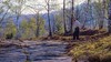


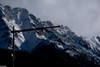
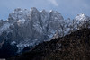
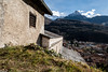
The above images may not be of the site on this page, but were taken nearby. They are loaded from Flickr so please click on them for image credits.
Click here to see more info for this site
Nearby sites
Click here to view sites on an interactive map of the areaKey: Red: member's photo, Blue: 3rd party photo, Yellow: other image, Green: no photo - please go there and take one, Grey: site destroyed
Download sites to:
KML (Google Earth)
GPX (GPS waypoints)
CSV (Garmin/Navman)
CSV (Excel)
To unlock full downloads you need to sign up as a Contributory Member. Otherwise downloads are limited to 50 sites.
Turn off the page maps and other distractions
Nearby sites listing. In the following links * = Image available
225m SE 132° Castagneto Rock Art
287m SW 230° ´Al de Plaha* Rock Art
576m NNE 14° Plas - Capitello Rock Art
607m SSE 160° In Vall Rock Engravings Rock Art
1.1km SW 228° Campanine Alta* Rock Art
1.2km WSW 239° Naquane* Rock Art
1.3km SW 229° Campanine Bosc del Vicare Rock Art
1.4km SW 234° Cemmo 3* Rock Art
1.5km SW 233° Borno Stelae (4)* Rock Art
1.5km WSW 256° Museo Nazionale Della Preistoria Della Valle Camonica Museum
1.6km SW 221° Foppe-Nadro Rock 34* Rock Art
1.6km SW 218° Foppe-Nadro Rock 26* Rock Art
1.6km SW 217° Foppe-Nadro Rock 29* Rock Art
1.6km SW 219° Foppe-Nadro Rock 25* Rock Art
1.6km SW 219° Foppe-Nadro Rock 24* Rock Art
1.6km W 270° Seradina - Bedolina* Rock Art
1.7km SW 217° Foppe-Nadro Rock 23* Rock Art
1.7km SSW 213° Sotto Roccia shelter II* Cave or Rock Shelter
1.7km SW 218° Foppe-Nadro Rock 22* Rock Art
1.7km SW 218° Foppe-Nadro Rock 21* Rock Art
1.7km SW 218° Foppe-Nadro Rock 4* Rock Art
1.8km SW 219° Foppe-Nadro Rock 6* Rock Art
1.8km SW 216° Foppe-Nadro Rock 1* Rock Art
1.9km SSW 212° Foppe-Nadro Villaggio Prehistorico* Museum
2.0km SSW 210° Foppe-Nadro Stone* Standing Stone (Menhir)
View more nearby sites and additional images


 We would like to know more about this location. Please feel free to add a brief description and any relevant information in your own language.
 Wir möchten mehr über diese Stätte erfahren. Bitte zögern Sie nicht, eine kurze Beschreibung und relevante Informationen in Deutsch hinzuzufügen.
 Nous aimerions en savoir encore un peu sur les lieux. S'il vous plaît n'hesitez pas à ajouter une courte description et tous les renseignements pertinents dans votre propre langue.
 Quisieramos informarnos un poco más de las lugares. No dude en añadir una breve descripción y otros datos relevantes en su propio idioma.